
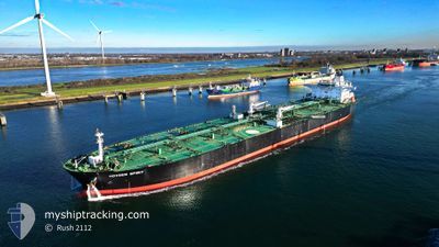
HOVDEN SPIRIT
Crude Oil Tanker
Current Trip
FOR ORDERS
| Time Travelled | 5 days |
|---|---|
| Remaining Time | --- |
| Distance Travelled | 1580.56 nm |
| Remaining Distance | --- |
| AVG Speed | 12.4 Knots |
| MAX Speed | 15.5 Knots |
| AVG Wind | 10.3 knots |
| MAX Wind | 21.7 knots |
| MIN Temp | 11.4°C / 52.52°F |
| MAX Temp | 19.6°C / 67.28°F |
| Dybgang | 11.1 m |
| Position Modtaget | 1 m siden |
Current Position
| Longitude | -9.12214° |
|---|---|
| Latitude | 34.79576° |
| Status | Under way using engine |
| Fart | 12.9 Knots |
| Kurs | 214.4° |
| Område | North Atlantic Ocean |
| Station | T-AIS |
| Position Modtaget | 1 m siden |
Info
Information
The current position of HOVDEN SPIRIT is in North Atlantic Ocean with coordinates 34.79576° / -9.12214° as reported on 2024-05-12 15:47 by AIS to our vessel tracker app. The vessel's current speed is 12.9 Knots
The vessel HOVDEN SPIRIT (IMO: 9596997, MMSI: 311001179) is a Crude Oil Tanker that was built in 2012 ( 12 år gamle ). It's sailing under the flag of [BS] Bahamas.
In this page you can find informations about the vessels current position, last detected port calls, and current voyage information. If the vessels is not in coverage by AIS you will find the latest position.
The current position of HOVDEN SPIRIT is detected by our AIS receivers and we are not responsible for the reliability of the data. The last position was recorded while the vessel was in Coverage by the Ais receivers of our vessel tracking app.
The current draught of HOVDEN SPIRIT as reported by AIS is 11.1 meters
Weather
| Temperature | 18.2°C / 64.76°F |
|---|---|
| Wind Speed | 19 knots |
| Direction | 356° N |
| Pressure | 1017.2 hPa |
| Humidity | 82.5 % |
| Cloud Coverage | 10 % |
Featured Company
Most Visited Ports (Last year)
| Port | Arrivals | |
|---|---|---|
| 1 | ||
| 1 | ||
| 1 | ||
| 1 | ||
| 1 |
Events
| Tid | Hændelsen | Detaljer | Position / Dest | Info |
|---|---|---|---|---|
| 2024-05-12 15:01 | Status er ændret | Under way using engine Default |
34.93362 / -9.01047
FOR ORDERS
|
Fart: 12.8 kn Kurs: 213° |
| 2024-05-12 14:58 | Status er ændret | Default Under way using engine |
34.94127 / -9.00423
FOR ORDERS
|
Fart: 12.6 kn Kurs: 225.7° |
| 2024-05-12 14:53 | Status er ændret | Under way using engine Default |
34.95534 / -8.99215
FOR ORDERS
|
Fart: 12 kn Kurs: 235° |
| 2024-05-12 14:50 | Status er ændret | Default Under way using engine |
34.96167 / -8.97833
FOR ORDERS
|
Fart: 12.7 kn Kurs: 235° |
| 2024-05-12 13:23 | ETA er ændret | 2024/05/23 16:00 2024/05/23 12:00 |
35.20047 / -8.73908
FOR ORDERS
|
Fart: 12.9 kn Kurs: 217.9° |
| 2024-05-12 13:16 | Ændre havområde | Moroccan part of the North Atlantic Ocean Portuguese part of the North Atlantic Ocean |
35.21717 / -8.72402
North Atlantic Ocean
FOR ORDERS
|
Fart: 12.9 kn Kurs: 216.5° |
| 2024-05-12 13:12 | Status er ændret | Under way using engine Default |
35.22942 / -8.71236
FOR ORDERS
|
Fart: 12.9 kn Kurs: 218° |
| 2024-05-12 13:02 | Status er ændret | Default Under way using engine |
35.25834 / -8.68333
FOR ORDERS
|
Fart: 12.8 kn Kurs: 218.8° |
| 2024-05-12 12:45 | Status er ændret | Under way using engine Default |
35.30646 / -8.63983
FOR ORDERS
|
Fart: 12 kn Kurs: 219° |
| 2024-05-12 12:29 | Indenfor Dækning |
35.30170 / -8.64409
North Atlantic Ocean
FOR ORDERS
|
Fart: 12.8 kn Kurs: 215.9° |