
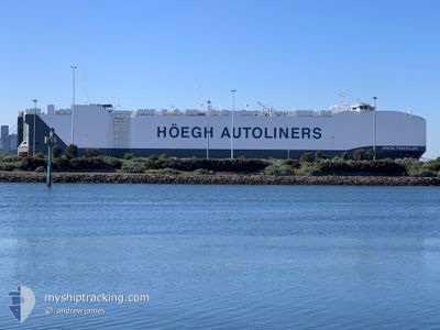
HOEGH TRAVELLER
Cargo
Current Trip
| Time Travelled | 6 h, 57 mins |
|---|---|
| Remaining Time | --- |
| Distance Travelled | 83.72 nm |
| Remaining Distance | --- |
| AVG Speed | 14.5 Noeuds |
| MAX Speed | 16.8 Noeuds |
| AVG Wind | 11.7 knots |
| MAX Wind | 15.1 knots |
| MIN Temp | 7.6°C / 45.68°F |
| MAX Temp | 12.2°C / 53.96°F |
| Tirant d eau | 9.2 m |
| Position reçue | 1 h, 13 m depuis |
Current Position
| Longitude | --- |
|---|---|
| Latitude | --- |
| Etat | Under way using engine |
| Vitesse | 14.2 Noeuds |
| Parcours | 224.5° |
| Zone | Mediterranean Sea - Western Basin |
| Station | T-AIS |
| Position reçue | 1 h, 13 m depuis |
Info
Information
The current position of HOEGH TRAVELLER is in Mediterranean Sea - Western Basin with coordinates 42.79345° / 8.75397° as reported on 2025-02-18 05:38 by AIS to our vessel tracker app. The vessel's current speed is 14.2 Noeuds
The vessel HOEGH TRAVELLER (IMO: 9710737, MMSI: 259075000) is a Cargo It's sailing under the flag of [NO] Norway.
In this page you can find informations about the vessels current position, last detected port calls, and current voyage information. If the vessels is not in coverage by AIS you will find the latest position.
The current position of HOEGH TRAVELLER is detected by our AIS receivers and we are not responsible for the reliability of the data. The last position was recorded while the vessel was in Coverage by the Ais receivers of our vessel tracking app.
The current draught of HOEGH TRAVELLER as reported by AIS is 9.2 meters
Weather
| Temperature | 12.2°C / 53.96°F |
|---|---|
| Wind Speed | 11 knots |
| Direction | 42° NE |
| Pressure | 1017.4 hPa |
| Humidity | 78.1 % |
| Cloud Coverage | 100 % |
Featured Company
Last Port Calls
| Port | Arrival | Departure | Time In Port |
|---|---|---|---|
| 2025-02-16 23:11 | 2025-02-17 23:54 | 1 d | |
| 2025-02-13 06:07 | 2025-02-14 02:34 | 20 h | |
| 2025-01-02 06:35 | 2025-01-03 05:36 | 23 h | |
| 2024-12-29 22:49 | 2024-12-30 10:28 | 11 h | |
| 2024-12-28 22:01 | 2024-12-29 05:57 | 7 h | |
| 2024-12-27 22:45 | 2024-12-28 10:17 | 11 h | |
| 2024-12-26 21:44 | 2024-12-27 13:28 | 15 h | |
| 2024-12-25 21:31 | 2024-12-26 07:01 | 9 h |
Most Visited Ports (Last year)
| Port | Arrivals | |
|---|---|---|
| 2 | ||
| 2 | ||
| 2 | ||
| 2 | ||
| 2 | ||
| 2 |
Last Trips
| Origin | Departure | Destination | Arrival | Distance | |
|---|---|---|---|---|---|
| 2025-02-14 03:34 | 2025-02-17 00:11 | 628.26 nm | |||
| 2025-01-03 13:36 | 2025-02-13 07:07 | 14261.79 nm | |||
| 2024-12-30 19:28 | 2025-01-02 14:35 | 840.02 nm | |||
| 2024-12-29 14:57 | 2024-12-30 07:49 | 248.45 nm | |||
| 2024-12-28 19:17 | 2024-12-29 07:01 | 107.79 nm | |||
| 2024-12-27 22:28 | 2024-12-28 07:45 | 118.29 nm | |||
| 2024-12-26 16:01 | 2024-12-27 06:44 | 180.11 nm | |||
| 2024-11-27 18:10 | 2024-12-26 06:31 | 10452.36 nm |
Events
| Heure | Evenement | Détails | Position/ Destination | Info |
|---|---|---|---|---|
| 2025-02-18 05:38 | Hors de la zone couverte |
42.79345 / 8.75397
Mediterranean Sea - Western Basin
IT LIV > BE ZEE
|
Vitesse: 14.2 kn Parcours: 224.5° |
|
| 2025-02-18 05:37 | Etat Changé | Under way using engine Default |
42.79458 / 8.75548
IT LIV > BE ZEE
|
Vitesse: 14 kn Parcours: 224° |
| 2025-02-18 05:05 | Etat Changé | Default Under way using engine |
42.88607 / 8.87735
IT LIV > BE ZEE
|
Vitesse: 14 kn Parcours: 223.5° |
| 2025-02-18 04:49 | Etat Changé | Under way using engine Default |
42.93101 / 8.93563
IT LIV > BE ZEE
|
Vitesse: 13.7 kn Parcours: 224° |
| 2025-02-18 04:45 | Etat Changé | Default Under way using engine |
42.94210 / 8.94991
IT LIV > BE ZEE
|
Vitesse: 13.8 kn Parcours: 222.6° |
| 2025-02-18 04:36 | Etat Changé | Under way using engine Default |
42.96842 / 8.98350
IT LIV > BE ZEE
|
Vitesse: 13.6 kn Parcours: 223° |
| 2025-02-18 04:31 | Etat Changé | Default Under way using engine |
42.98150 / 9.00011
IT LIV > BE ZEE
|
Vitesse: 13.5 kn Parcours: 222.2° |
| 2025-02-18 04:24 | Etat Changé | Under way using engine Default |
43.00228 / 9.02684
IT LIV > BE ZEE
|
Vitesse: 13.7 kn Parcours: 224° |
| 2025-02-18 04:21 | Etat Changé | Default Under way using engine |
43.00973 / 9.03635
IT LIV > BE ZEE
|
Vitesse: 13.8 kn Parcours: 222.9° |
| 2025-02-18 03:46 | Changement de zone | French part of the Mediterranean Sea - Western Basin French part of the Ligurian Sea |
43.10326 / 9.16268
Mediterranean Sea - Western Basin
IT LIV > BE ZEE
|
Vitesse: 13.6 kn Parcours: 238.5° |