

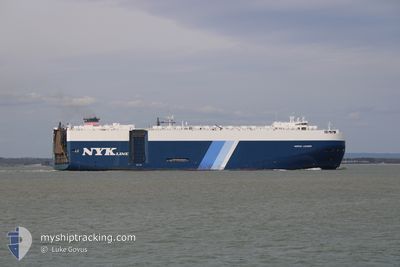
HEROIC LEADER
Vehicles Carrier

Current Trip
SG SIN
| Time Travelled | 1 day |
|---|---|
| Remaining Time | --- |
| Distance Travelled | 243.65 nm |
| Remaining Distance | --- |
| AVG Speed | 15 Noeuds |
| MAX Speed | 17 Noeuds |
| AVG Wind | 6 knots |
| MAX Wind | 16.8 knots |
| MIN Temp | 10.1°C / 50.18°F |
| MAX Temp | 17.1°C / 62.78°F |
| Tirant d eau | 9.4 m |
| Position reçue | 19 h, 12 m depuis |
Current Position
| Longitude | --- |
|---|---|
| Latitude | --- |
| Etat | Under way using engine |
| Vitesse | 14 Noeuds |
| Parcours | 204° |
| Zone | Philippine Sea |
| Station | T-AIS |
| Position reçue | 19 h, 12 m depuis |
Information
The current position of HEROIC LEADER is in Philippine Sea with coordinates 33.21173° / 134.68667° as reported on 2025-02-27 14:14 by AIS to our vessel tracker app. The vessel's current speed is 14 Noeuds
The vessel HEROIC LEADER (IMO: 9441570, MMSI: 311052700) is a Vehicles Carrier that was built in 2011 ( 14 Age ). It's sailing under the flag of [BS] Bahamas.
In this page you can find informations about the vessels current position, last detected port calls, and current voyage information. If the vessels is not in coverage by AIS you will find the latest position.
The current position of HEROIC LEADER is detected by our AIS receivers and we are not responsible for the reliability of the data. The last position was recorded while the vessel was in Coverage by the Ais receivers of our vessel tracking app.
The current draught of HEROIC LEADER as reported by AIS is 9.4 meters
Weather
| Temperature | 19.9°C / 67.82°F |
|---|---|
| Wind Speed | 20 knots |
| Direction | 240° WSW |
| Pressure | 1019.6 hPa |
| Humidity | 83.9 % |
| Cloud Coverage | 85 % |


Featured Company
Last Port Calls
| Port | Arrival | Departure | Time In Port |
|---|---|---|---|
| 2025-02-26 21:59 | 2025-02-27 07:48 | 9 h | |
| 2025-02-25 01:32 | 2025-02-26 10:24 | 1 d | |
| 2025-02-23 05:00 | 2025-02-24 07:29 | 1 d | |
| 2025-02-18 21:49 | 2025-02-21 10:21 | 2 d | |
| 2025-01-31 13:52 | 2025-02-01 01:59 | 12 h | |
| 2025-01-25 10:53 | 2025-01-26 01:27 | 14 h | |
| 2025-01-18 21:31 | 2025-01-19 16:15 | 18 h | |
| 2024-12-31 12:00 | 2025-01-02 19:57 | 2 d | |
| 2024-12-27 21:57 | 2024-12-29 20:06 | 1 d | |
| 2024-12-24 12:14 | 2024-12-26 21:14 | 2 d |
Most Visited Ports (Last year)
| Port | Arrivals | |
|---|---|---|
| 4 | ||
| 3 | ||
| 3 | ||
| 3 | ||
| 2 | ||
| 2 |
Last Trips
| Origin | Departure | Destination | Arrival | Distance | |
|---|---|---|---|---|---|
| 2025-02-26 19:24 | 2025-02-27 06:59 | 11.17 nm | |||
| 2025-02-24 16:29 | 2025-02-25 10:32 | 257.27 nm | |||
| 2025-02-21 19:21 | 2025-02-23 14:00 | 320.04 nm | |||
| 2025-01-31 17:59 | 2025-02-19 06:49 | 5991.26 nm | |||
| 2025-01-25 19:27 | 2025-01-31 05:52 | 1431.60 nm | |||
| 2025-01-19 11:15 | 2025-01-25 04:53 | 1651.66 nm | |||
| 2025-01-02 19:57 | 2025-01-18 16:31 | 5136.51 nm | |||
| 2024-12-29 21:06 | 2024-12-31 12:00 | 245.81 nm | |||
| 2024-12-26 22:14 | 2024-12-27 22:57 | 330.01 nm | |||
| 2024-12-23 13:49 | 2024-12-24 13:14 | 317.61 nm |
Events
| Heure | Evenement | Détails | Position/ Destination | Info |
|---|---|---|---|---|
| 2025-02-27 14:21 | Etat Changé | Default Under way using engine |
33.18333 / 134.67166
SG SIN
|
Vitesse: 14 kn Parcours: 204° |
| 2025-02-27 14:14 | Etat Changé | Under way using engine Default |
33.21173 / 134.68667
SG SIN
|
Vitesse: 14 kn Parcours: 200° |
| 2025-02-27 14:14 | Hors de la zone couverte |
33.21173 / 134.68667
Philippine Sea
|
Vitesse: 14 kn Parcours: 204° |
|
| 2025-02-27 14:00 | Dans la zone couverte |
33.21173 / 134.68667
Philippine Sea
|
Vitesse: 14 kn Parcours: 204° |
|
| 2025-02-27 10:46 | Etat Changé | Default Under way using engine |
34.02426 / 134.95550
SG SIN
|
Vitesse: 14.5 kn Parcours: 188.6° |
| 2025-02-27 10:38 | Hors de la zone couverte |
34.05557 / 134.95889
Philippine Sea
|
Vitesse: 14.5 kn Parcours: 188.6° |
|
| 2025-02-27 09:41 | Changement de zone | Japanese part of the Philippine Sea Japanese part of the Inland Sea |
34.26870 / 134.97501
Philippine Sea
|
Vitesse: 10.3 kn Parcours: 177.2° |
| 2025-02-27 09:31 | Changement d'ETA | 2025/02/07 04:00 2025/02/07 22:00 |
34.30179 / 134.97692
SG SIN
|
Vitesse: 14.3 kn Parcours: 192.6° |
| 2025-02-27 09:25 | Changement d'ETA | 2025/02/07 22:00 2025/02/05 22:00 |
34.32608 / 134.98367
SG SIN
|
Vitesse: 15.6 kn Parcours: 203.3° |
| 2025-02-27 07:48 | PORT DE DEPART |
|
34.53563 / 135.37977
SG SIN
|
Vitesse: 8.5 kn Parcours: 337° |