
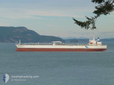
HELLESPONT PROMISE
Oil Products Tanker
Current Trip
| Time Travelled | 38 days |
|---|---|
| Remaining Time | --- |
| Distance Travelled | 6705.42 nm |
| Remaining Distance | --- |
| AVG Speed | 10.8 Noeuds |
| MAX Speed | 15 Noeuds |
| AVG Wind | 15.5 knots |
| MAX Wind | 32 knots |
| MIN Temp | 2.9°C / 37.22°F |
| MAX Temp | 33.4°C / 92.12°F |
| Tirant d eau | 8.8 m |
| Position reçue | 2 h, 50 m depuis |
Current Position
| Longitude | --- |
|---|---|
| Latitude | --- |
| Etat | Under way using engine |
| Vitesse | 12.5 Noeuds |
| Parcours | 56° |
| Zone | Caribbean Sea |
| Station | T-AIS |
| Position reçue | 2 h, 50 m depuis |
Info
Information
The current position of HELLESPONT PROMISE is in Caribbean Sea with coordinates 11.46500° / -74.91138° as reported on 2025-02-17 03:45 by AIS to our vessel tracker app. The vessel's current speed is 12.5 Noeuds and is heading at the port of ST EUSTATIUS. The estimated time of arrival as calculated by MyShipTracking vessel tracking app is 2025-02-19 15:00 LT
The vessel HELLESPONT PROMISE (IMO: 9351438, MMSI: 232012087) is a Oil Products Tanker that was built in 2007 ( 18 Age ). It's sailing under the flag of [GB] United Kingdom.
In this page you can find informations about the vessels current position, last detected port calls, and current voyage information. If the vessels is not in coverage by AIS you will find the latest position.
The current position of HELLESPONT PROMISE is detected by our AIS receivers and we are not responsible for the reliability of the data. The last position was recorded while the vessel was in Coverage by the Ais receivers of our vessel tracking app.
The current draught of HELLESPONT PROMISE as reported by AIS is 8.8 meters
Weather
| Temperature | 25.3°C / 77.54°F |
|---|---|
| Wind Speed | 25 knots |
| Direction | 70° ENE |
| Pressure | 1010.7 hPa |
| Humidity | 87.5 % |
| Cloud Coverage | 51 % |
Featured Company
Most Visited Ports (Last year)
| Port | Arrivals | |
|---|---|---|
| 3 | ||
| 3 | ||
| 2 | ||
| 2 | ||
| 1 | ||
| 1 |
Events
| Heure | Evenement | Détails | Position/ Destination | Info |
|---|---|---|---|---|
| 2025-02-17 03:51 | Etat Changé | Default Under way using engine |
11.47660 / -74.89377
BQEUX
|
Vitesse: 12.5 kn Parcours: 56° |
| 2025-02-17 03:45 | Hors de la zone couverte |
11.46500 / -74.91138
Caribbean Sea
BQEUX
|
Vitesse: 12.5 kn Parcours: 56° |
|
| 2025-02-17 03:33 | Etat Changé | Under way using engine Default |
11.44093 / -74.94948
BQEUX
|
Vitesse: 12.6 kn Parcours: 57° |
| 2025-02-17 03:18 | Etat Changé | Default Under way using engine |
11.41422 / -74.99320
BQEUX
|
Vitesse: 12.4 kn Parcours: 58° |
| 2025-02-17 02:58 | Etat Changé | Under way using engine Default |
11.37877 / -75.05222
BQEUX
|
Vitesse: 12.5 kn Parcours: 58° |
| 2025-02-17 02:54 | Etat Changé | Default Under way using engine |
11.37068 / -75.06587
BQEUX
|
Vitesse: 12.5 kn Parcours: 60° |
| 2025-02-17 02:47 | Etat Changé | Under way using engine Default |
11.35852 / -75.08740
BQEUX
|
Vitesse: 12.4 kn Parcours: 60° |
| 2025-02-17 02:17 | Etat Changé | Default Under way using engine |
11.30972 / -75.17557
BQEUX
|
Vitesse: 11.3 kn Parcours: 61° |
| 2025-02-17 01:57 | Etat Changé | Under way using engine Default |
11.27823 / -75.23380
BQEUX
|
Vitesse: 11.3 kn Parcours: 62° |
| 2025-02-17 01:42 | Dans la zone couverte |
11.28010 / -75.23002
Caribbean Sea
BQEUX
|
Vitesse: 11.4 kn Parcours: 63° |