
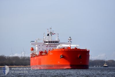
HAYAT
Tanker
Current Trip
| Time Travelled | 10 days |
|---|---|
| Remaining Time | --- |
| Distance Travelled | 2659.38 nm |
| Remaining Distance | --- |
| AVG Speed | 12.3 Noeuds |
| MAX Speed | 15.8 Noeuds |
| AVG Wind | 10.9 knots |
| MAX Wind | 28.9 knots |
| MIN Temp | 24.1°C / 75.38°F |
| MAX Temp | 29.7°C / 85.46°F |
| Tirant d eau | 10.8 m |
| Position reçue | 2 m depuis |
Current Position
| Longitude | 38.85661° |
|---|---|
| Latitude | 21.35168° |
| Etat | Under way using engine |
| Vitesse | 0.3 Noeuds |
| Parcours | 244° |
| Zone | Red Sea |
| Station | T-AIS |
| Position reçue | 2 m depuis |
Info
Information
The current position of HAYAT is in Red Sea with coordinates 21.35168° / 38.85661° as reported on 2024-05-03 12:34 by AIS to our vessel tracker app. The vessel's current speed is 0.3 Noeuds
The vessel HAYAT (IMO: 9917854, MMSI: 403643000) is a Tanker It's sailing under the flag of [SA] Saudi Arabia.
In this page you can find informations about the vessels current position, last detected port calls, and current voyage information. If the vessels is not in coverage by AIS you will find the latest position.
The current position of HAYAT is detected by our AIS receivers and we are not responsible for the reliability of the data. The last position was recorded while the vessel was in Coverage by the Ais receivers of our vessel tracking app.
The current draught of HAYAT as reported by AIS is 10.8 meters
Weather
| Temperature | 28.2°C / 82.76°F |
|---|---|
| Wind Speed | 13 knots |
| Direction | 323° NW |
| Pressure | 1007.6 hPa |
| Humidity | 64.2 % |
| Cloud Coverage | --- |
Featured Company
Last Port Calls
| Port | Arrival | Departure | Time In Port |
|---|---|---|---|
| 2024-04-22 07:34 | 2024-04-23 10:46 | 1 d | |
| 2024-04-01 06:50 | 2024-04-02 20:32 | 1 d | |
| 2024-03-28 11:25 | |||
| 2024-03-11 19:02 | 2024-03-13 05:28 | 1 d |
Events
| Heure | Evenement | Détails | Position/ Destination | Info |
|---|---|---|---|---|
| 2024-05-03 11:45 | Etat Changé | Under way using engine Default |
21.35462 / 38.85359
SAJED
|
Vitesse: Parcours: -1° |
| 2024-05-03 11:28 | Dans la zone couverte |
21.35456 / 38.85366
Red Sea
|
Vitesse: 0.2 kn Parcours: 128.7° |
|
| 2024-05-03 10:07 | Etat Changé | Default Under way using engine |
21.35614 / 38.84891
SAJED
|
Vitesse: Parcours: 253° |
| 2024-05-03 10:07 | Hors de la zone couverte |
21.35612 / 38.84892
Red Sea
|
Vitesse: Parcours: 284.4° |
|
| 2024-05-03 10:05 | Etat Changé | Under way using engine Default |
21.35611 / 38.84893
SAJED
|
Vitesse: Parcours: 256° |
| 2024-05-03 09:55 | Etat Changé | Default Under way using engine |
21.35500 / 38.84833
SAJED
|
Vitesse: Parcours: 257° |
| 2024-05-03 09:46 | Etat Changé | Under way using engine Default |
21.35603 / 38.84924
SAJED
|
Vitesse: Parcours: -1° |
| 2024-05-03 09:43 | Etat Changé | Default Under way using engine |
21.35500 / 38.84833
SAJED
|
Vitesse: Parcours: 255° |
| 2024-05-03 09:15 | Etat Changé | Under way using engine Default |
21.35604 / 38.84980
SAJED
|
Vitesse: Parcours: 249° |
| 2024-05-03 09:05 | Etat Changé | Default Under way using engine |
21.35609 / 38.84994
SAJED
|
Vitesse: Parcours: 249° |