
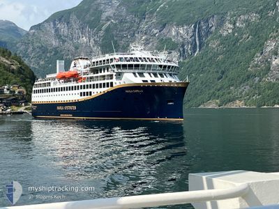
HAVILA CAPELLA
Passenger
Current Trip
| Time Travelled | 1 h, 25 mins |
|---|---|
| Remaining Time | 6 h, 19 mins |
| Distance Travelled | 19.45 nm |
| Remaining Distance | 93.72 nm |
| AVG Speed | 14 Noeuds |
| MAX Speed | 15.3 Noeuds |
| AVG Wind | 9.2 knots |
| MAX Wind | 14 knots |
| MIN Temp | --- |
| MAX Temp | 3.2°C / 37.76°F |
| Tirant d eau | 5.3 m |
| Position reçue | 1 m depuis |
Current Position
| Longitude | --- |
|---|---|
| Latitude | --- |
| Etat | Under way using engine |
| Vitesse | 14 Noeuds |
| Parcours | 180° |
| Zone | Norwegian Sea |
| Station | T-AIS |
| Position reçue | 1 m depuis |
Info
Information
The current position of HAVILA CAPELLA is in Norwegian Sea with coordinates 61.71484° / 4.95832° as reported on 2025-02-20 06:19 by AIS to our vessel tracker app. The vessel's current speed is 14 Noeuds and is heading at the port of BERGEN. The estimated time of arrival as calculated by MyShipTracking vessel tracking app is 2025-02-20 12:39 LT
The vessel HAVILA CAPELLA (IMO: 9865570, MMSI: 257753000) is a Passenger It's sailing under the flag of [NO] Norway.
In this page you can find informations about the vessels current position, last detected port calls, and current voyage information. If the vessels is not in coverage by AIS you will find the latest position.
The current position of HAVILA CAPELLA is detected by our AIS receivers and we are not responsible for the reliability of the data. The last position was recorded while the vessel was in Coverage by the Ais receivers of our vessel tracking app.
The current draught of HAVILA CAPELLA as reported by AIS is 5.3 meters
Weather
| Temperature | 2.9°C / 37.22°F |
|---|---|
| Wind Speed | 14 knots |
| Direction | 156° SSE |
| Pressure | 1011.8 hPa |
| Humidity | 56.7 % |
| Cloud Coverage | 100 % |
Featured Company
Last Port Calls
| Port | Arrival | Departure | Time In Port |
|---|---|---|---|
| 2025-02-20 04:41 | 2025-02-20 04:55 | 14 m | |
| 2025-02-19 23:32 | 2025-02-20 00:16 | 43 m | |
| 2025-02-19 20:18 | 2025-02-19 20:49 | 30 m | |
| 2025-02-19 15:10 | 2025-02-19 16:35 | 1 h | |
| 2025-02-19 05:21 | 2025-02-19 08:29 | 3 h | |
| 2025-02-18 19:58 | 2025-02-18 20:31 | 33 m | |
| 2025-02-18 14:00 | 2025-02-18 16:23 | 2 h | |
| 2025-02-18 10:41 | 2025-02-18 11:20 | 39 m | |
| 2025-02-18 09:21 | 2025-02-18 09:39 | 18 m | |
| 2025-02-18 05:21 | 2025-02-18 05:31 | 10 m |
Last Trips
| Origin | Departure | Destination | Arrival | Distance | |
|---|---|---|---|---|---|
| 2025-02-20 01:16 | 2025-02-20 05:41 | 53.31 nm | |||
| 2025-02-19 21:49 | 2025-02-20 00:32 | 34.58 nm | |||
| 2025-02-19 17:35 | 2025-02-19 21:18 | 49.34 nm | |||
| 2025-02-19 09:29 | 2025-02-19 16:10 | 92.62 nm | |||
| 2025-02-18 21:31 | 2025-02-19 06:21 | 125.45 nm | |||
| 2025-02-18 17:23 | 2025-02-18 20:58 | 45.87 nm | |||
| 2025-02-18 12:20 | 2025-02-18 15:00 | 36.33 nm | |||
| 2025-02-18 10:39 | 2025-02-18 11:41 | 14.21 nm | |||
| 2025-02-18 06:31 | 2025-02-18 10:21 | 51.81 nm | |||
| 2025-02-18 03:25 | 2025-02-18 06:21 | 37.83 nm |
Events
| Heure | Evenement | Détails | Position/ Destination | Info |
|---|---|---|---|---|
| 2025-02-20 04:55 | PORT DE DEPART |
|
61.92553 / 5.12118
NO BGO
|
Vitesse: 11.2 kn Parcours: 185° |
| 2025-02-20 04:51 | Démarrage |
61.93703 / 5.12381
[NO] MALOY
|
Vitesse: 7.1 kn Parcours: 186° |
|
| 2025-02-20 04:41 | Arret |
61.93935 / 5.12285
[NO] MALOY
|
Vitesse: 0.2 kn Parcours: 29° |
|
| 2025-02-20 04:41 | Port d'arrivée |
|
61.93935 / 5.12285
[NO] MALOY
|
Vitesse: 0.8 kn Parcours: 350° |
| 2025-02-20 01:40 | Démarrage | 2.2 nm, North East of MJOLSTADNESET |
62.33662 / 5.74027
NO BGO
|
Vitesse: 9 kn Parcours: 131.8° |
| 2025-02-20 01:29 | Arret | 1.91 nm, North East of MJOLSTADNESET |
62.33675 / 5.72865
NO BGO
|
Vitesse: 0.1 kn Parcours: 36° |
| 2025-02-20 00:16 | PORT DE DEPART |
|
62.47663 / 6.13318
NO BGO
|
Vitesse: 8 kn Parcours: 273° |
| 2025-02-20 00:14 | Démarrage |
62.47609 / 6.14531
[NO] ALESUND
|
Vitesse: 8 kn Parcours: 273° |
|
| 2025-02-19 23:39 | Arret |
62.47568 / 6.15234
[NO] ALESUND
|
Vitesse: Parcours: 252° |
|
| 2025-02-19 23:32 | Port d'arrivée |
|
62.47708 / 6.15465
[NO] ALESUND
|
Vitesse: 6.6 kn Parcours: 176.8° |