
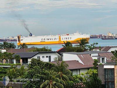
GRANDE ROMA
Vehicles Carrier
Current Trip
| Time Travelled | 22 days |
|---|---|
| Remaining Time | 1 day |
| Distance Travelled | 7210.47 nm |
| Remaining Distance | 537.27 nm |
| AVG Speed | 12.9 Noeuds |
| MAX Speed | 17.1 Noeuds |
| AVG Wind | 7.9 knots |
| MAX Wind | 19.8 knots |
| MIN Temp | 15.4°C / 59.72°F |
| MAX Temp | 30.9°C / 87.62°F |
| Tirant d eau | 8.2 m |
| Position reçue | Maintenant |
Current Position
| Longitude | 37.27892° |
|---|---|
| Latitude | 22.26646° |
| Etat | Under way using engine |
| Vitesse | 14.5 Noeuds |
| Parcours | 334.2° |
| Zone | Red Sea |
| Station | T-AIS |
| Position reçue | Maintenant |
Info
Information
The current position of GRANDE ROMA is in Red Sea with coordinates 22.26646° / 37.27892° as reported on 2024-05-16 20:38 by AIS to our vessel tracker app. The vessel's current speed is 14.5 Noeuds and is heading at the port of SUEZ CANAL. The estimated time of arrival as calculated by MyShipTracking vessel tracking app is 2024-05-18 08:43 LT
The vessel GRANDE ROMA (IMO: 9247936, MMSI: 247086800) is a Vehicles Carrier that was built in 2003 ( 21 Age ). It's sailing under the flag of [IT] Italy.
In this page you can find informations about the vessels current position, last detected port calls, and current voyage information. If the vessels is not in coverage by AIS you will find the latest position.
The current position of GRANDE ROMA is detected by our AIS receivers and we are not responsible for the reliability of the data. The last position was recorded while the vessel was in Coverage by the Ais receivers of our vessel tracking app.
The current draught of GRANDE ROMA as reported by AIS is 8.2 meters
Weather
| Temperature | 26.8°C / 80.24°F |
|---|---|
| Wind Speed | 15 knots |
| Direction | 331° NNW |
| Pressure | 1011.2 hPa |
| Humidity | 70.1 % |
| Cloud Coverage | 5 % |
Featured Company
Last Port Calls
| Port | Arrival | Departure | Time In Port |
|---|---|---|---|
| 2024-04-22 00:20 | 2024-04-24 07:23 | 2 d | |
| 2024-04-20 02:08 | 2024-04-20 09:41 | 7 h | |
| 2024-03-30 23:22 | 2024-04-01 19:00 | 1 d | |
| 2024-03-22 02:34 | 2024-03-22 10:55 | 8 h | |
| 2024-03-18 01:57 | 2024-03-18 22:42 | 20 h | |
| 2024-03-10 17:45 | 2024-03-11 12:41 | 18 h | |
| 2024-03-08 14:31 | 2024-03-10 00:50 | 1 d | |
| 2024-03-07 23:14 | 2024-03-08 12:14 | 13 h | |
| 2024-03-05 14:00 | 2024-03-07 03:01 | 1 d | |
| 2024-03-03 13:42 | 2024-03-04 16:45 | 1 d |
Most Visited Ports (Last year)
| Port | Arrivals | |
|---|---|---|
| 6 | ||
| 4 | ||
| 3 | ||
| 3 | ||
| 3 | ||
| 2 |
Last Trips
| Origin | Departure | Destination | Arrival | Distance | |
|---|---|---|---|---|---|
| 2024-04-20 18:41 | 2024-04-22 09:20 | 555.02 nm | |||
| 2024-04-01 23:00 | 2024-04-20 11:08 | 6416.92 nm | |||
| 2024-03-18 23:42 | 2024-03-31 03:22 | 3919.53 nm | |||
| 2024-03-18 23:42 | 2024-03-22 04:34 | 979.05 nm | |||
| 2024-03-11 12:41 | 2024-03-18 02:57 | 2322.02 nm | |||
| 2024-03-10 01:50 | 2024-03-10 17:45 | 252.89 nm | |||
| 2024-03-08 13:14 | 2024-03-08 15:31 | 31.56 nm | |||
| 2024-03-07 04:01 | 2024-03-08 00:14 | 297.63 nm | |||
| 2024-03-04 17:45 | 2024-03-05 15:00 | 251.97 nm | |||
| 2024-03-03 14:35 | 2024-03-03 14:42 | 0.20 nm |
Events
| Heure | Evenement | Détails | Position/ Destination | Info |
|---|---|---|---|---|
| 2024-05-16 19:13 | Changement de zone | Disputed Sudan-Egypt part of the Red Sea Sudanese part of the Red Sea |
21.95185 / 37.43491
Red Sea
SGSIN>EGSUZ
|
Vitesse: 15 kn Parcours: 335.4° |
| 2024-05-16 19:01 | Etat Changé | Under way using engine Default |
21.90343 / 37.45894
SGSIN>EGSUZ
|
Vitesse: 15.1 kn Parcours: 335° |
| 2024-05-16 18:45 | Etat Changé | Default Under way using engine |
21.84370 / 37.48824
SGSIN>EGSUZ
|
Vitesse: 15 kn Parcours: 335.8° |
| 2024-05-16 18:42 | Etat Changé | Under way using engine Default |
21.83149 / 37.49412
SGSIN>EGSUZ
|
Vitesse: 15 kn Parcours: 336° |
| 2024-05-16 18:23 | Dans la zone couverte |
21.83149 / 37.49412
Red Sea
SGSIN>EGSUZ
|
Vitesse: 15 kn Parcours: 335.8° |
|
| 2024-05-16 17:30 | Etat Changé | Default Under way using engine |
21.56106 / 37.63027
SGSIN>EGSUZ
|
Vitesse: 14.8 kn Parcours: 334.4° |
| 2024-05-16 17:27 | Hors de la zone couverte |
21.55017 / 37.63588
Red Sea
SGSIN>EGSUZ
|
Vitesse: 14.8 kn Parcours: 334.4° |
|
| 2024-05-16 17:19 | Etat Changé | Under way using engine Default |
21.51805 / 37.65233
SGSIN>EGSUZ
|
Vitesse: 14.7 kn Parcours: 334° |
| 2024-05-16 17:04 | Etat Changé | Default Under way using engine |
21.46287 / 37.68066
SGSIN>EGSUZ
|
Vitesse: 14.8 kn Parcours: 334.6° |
| 2024-05-16 16:57 | Etat Changé | Under way using engine Default |
21.43697 / 37.69390
SGSIN>EGSUZ
|
Vitesse: 14.8 kn Parcours: 334° |