

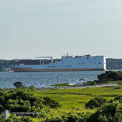
GRANDE COTONOU
Cargo

Current Trip
NG LOS > CN ZOS
| Time Travelled | 5 days |
|---|---|
| Remaining Time | --- |
| Distance Travelled | 1771.07 nm |
| Remaining Distance | --- |
| AVG Speed | 16.9 Noeuds |
| MAX Speed | 18.7 Noeuds |
| AVG Wind | 12.8 knots |
| MAX Wind | 22 knots |
| MIN Temp | 5.5°C / 41.9°F |
| MAX Temp | 26.4°C / 79.52°F |
| Tirant d eau | 8 m |
| Position reçue | 2025-01-04 08:07 |
Current Position
| Longitude | --- |
|---|---|
| Latitude | --- |
| Etat | Under way using engine |
| Vitesse | 17 Noeuds |
| Parcours | 109.8° |
| Zone | South Atlantic Ocean |
| Station | T-AIS |
| Position reçue | 2025-01-04 08:07 |
Information
The current position of GRANDE COTONOU is in South Atlantic Ocean with coordinates -34.73387° / 19.09426° as reported on 2025-01-04 08:07 by AIS to our vessel tracker app. The vessel's current speed is 17 Noeuds
The vessel GRANDE COTONOU (IMO: 9672105, MMSI: 247341500) is a Cargo It's sailing under the flag of [IT] Italy.
In this page you can find informations about the vessels current position, last detected port calls, and current voyage information. If the vessels is not in coverage by AIS you will find the latest position.
The current position of GRANDE COTONOU is detected by our AIS receivers and we are not responsible for the reliability of the data. The last position was recorded while the vessel was in Coverage by the Ais receivers of our vessel tracking app.
The current draught of GRANDE COTONOU as reported by AIS is 8 meters
Weather
| Temperature | 26.4°C / 79.52°F |
|---|---|
| Wind Speed | 10 knots |
| Direction | 34° NE |
| Pressure | 1010.4 hPa |
| Humidity | 83.7 % |
| Cloud Coverage | 100 % |


Featured Company
Events
| Heure | Evenement | Détails | Position/ Destination | Info |
|---|---|---|---|---|
| 2025-02-25 01:25 | Démarrage | 7.92 nm, South East of SHANGHAI |
31.30790 / 121.74355
NG LOS > CN ZOS
|
Vitesse: 7 kn Parcours: 114° |
| 2025-02-25 00:22 | Arret | 7.6 nm, South East of SHANGHAI |
31.30841 / 121.73682
NG LOS > CN ZOS
|
Vitesse: 0.1 kn Parcours: 142° |
| 2025-02-24 23:48 | Démarrage | 5.23 nm, South East of SHANGHAI |
31.32689 / 121.69609
NG LOS > CN ZOS
|
Vitesse: 8.4 kn Parcours: 90° |
| 2025-02-24 23:41 | PORT DE DEPART |
|
31.32591 / 121.68375
NG LOS > CN ZOS
|
Vitesse: 1.7 kn Parcours: 100° |
| 2025-02-24 15:10 | Arret |
31.32426 / 121.67863
[CN] SHANGHAI
|
Vitesse: Parcours: 127° |
|
| 2025-02-24 14:49 | Port d'arrivée |
|
31.32488 / 121.67899
[CN] SHANGHAI
|
Vitesse: 5.8 kn Parcours: 138° |
| 2025-02-24 11:40 | PORT DE DEPART |
|
31.64931 / 121.22136
NG LOS > CN ZOS
|
Vitesse: 8 kn Parcours: 119° |
| 2025-02-24 11:38 | Démarrage |
31.65328 / 121.21410
[CN] TAICANG
|
Vitesse: 8 kn Parcours: 119° |
|
| 2025-02-21 09:01 | Arret |
31.65486 / 121.20796
[CN] TAICANG
|
Vitesse: 0.3 kn Parcours: 129° |
|
| 2025-02-21 09:01 | Port d'arrivée |
|
31.65486 / 121.20796
[CN] TAICANG
|
Vitesse: 0.7 kn Parcours: 129° |