
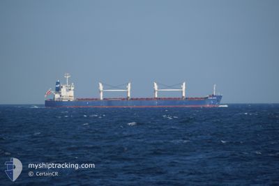
ASP BRAVE
Bulk Carrier
Current Trip
TANJUNG BUYUT-ID
| Time Travelled | 42 days |
|---|---|
| Remaining Time | --- |
| Distance Travelled | 5629.11 nm |
| Remaining Distance | --- |
| AVG Speed | 11.4 Noeuds |
| MAX Speed | 16.2 Noeuds |
| AVG Wind | 10.1 knots |
| MAX Wind | 28.8 knots |
| MIN Temp | 12.4°C / 54.32°F |
| MAX Temp | 30°C / 86°F |
| Tirant d eau | 6.5 m |
| Position reçue | 8 d depuis |
Current Position
| Longitude | --- |
|---|---|
| Latitude | --- |
| Etat | Under way using engine |
| Vitesse | 12.4 Noeuds |
| Parcours | 86° |
| Zone | Singapore Strait |
| Station | T-AIS |
| Position reçue | 8 d depuis |
Info
Information
The current position of ASP BRAVE is in Singapore Strait with coordinates 1.25420° / 104.18618° as reported on 2025-02-17 22:17 by AIS to our vessel tracker app. The vessel's current speed is 12.4 Noeuds
The vessel ASP BRAVE (IMO: 9434606, MMSI: 354440000) is a Bulk Carrier that was built in 2010 ( 15 Age ). It's sailing under the flag of [PA] Panama.
In this page you can find informations about the vessels current position, last detected port calls, and current voyage information. If the vessels is not in coverage by AIS you will find the latest position.
The current position of ASP BRAVE is detected by our AIS receivers and we are not responsible for the reliability of the data. The last position was recorded while the vessel was in Coverage by the Ais receivers of our vessel tracking app.
The current draught of ASP BRAVE as reported by AIS is 6.5 meters
Weather
| Temperature | 27°C / 80.6°F |
|---|---|
| Wind Speed | 6 knots |
| Direction | 342° NNW |
| Pressure | 1013.7 hPa |
| Humidity | 77.1 % |
| Cloud Coverage | 100 % |
Featured Company
Events
| Heure | Evenement | Détails | Position/ Destination | Info |
|---|---|---|---|---|
| 2025-02-22 01:48 | Arret | 12.76 nm, West of MENTOK |
-2.09907 / 104.95132
TANJUNG BUYUT-ID
|
Vitesse: 0.3 kn Parcours: 311° |
| 2025-02-22 01:02 | Démarrage | 12.29 nm, West of MENTOK |
-2.03113 / 104.96200
TANJUNG BUYUT-ID
|
Vitesse: 11.6 kn Parcours: 184° |
| 2025-02-21 15:41 | Arret | 12.2 nm, West of MENTOK |
-2.02468 / 104.96510
TANJUNG BUYUT-ID
|
Vitesse: 0.1 kn Parcours: 358° |
| 2025-02-20 22:04 | Démarrage |
1.70073 / 104.85484
TANJUNG BUYUT-ID
|
Vitesse: 4.5 kn Parcours: 179° |
|
| 2025-02-18 03:06 | Arret |
1.70660 / 104.85782
TANJUNG BUYUT-ID
|
Vitesse: 0.3 kn Parcours: 15° |
|
| 2025-02-17 22:21 | Etat Changé | Default Under way using engine |
1.25510 / 104.20232
TANJUNG BUYUT-ID
|
Vitesse: 12.4 kn Parcours: 86° |
| 2025-02-17 22:17 | Hors de la zone couverte |
1.25420 / 104.18618
Singapore Strait
TANJUNG BUYUT-ID
|
Vitesse: 12.4 kn Parcours: 86° |
|
| 2025-02-17 19:32 | Tirant d'eau modifié | 6.5 13.4 |
1.07048 / 103.68732
TANJUNG BUYUT-ID
|
Vitesse: 12 kn Parcours: 68° |
| 2025-02-17 19:32 | Changement de destination | TANJUNG BUYUT-ID SGP_PEBGA |
1.07048 / 103.68732
TANJUNG BUYUT-ID
|
Vitesse: 12 kn Parcours: 68° |
| 2025-02-17 19:32 | Changement d'ETA | 2025/02/19 07:10 2025/01/31 01:00 |
1.07048 / 103.68732
TANJUNG BUYUT-ID
|
Vitesse: 12 kn Parcours: 68° |