
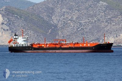
GAZ REDSEA
Lpg Tanker
Current Trip
| Time Travelled | 1 day |
|---|---|
| Remaining Time | --- |
| Distance Travelled | 305.15 nm |
| Remaining Distance | --- |
| AVG Speed | 10.4 Noeuds |
| MAX Speed | 13.2 Noeuds |
| AVG Wind | 8.2 knots |
| MAX Wind | 13 knots |
| MIN Temp | 3.4°C / 38.12°F |
| MAX Temp | 11.4°C / 52.52°F |
| Tirant d eau | 6.3 m |
| Position reçue | 2 m depuis |
Current Position
| Longitude | --- |
|---|---|
| Latitude | --- |
| Etat | Under way using engine |
| Vitesse | 0.9 Noeuds |
| Parcours | 278° |
| Zone | Black Sea |
| Station | T-AIS |
| Position reçue | 2 m depuis |
Info
Information
The current position of GAZ REDSEA is in Black Sea with coordinates 41.44553° / 29.08984° as reported on 2024-12-04 07:17 by AIS to our vessel tracker app. The vessel's current speed is 0.9 Noeuds and is heading at the port of ALEXANDRIA. The estimated time of arrival as calculated by MyShipTracking vessel tracking app is 2024-11-24 12:00 LT
The vessel GAZ REDSEA (IMO: 9264192, MMSI: 353130000) is a Lpg Tanker that was built in 2002 ( 22 Age ). It's sailing under the flag of [PA] Panama.
In this page you can find informations about the vessels current position, last detected port calls, and current voyage information. If the vessels is not in coverage by AIS you will find the latest position.
The current position of GAZ REDSEA is detected by our AIS receivers and we are not responsible for the reliability of the data. The last position was recorded while the vessel was in Coverage by the Ais receivers of our vessel tracking app.
The current draught of GAZ REDSEA as reported by AIS is 6.3 meters
Weather
| Temperature | --- |
|---|---|
| Wind Speed | --- |
| Direction | --- |
| Pressure | --- |
| Humidity | --- |
| Cloud Coverage | --- |
Featured Company
Last Port Calls
| Port | Arrival | Departure | Time In Port |
|---|---|---|---|
| 2024-11-27 11:59 | 2024-12-02 07:41 | 4 d | |
| 2024-11-19 12:08 | 2024-11-20 13:00 | 1 d | |
| 2024-11-15 16:36 | 2024-11-16 14:28 | 21 h | |
| 2024-11-14 04:34 | 2024-11-15 04:15 | 23 h | |
| 2024-11-11 04:18 | 2024-11-11 17:12 | 12 h | |
| 2024-11-09 19:42 | 2024-11-10 15:22 | 19 h | |
| 2024-11-09 03:58 | |||
| 2024-11-04 05:42 | 2024-11-05 23:18 | 1 d | |
| 2024-10-29 10:39 | 2024-11-01 09:27 | 2 d | |
| 2024-10-20 11:08 | 2024-10-21 11:29 | 1 d |
Last Trips
| Origin | Departure | Destination | Arrival | Distance | |
|---|---|---|---|---|---|
| 2024-11-16 16:28 | 2024-11-19 14:08 | 300.83 nm | |||
| 2024-11-15 06:15 | 2024-11-15 18:36 | 122.33 nm | |||
| 2024-11-11 19:12 | 2024-11-14 06:34 | 504.36 nm | |||
| 2024-11-10 17:22 | 2024-11-11 06:18 | 4.41 nm | |||
| 2024-11-06 02:18 | 2024-11-09 05:58 | 908.30 nm | |||
| 2024-11-01 11:27 | 2024-11-04 08:42 | 421.41 nm | |||
| 2024-10-21 13:29 | 2024-10-29 12:39 | 1142.41 nm | |||
| 2024-10-10 11:25 | 2024-10-20 13:08 | 1407.62 nm | |||
| 2024-10-03 17:51 | 2024-10-09 07:49 | 1019.29 nm | |||
| 2024-09-28 09:47 | 2024-10-02 15:21 | 1120.84 nm |
Events
| Heure | Evenement | Détails | Position/ Destination | Info |
|---|---|---|---|---|
| 2024-12-04 06:19 | Etat Changé | Under way using engine Default |
41.45786 / 29.09665
EG ALY
|
Vitesse: 0.8 kn Parcours: 277° |
| 2024-12-04 06:12 | Etat Changé | Default Under way using engine |
41.45943 / 29.09763
EG ALY
|
Vitesse: 1 kn Parcours: 276° |
| 2024-12-04 03:38 | Etat Changé | Under way using engine Default |
41.49705 / 29.11935
EG ALY
|
Vitesse: 10.9 kn Parcours: 204° |
| 2024-12-04 03:38 | Dans la zone couverte |
41.49505 / 29.11717
Black Sea
|
Vitesse: 2 kn Parcours: 238° |
|
| 2024-12-03 05:28 | Démarrage | 4.49 nm, East of TULCEA |
45.18749 / 28.90225
EG ALY
|
Vitesse: 8.8 kn Parcours: 71° |
| 2024-12-02 12:20 | Arret | 3.5 nm, East of TULCEA |
45.19364 / 28.87740
EG ALY
|
Vitesse: 0.1 kn Parcours: 322° |
| 2024-12-02 07:41 | PORT DE DEPART |
|
45.44058 / 28.18877
EG ALY
|
Vitesse: 1 kn Parcours: 298° |
| 2024-11-27 11:59 | Arret |
45.44176 / 28.12131
[RO] GALATI
|
Vitesse: Parcours: 287° |
|
| 2024-11-27 11:59 | Port d'arrivée |
|
45.44176 / 28.12131
[RO] GALATI
|
Vitesse: 0.6 kn Parcours: 297° |
| 2024-11-27 05:43 | Démarrage | 3.57 nm, East of TULCEA |
45.19420 / 28.87882
EG ALY
|
Vitesse: 4 kn Parcours: 312° |