
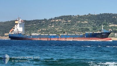
GAUJA
Container Ship
Current Trip
EGSAID
| Time Travelled | 6 days |
|---|---|
| Remaining Time | --- |
| Distance Travelled | 1262.66 nm |
| Remaining Distance | --- |
| AVG Speed | 11.6 Noeuds |
| MAX Speed | 14.5 Noeuds |
| AVG Wind | 11.3 knots |
| MAX Wind | 21.8 knots |
| MIN Temp | 7°C / 44.6°F |
| MAX Temp | 20.7°C / 69.26°F |
| Tirant d eau | 9.6 m |
| Position reçue | 12 h, 25 m depuis |
Current Position
| Longitude | --- |
|---|---|
| Latitude | --- |
| Etat | Under way using engine |
| Vitesse | 12.8 Noeuds |
| Parcours | 155.4° |
| Zone | Red Sea |
| Station | T-AIS |
| Position reçue | 12 h, 25 m depuis |
Info
Information
The current position of GAUJA is in Red Sea with coordinates 27.18953° / 34.23462° as reported on 2025-01-11 04:58 by AIS to our vessel tracker app. The vessel's current speed is 12.8 Noeuds
The vessel GAUJA (IMO: 9348493, MMSI: 372818000) is a Container Ship that was built in 2006 ( 19 Age ). It's sailing under the flag of [PA] Panama.
In this page you can find informations about the vessels current position, last detected port calls, and current voyage information. If the vessels is not in coverage by AIS you will find the latest position.
The current position of GAUJA is detected by our AIS receivers and we are not responsible for the reliability of the data. The last position was recorded while the vessel was in Coverage by the Ais receivers of our vessel tracking app.
The current draught of GAUJA as reported by AIS is 9.6 meters
Weather
| Temperature | 20.5°C / 68.9°F |
|---|---|
| Wind Speed | 15 knots |
| Direction | 348° NNW |
| Pressure | 1018.2 hPa |
| Humidity | 61 % |
| Cloud Coverage | --- |
Featured Company
Last Port Calls
| Port | Arrival | Departure | Time In Port |
|---|---|---|---|
| 2025-01-10 04:18 | 2025-01-10 13:16 | 8 h | |
| 2025-01-05 05:25 | 2025-01-05 16:37 | 11 h | |
| 2025-01-03 10:07 | 2025-01-03 22:25 | 12 h | |
| 2024-12-31 12:22 | 2025-01-01 09:58 | 21 h | |
| 2024-12-26 02:05 | 2024-12-30 20:25 | 4 d | |
| 2024-12-14 02:12 | 2024-12-14 11:09 | 8 h | |
| 2024-12-11 19:37 | 2024-12-12 08:29 | 12 h | |
| 2024-12-08 21:47 | 2024-12-09 11:33 | 13 h | |
| 2024-12-05 08:21 | 2024-12-06 00:09 | 15 h | |
| 2024-11-25 15:24 | 2024-11-26 10:06 | 18 h |
Most Visited Ports (Last year)
| Port | Arrivals | |
|---|---|---|
| 11 | ||
| 11 | ||
| 6 | ||
| 5 | ||
| 5 | ||
| 5 |
Last Trips
| Origin | Departure | Destination | Arrival | Distance | |
|---|---|---|---|---|---|
| 2025-01-05 19:37 | 2025-01-10 06:18 | 897.63 nm | |||
| 2025-01-04 01:25 | 2025-01-05 08:25 | 269.13 nm | |||
| 2025-01-01 11:58 | 2025-01-03 13:07 | 598.97 nm | |||
| 2024-12-14 16:39 | 2024-12-31 14:22 | 3448.91 nm | |||
| 2024-12-14 16:39 | 2024-12-26 04:05 | 3288.71 nm | |||
| 2024-12-12 13:59 | 2024-12-14 07:42 | 439.82 nm | |||
| 2024-12-09 17:03 | 2024-12-12 01:07 | 469.90 nm | |||
| 2024-12-06 04:09 | 2024-12-09 03:17 | 781.20 nm | |||
| 2024-11-26 14:06 | 2024-12-05 12:21 | 1180.07 nm | |||
| 2024-11-22 02:29 | 2024-11-25 19:24 | 976.65 nm |
Events
| Heure | Evenement | Détails | Position/ Destination | Info |
|---|---|---|---|---|
| 2025-01-11 05:12 | Etat Changé | Default Under way using engine |
27.14256 / 34.25852
EGSAID
|
Vitesse: 12.8 kn Parcours: 155.4° |
| 2025-01-11 04:58 | Hors de la zone couverte |
27.18953 / 34.23462
Red Sea
|
Vitesse: 12.8 kn Parcours: 155.4° |
|
| 2025-01-11 04:45 | Detecté en mer | Egyptian part of the Red Sea |
27.23058 / 34.21387
Red Sea
|
Vitesse: 12.6 kn Parcours: 155.8° |
| 2025-01-11 04:45 | Etat Changé | Under way using engine Default |
27.23058 / 34.21387
EGSAID
|
Vitesse: 12.5 kn Parcours: 157° |
| 2025-01-11 04:37 | Dans la zone couverte |
27.23058 / 34.21387
Red Sea
|
Vitesse: 12.6 kn Parcours: 155.8° |
|
| 2025-01-10 13:57 | Etat Changé | Default Under way using engine |
29.85129 / 32.55287
EGSAID
|
Vitesse: 12 kn Parcours: 169.7° |
| 2025-01-10 13:52 | Hors de la zone couverte |
29.86922 / 32.55077
Gulf of Suez
|
Vitesse: 12 kn Parcours: 169.7° |
|
| 2025-01-10 13:17 | Changement de zone | Egyptian part of the Gulf of Suez Egyptian part of the Mediterranean Sea - Eastern Basin |
29.94362 / 32.57567
Gulf of Suez
|
Vitesse: 7.7 kn Parcours: 214.8° |
| 2025-01-10 13:16 | PORT DE DEPART |
|
29.94508 / 32.57693
EGSAID
|
Vitesse: 8 kn Parcours: 215° |
| 2025-01-10 12:12 | Tirant d'eau modifié | 9.6 9.5 |
30.12411 / 32.57039
[EG] SUEZ CANAL
|
Vitesse: 10.9 kn Parcours: 177° |