
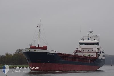
FRI BREVIK
General Cargo
Current Trip
| Time Travelled | 2 days |
|---|---|
| Remaining Time | 1 day |
| Distance Travelled | 506.46 nm |
| Remaining Distance | 195.37 nm |
| AVG Speed | 8.3 Noeuds |
| MAX Speed | 12.7 Noeuds |
| AVG Wind | 10 knots |
| MAX Wind | 22 knots |
| MIN Temp | 6.3°C / 43.34°F |
| MAX Temp | 14.5°C / 58.1°F |
| Tirant d eau | 5.7 m |
| Position reçue | Maintenant |
Current Position
| Longitude | 9.99827° |
|---|---|
| Latitude | 54.35067° |
| Etat | Under way using engine |
| Vitesse | 6.9 Noeuds |
| Parcours | 47.9° |
| Zone | North Sea |
| Station | T-AIS |
| Position reçue | Maintenant |
Info
Information
The current position of FRI BREVIK is in North Sea with coordinates 54.35067° / 9.99827° as reported on 2024-04-29 03:52 by AIS to our vessel tracker app. The vessel's current speed is 6.9 Noeuds and is heading at the port of HALMSTAD. The estimated time of arrival as calculated by MyShipTracking vessel tracking app is 2024-04-30 09:19 LT
The vessel FRI BREVIK (IMO: 9190183, MMSI: 209488000) is a General Cargo that was built in 2001 ( 23 Age ). It's sailing under the flag of [CY] Cyprus.
In this page you can find informations about the vessels current position, last detected port calls, and current voyage information. If the vessels is not in coverage by AIS you will find the latest position.
The current position of FRI BREVIK is detected by our AIS receivers and we are not responsible for the reliability of the data. The last position was recorded while the vessel was in Coverage by the Ais receivers of our vessel tracking app.
The current draught of FRI BREVIK as reported by AIS is 5.7 meters
Weather
| Temperature | 6.5°C / 43.7°F |
|---|---|
| Wind Speed | 6 knots |
| Direction | 188° S |
| Pressure | 1018.8 hPa |
| Humidity | 93.3 % |
| Cloud Coverage | 85 % |
Featured Company
Last Port Calls
| Port | Arrival | Departure | Time In Port |
|---|---|---|---|
| 2024-04-22 10:21 | 2024-04-26 23:26 | 4 d | |
| 2024-04-17 08:08 | 2024-04-17 21:01 | 12 h | |
| 2024-04-16 17:15 | 2024-04-16 17:51 | 35 m | |
| 2024-04-14 09:57 | 2024-04-16 10:35 | 2 d | |
| 2024-04-14 02:58 | 2024-04-14 03:18 | 20 m | |
| 2024-04-07 04:53 | 2024-04-08 19:51 | 1 d | |
| 2024-04-03 07:41 | 2024-04-03 20:18 | 12 h | |
| 2024-03-28 19:44 | 2024-03-29 16:45 | 21 h | |
| 2024-03-27 01:03 | 2024-03-28 13:30 | 1 d | |
| 2024-03-20 06:05 | 2024-03-21 17:24 | 1 d |
Most Visited Ports (Last year)
| Port | Arrivals | |
|---|---|---|
| 6 | ||
| 5 | ||
| 3 | ||
| 3 | ||
| 2 | ||
| 2 |
Last Trips
| Origin | Departure | Destination | Arrival | Distance | |
|---|---|---|---|---|---|
| 2024-04-17 23:01 | 2024-04-22 11:21 | 778.23 nm | |||
| 2024-04-16 19:51 | 2024-04-17 10:08 | 161.94 nm | |||
| 2024-04-16 12:35 | 2024-04-16 19:15 | 65.06 nm | |||
| 2024-04-14 05:18 | 2024-04-14 11:57 | 65.67 nm | |||
| 2024-04-08 20:51 | 2024-04-14 04:58 | 1270.54 nm | |||
| 2024-04-03 20:18 | 2024-04-07 05:53 | 853.44 nm | |||
| 2024-03-29 16:45 | 2024-04-03 07:41 | 911.71 nm | |||
| 2024-03-28 13:30 | 2024-03-28 19:44 | 67.76 nm | |||
| 2024-03-21 18:24 | 2024-03-27 01:03 | 1062.64 nm | |||
| 2024-03-19 22:12 | 2024-03-20 07:05 | 81.54 nm |
Events
| Heure | Evenement | Détails | Position/ Destination | Info |
|---|---|---|---|---|
| 2024-04-28 23:41 | Démarrage | 0.17 nm, South West of FISCHERHUTTE |
54.15175 / 9.36998
SEHAD
|
Vitesse: 5.6 kn Parcours: 54.5° |
| 2024-04-28 23:17 | Arret | 0.33 nm, South West of FISCHERHUTTE |
54.15006 / 9.36637
SEHAD
|
Vitesse: 0.3 kn Parcours: 58° |
| 2024-04-28 22:37 | Etat Changé | Under way using engine Default |
54.12196 / 9.32898
SEHAD
|
Vitesse: 6.3 kn Parcours: 357° |
| 2024-04-28 22:34 | Etat Changé | Default Under way using engine |
54.11691 / 9.32840
SEHAD
|
Vitesse: 6.4 kn Parcours: 355.4° |
| 2024-04-28 20:16 | Démarrage | 0.6 nm, South West of BRUNSBUETTEL |
53.89541 / 9.14880
SEHAD
|
Vitesse: 5.1 kn Parcours: 46.1° |
| 2024-04-28 19:34 | Arret | 0.73 nm, South West of BRUNSBUETTEL |
53.89390 / 9.14618
SEHAD
|
Vitesse: 0.2 kn Parcours: 48° |
| 2024-04-28 15:57 | Etat Changé | Under way using engine Default |
53.97200 / 8.49912
SEHAD
|
Vitesse: 9.8 kn Parcours: 98° |
| 2024-04-28 15:40 | Dans la zone couverte |
53.97200 / 8.49912
North Sea
SEHAD
|
Vitesse: 9.7 kn Parcours: 100.9° |
|
| 2024-04-28 12:15 | Etat Changé | Default Under way using engine |
53.87995 / 7.34985
SEHAD
|
Vitesse: 12 kn Parcours: 74.7° |
| 2024-04-28 12:08 | Hors de la zone couverte |
53.87379 / 7.31343
North Sea
SEHAD
|
Vitesse: 12 kn Parcours: 74.7° |