
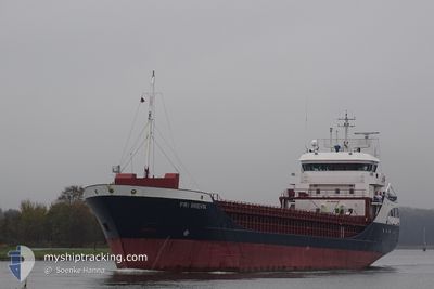
FRI BREVIK
General Cargo
Current Trip
| Time Travelled | 5 days |
|---|---|
| Remaining Time | 43 mins |
| Distance Travelled | 1292.53 nm |
| Remaining Distance | 10.71 nm |
| AVG Speed | 8.5 Knots |
| MAX Speed | 14.3 Knots |
| AVG Wind | 6.7 knots |
| MAX Wind | 13 knots |
| MIN Temp | 5.5°C / 41.9°F |
| MAX Temp | 17°C / 62.6°F |
| Dybgang | 5.9 m |
| Position Modtaget | 2 m siden |
Current Position
| Longitude | -6.96453° |
|---|---|
| Latitude | 52.15159° |
| Status | At anchor |
| Fart | |
| Kurs | 217° |
| Område | Celtic Sea |
| Station | T-AIS |
| Position Modtaget | 2 m siden |
Info
Information
The current position of FRI BREVIK is in Celtic Sea with coordinates 52.15159° / -6.96453° as reported on 2024-05-12 22:06 by AIS to our vessel tracker app. The vessel's current speed is 0 Knots and is heading at the port of WATERFORD. The estimated time of arrival as calculated by MyShipTracking vessel tracking app is 2024-05-12 22:52 LT
The vessel FRI BREVIK (IMO: 9190183, MMSI: 209488000) is a General Cargo that was built in 2001 ( 23 år gamle ). It's sailing under the flag of [CY] Cyprus.
In this page you can find informations about the vessels current position, last detected port calls, and current voyage information. If the vessels is not in coverage by AIS you will find the latest position.
The current position of FRI BREVIK is detected by our AIS receivers and we are not responsible for the reliability of the data. The last position was recorded while the vessel was in Coverage by the Ais receivers of our vessel tracking app.
The current draught of FRI BREVIK as reported by AIS is 5.9 meters
Weather
| Temperature | 10.3°C / 50.54°F |
|---|---|
| Wind Speed | 5 knots |
| Direction | 195° SSW |
| Pressure | 1006.4 hPa |
| Humidity | 93.7 % |
| Cloud Coverage | 88 % |
Featured Company
Last Port Calls
| Port | Arrival | Departure | Time In Port |
|---|---|---|---|
| 2024-05-05 12:45 | 2024-05-07 10:56 | 1 d | |
| 2024-05-02 04:15 | 2024-05-03 19:45 | 1 d | |
| 2024-04-29 05:20 | 2024-04-29 05:23 | 3 m | |
| 2024-04-22 10:21 | 2024-04-26 23:26 | 4 d | |
| 2024-04-17 08:08 | 2024-04-17 21:01 | 12 h | |
| 2024-04-16 17:15 | 2024-04-16 17:51 | 35 m | |
| 2024-04-14 09:57 | 2024-04-16 10:35 | 2 d | |
| 2024-04-14 02:58 | 2024-04-14 03:18 | 20 m | |
| 2024-04-07 04:53 | 2024-04-08 19:51 | 1 d | |
| 2024-04-03 07:41 | 2024-04-03 20:18 | 12 h |
Most Visited Ports (Last year)
| Port | Arrivals | |
|---|---|---|
| 6 | ||
| 5 | ||
| 3 | ||
| 3 | ||
| 3 | ||
| 2 |
Last Trips
| Origin | Departure | Destination | Arrival | Distance | |
|---|---|---|---|---|---|
| 2024-05-03 21:45 | 2024-05-05 15:45 | 432.85 nm | |||
| 2024-04-29 07:23 | 2024-05-02 06:15 | 196.35 nm | |||
| 2024-04-27 00:26 | 2024-04-29 07:20 | 512.71 nm | |||
| 2024-04-17 23:01 | 2024-04-22 11:21 | 778.23 nm | |||
| 2024-04-16 19:51 | 2024-04-17 10:08 | 161.94 nm | |||
| 2024-04-16 12:35 | 2024-04-16 19:15 | 65.06 nm | |||
| 2024-04-14 05:18 | 2024-04-14 11:57 | 65.67 nm | |||
| 2024-04-08 20:51 | 2024-04-14 04:58 | 1270.54 nm | |||
| 2024-04-03 20:18 | 2024-04-07 05:53 | 853.44 nm | |||
| 2024-03-29 16:45 | 2024-04-03 07:41 | 911.71 nm |
Events
| Tid | Hændelsen | Detaljer | Position / Dest | Info |
|---|---|---|---|---|
| 2024-05-12 21:45 | Status er ændret | At anchor Under way using engine |
52.15080 / -6.96392
IEWAT
|
Fart: 0.2 kn Kurs: 265° |
| 2024-05-12 21:43 | STOP Sejllads | 0.99 nm, East of DUNMORE EAST |
52.15067 / -6.96377
IEWAT
|
Fart: 0.3 kn Kurs: 276° |
| 2024-05-12 17:10 | Fundet i havområde | Irish part of the Celtic Sea |
51.42101 / -6.55798
Celtic Sea
IEWAT
|
Fart: 10.6 kn Kurs: 340° |
| 2024-05-12 17:10 | Indenfor Dækning |
51.42101 / -6.55798
Celtic Sea
IEWAT
|
Fart: 10.6 kn Kurs: 340° |
|
| 2024-05-12 16:08 | Status er ændret | Default Under way using engine |
51.24872 / -6.45728
IEWAT
|
Fart: 10.6 kn Kurs: 338.4° |
| 2024-05-12 16:03 | Udenfor Dækning |
51.23446 / -6.44892
Celtic Sea
IEWAT
|
Fart: 10.6 kn Kurs: 338.4° |
|
| 2024-05-12 15:13 | Fundet i havområde | United Kingdom part of the Celtic Sea |
51.09560 / -6.37047
Celtic Sea
IEWAT
|
Fart: 10.5 kn Kurs: 340.8° |
| 2024-05-12 15:13 | Status er ændret | Under way using engine Default |
51.09560 / -6.37047
IEWAT
|
Fart: 10.4 kn Kurs: 339° |
| 2024-05-12 15:10 | Indenfor Dækning |
51.09560 / -6.37047
Celtic Sea
IEWAT
|
Fart: 10.5 kn Kurs: 340.8° |
|
| 2024-05-12 05:52 | Udenfor Dækning |
49.91528 / -5.17472
English Channel
IEWAT
|
Fart: 10.3 kn Kurs: 261.1° |