

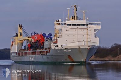
FRAUKE
General Cargo

Current Trip
AO LAD
| Time Travelled | 4 days |
|---|---|
| Remaining Time | --- |
| Distance Travelled | 66.80 nm |
| Remaining Distance | --- |
| AVG Speed | 13.4 Noeuds |
| MAX Speed | 17.9 Noeuds |
| AVG Wind | 7.6 knots |
| MAX Wind | 16 knots |
| MIN Temp | 25.3°C / 77.54°F |
| MAX Temp | 28.9°C / 84.02°F |
| Tirant d eau | 9.5 m |
| Position reçue | 2024-12-28 15:32 |
Current Position
| Longitude | --- |
|---|---|
| Latitude | --- |
| Etat | Under way using engine |
| Vitesse | 17.2 Noeuds |
| Parcours | 200.6° |
| Zone | North Atlantic Ocean |
| Station | T-AIS |
| Position reçue | 2024-12-28 15:32 |
Information
The current position of FRAUKE is in North Atlantic Ocean with coordinates 27.68244° / -15.32971° as reported on 2024-12-28 15:32 by AIS to our vessel tracker app. The vessel's current speed is 17.2 Noeuds
The vessel FRAUKE (IMO: 9376488, MMSI: 305164000) is a General Cargo that was built in 2008 ( 17 Age ). It's sailing under the flag of [AG] Antigua Barbuda.
In this page you can find informations about the vessels current position, last detected port calls, and current voyage information. If the vessels is not in coverage by AIS you will find the latest position.
The current position of FRAUKE is detected by our AIS receivers and we are not responsible for the reliability of the data. The last position was recorded while the vessel was in Coverage by the Ais receivers of our vessel tracking app.
The current draught of FRAUKE as reported by AIS is 9.5 meters
Weather
| Temperature | 27.3°C / 81.14°F |
|---|---|
| Wind Speed | 16 knots |
| Direction | 251° WSW |
| Pressure | 1006.1 hPa |
| Humidity | 85.1 % |
| Cloud Coverage | 85 % |


Featured Company
Most Visited Ports (Last year)
| Port | Arrivals | |
|---|---|---|
| 5 | ||
| 3 | ||
| 2 | ||
| 2 | ||
| 2 | ||
| 1 |
Last Trips
| Origin | Departure | Destination | Arrival | Distance | |
|---|---|---|---|---|---|
| 2025-03-22 14:41 | 2025-03-24 10:57 | 5.64 nm | |||
| 2025-03-11 08:08 | 2025-03-21 09:08 | 73.20 nm | |||
| 2025-03-03 09:39 | 2025-03-05 09:52 | 67.53 nm | |||
| 2025-01-07 11:00 | 2025-02-25 09:56 | 283.96 nm | |||
| 2024-12-28 13:45 | 2025-01-05 13:52 | 3316.90 nm |
Events
| Heure | Evenement | Détails | Position/ Destination | Info |
|---|---|---|---|---|
| 2025-03-25 12:30 | Arret | 4.96 nm, North of LUANDA |
-8.71010 / 13.27490
AO LAD
|
Vitesse: 0.3 kn Parcours: 114° |
| 2025-03-25 07:04 | PORT DE DEPART |
|
-8.76319 / 13.27384
AO LAD
|
Vitesse: 10.1 kn Parcours: 51° |
| 2025-03-25 06:49 | Démarrage |
-8.79369 / 13.25314
[AO] LUANDA
|
Vitesse: 3.7 kn Parcours: 320° |
|
| 2025-03-24 10:32 | Arret |
-8.79652 / 13.25625
[AO] LUANDA
|
Vitesse: 0.3 kn Parcours: 69° |
|
| 2025-03-24 09:57 | Port d'arrivée |
|
-8.76696 / 13.27115
[AO] LUANDA
|
Vitesse: 5.2 kn Parcours: 206° |
| 2025-03-24 09:33 | Démarrage | 4.09 nm, North East of LUANDA |
-8.72881 / 13.28130
AO LAD
|
Vitesse: 4.1 kn Parcours: 171° |
| 2025-03-22 14:08 | Arret | 4.32 nm, North East of LUANDA |
-8.72383 / 13.28012
AO LAD
|
Vitesse: 0.2 kn Parcours: 269° |
| 2025-03-22 13:41 | PORT DE DEPART |
|
-8.76004 / 13.27654
AO LAD
|
Vitesse: 11.2 kn Parcours: 37° |
| 2025-03-22 13:29 | Démarrage |
-8.78871 / 13.25428
[AO] LUANDA
|
Vitesse: 7.6 kn Parcours: 40° |
|
| 2025-03-21 08:45 | Arret |
-8.79618 / 13.25473
[AO] LUANDA
|
Vitesse: 0.3 kn Parcours: 166° |