
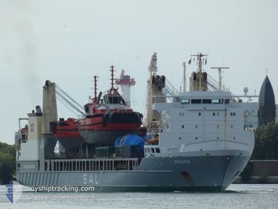
FRAUKE
General Cargo
Current Trip
| Time Travelled | 8 days |
|---|---|
| Remaining Time | --- |
| Distance Travelled | 2700.86 nm |
| Remaining Distance | --- |
| AVG Speed | 15.8 Knots |
| MAX Speed | 20.3 Knots |
| AVG Wind | 8.8 knots |
| MAX Wind | 19 knots |
| MIN Temp | 11.4°C / 52.52°F |
| MAX Temp | 29.3°C / 84.74°F |
| Draught | 7.9 m |
| Position Received | 7 d ago |
Current Position
| Longitude | 104.33307° |
|---|---|
| Latitude | 1.29392° |
| Status | Under way using engine |
| Speed | 18.7 Knots |
| Course | 72.5° |
| Area | Singapore Strait |
| Station | T-AIS |
| Position Received | 7 d ago |
Info
Information
The current position of FRAUKE is in Singapore Strait with coordinates 1.29392° / 104.33307° as reported on 2024-04-12 21:02 by AIS to our vessel tracker app. The vessel's current speed is 18.7 Knots and is heading at the port of PENGLAI. The estimated time of arrival as calculated by MyShipTracking vessel tracking app is 2024-04-19 04:00 LT
The vessel FRAUKE (IMO: 9376488, MMSI: 305164000) is a General Cargo that was built in 2008 ( 16 years old ). It's sailing under the flag of [AG] Antigua Barbuda.
In this page you can find informations about the vessels current position, last detected port calls, and current voyage information. If the vessels is not in coverage by AIS you will find the latest position.
The current position of FRAUKE is detected by our AIS receivers and we are not responsible for the reliability of the data. The last position was recorded while the vessel was in Coverage by the Ais receivers of our vessel tracking app.
The current draught of FRAUKE as reported by AIS is 7.9 meters
Weather
| Temperature | 12.7°C / 54.86°F |
|---|---|
| Wind Speed | 9 knots |
| Direction | 105° ESE |
| Pressure | 1010.2 hPa |
| Humidity | 70 % |
| Cloud Coverage | 83 % |
Featured Company
Last Port Calls
| Port | Arrival | Departure | Time In Port |
|---|---|---|---|
| 2024-04-10 10:20 | 2024-04-12 01:23 | 1 d | |
| 2024-04-02 23:01 | 2024-04-04 02:17 | 1 d | |
| 2024-03-30 09:53 | 2024-04-01 08:45 | 1 d | |
| 2024-02-22 05:21 | 2024-02-22 07:05 | 1 h | |
| 2024-02-17 11:09 | 2024-02-21 14:33 | 4 d | |
| 2024-02-10 16:07 | 2024-02-13 15:20 | 2 d | |
| 2024-02-08 20:53 | 2024-02-08 20:56 | 2 m | |
| 2024-02-05 06:55 | 2024-02-07 15:18 | 2 d | |
| 2024-02-02 16:18 | 2024-02-05 05:15 | 2 d |
Most Visited Ports (Last year)
| Port | Arrivals | |
|---|---|---|
| 3 | ||
| 3 | ||
| 2 | ||
| 2 | ||
| 2 | ||
| 2 |
Last Trips
| Origin | Departure | Destination | Arrival | Distance | |
|---|---|---|---|---|---|
| 2024-04-04 10:17 | 2024-04-10 18:20 | 1848.24 nm | |||
| 2024-04-01 16:45 | 2024-04-03 07:01 | 19.04 nm | |||
| 2024-02-22 08:05 | 2024-03-30 17:53 | 14064.46 nm | |||
| 2024-02-21 15:33 | 2024-02-22 06:21 | 113.62 nm | |||
| 2024-02-13 16:20 | 2024-02-17 12:09 | 411.95 nm | |||
| 2024-02-08 21:56 | 2024-02-10 17:07 | 365.63 nm | |||
| 2024-02-07 16:18 | 2024-02-08 21:53 | 331.55 nm | |||
| 2024-02-05 06:15 | 2024-02-05 07:55 | 16.96 nm | |||
| 2024-01-28 11:04 | 2024-02-02 17:18 | 2284.29 nm |
Events
| Time | Event | Details | Position / Dest | Info |
|---|---|---|---|---|
| 2024-04-19 22:52 | STOP Moving | 7.84 nm, East of PENGLAI |
37.82368 / 120.90173
CNPLA
|
Speed: Course: 269° |
| 2024-04-19 22:44 | START Moving | 7.62 nm, East of PENGLAI |
37.82784 / 120.89735
CNPLA
|
Speed: 3.3 kn Course: 162° |
| 2024-04-12 21:06 | Status Changed | Default Under way using engine |
1.30805 / 104.35149
CNPLA
|
Speed: 18.7 kn Course: 72.5° |
| 2024-04-12 21:02 | OUT of Coverage |
1.29392 / 104.33307
Singapore Strait
CNPLA
|
Speed: 18.7 kn Course: 72.5° |
|
| 2024-04-12 20:22 | Change Sea Area | Malaysian part of the Singapore Strait Indonesian part of the Singapore Strait |
1.26306 / 104.13496
Singapore Strait
CNPLA
|
Speed: 18.8 kn Course: 81.8° |
| 2024-04-12 19:17 | Change Sea Area | Indonesian part of the Singapore Strait Singaporean part of the Singapore Strait |
1.17917 / 103.83919
Singapore Strait
CNPLA
|
Speed: 13.7 kn Course: 106.4° |
| 2024-04-12 18:30 | Draught Changed | 7.9 7.4 |
1.25092 / 103.80268
CNPLA
|
Speed: 5.3 kn Course: 288.9° |
| 2024-04-12 18:30 | Destination Changed | CNPLA SGSIN |
1.25092 / 103.80268
CNPLA
|
Speed: 5.3 kn Course: 288.9° |
| 2024-04-12 18:30 | ETA Changed | 2024/04/19 04:00 2024/04/10 09:00 |
1.25092 / 103.80268
CNPLA
|
Speed: 5.3 kn Course: 288.9° |
| 2024-04-12 18:26 | START Moving | 2.77 nm, West of SINGAPORE |
1.24812 / 103.80947
SGSIN
|
Speed: 6.4 kn Course: 297° |