
FOURNI
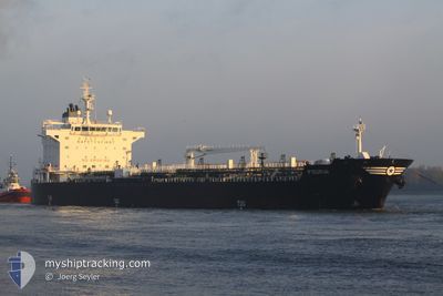
Oil/Chemical Tanker
Current Trip
| Time Travelled | 4 days |
|---|---|
| Remaining Time | --- |
| Distance Travelled | 766.58 nm |
| Remaining Distance | --- |
| AVG Speed | 13.9 Noeuds |
| MAX Speed | 17.1 Noeuds |
| AVG Wind | 3.7 knots |
| MAX Wind | 9.5 knots |
| MIN Temp | 21.8°C / 71.24°F |
| MAX Temp | 38.5°C / 101.3°F |
| Tirant d eau | 11.3 m |
| Position reçue | 1 h, 50 m depuis |
Current Position
| Longitude | -50.54780° |
|---|---|
| Latitude | 0.30187° |
| Etat | Under way using engine |
| Vitesse | 15.1 Noeuds |
| Parcours | 53° |
| Zone | North Atlantic Ocean |
| Station | T-AIS |
| Position reçue | 1 h, 50 m depuis |
Info
Information
The current position of FOURNI is in North Atlantic Ocean with coordinates 0.30187° / -50.54780° as reported on 2024-08-01 20:46 by AIS to our vessel tracker app. The vessel's current speed is 15.1 Noeuds and is heading at the port of GUAYANILLA. The estimated time of arrival as calculated by MyShipTracking vessel tracking app is 2024-08-09 18:00 LT
The vessel FOURNI (IMO: 9405564, MMSI: 240991000) is a Oil/Chemical Tanker that was built in 2010 ( 14 Age ). It's sailing under the flag of [GR] Greece.
In this page you can find informations about the vessels current position, last detected port calls, and current voyage information. If the vessels is not in coverage by AIS you will find the latest position.
The current position of FOURNI is detected by our AIS receivers and we are not responsible for the reliability of the data. The last position was recorded while the vessel was in Coverage by the Ais receivers of our vessel tracking app.
The current draught of FOURNI as reported by AIS is 11.3 meters
Weather
| Temperature | 28.1°C / 82.58°F |
|---|---|
| Wind Speed | 9 knots |
| Direction | 74° ENE |
| Pressure | 1012.4 hPa |
| Humidity | 74.1 % |
| Cloud Coverage | 32 % |
Featured Company
Last Port Calls
| Port | Arrival | Departure | Time In Port |
|---|---|---|---|
| 2024-07-23 18:50 | 2024-07-28 17:58 | 4 d | |
| 2024-07-09 23:07 | 2024-07-11 18:44 | 1 d | |
| 2024-07-06 05:03 | 2024-07-09 01:20 | 2 d | |
| 2024-06-25 19:01 | 2024-06-27 15:20 | 1 d | |
| 2024-06-21 11:07 | 2024-06-22 22:59 | 1 d | |
| 2024-06-15 09:06 | 2024-06-17 16:26 | 2 d | |
| 2024-06-07 03:30 | 2024-06-14 11:51 | 7 d | |
| 2024-06-02 11:52 | 2024-06-03 21:53 | 1 d | |
| 2024-06-02 00:16 |
Most Visited Ports (Last year)
| Port | Arrivals | |
|---|---|---|
| 5 | ||
| 5 | ||
| 4 | ||
| 2 | ||
| 2 | ||
| 2 |
Last Trips
| Origin | Departure | Destination | Arrival | Distance | |
|---|---|---|---|---|---|
| 2024-07-11 14:44 | 2024-07-23 14:50 | 2397.02 nm | |||
| 2024-07-08 21:20 | 2024-07-09 19:07 | 143.44 nm | |||
| 2024-06-27 11:20 | 2024-07-06 01:03 | 706.01 nm | |||
| 2024-06-22 18:59 | 2024-06-25 15:01 | 199.03 nm | |||
| 2024-06-17 12:26 | 2024-06-21 07:07 | 298.45 nm | |||
| 2024-06-14 07:51 | 2024-06-15 05:06 | 178.97 nm | |||
| 2024-06-03 17:53 | 2024-06-06 23:30 | 305.12 nm | |||
| 2024-06-01 20:16 | 2024-06-02 07:52 | 126.33 nm |
Events
| Heure | Evenement | Détails | Position/ Destination | Info |
|---|---|---|---|---|
| 2024-08-01 20:53 | Etat Changé | Default Under way using engine |
.31985 / -50.52702
PRGUY
|
Vitesse: 15.1 kn Parcours: 53° |
| 2024-08-01 20:46 | Hors de la zone couverte |
.30187 / -50.54780
North Atlantic Ocean
PRGUY
|
Vitesse: 15.1 kn Parcours: 53° |
|
| 2024-08-01 20:44 | Etat Changé | Under way using engine Default |
.29572 / -50.55622
PRGUY
|
Vitesse: 15.2 kn Parcours: 53° |
| 2024-08-01 20:42 | Dans la zone couverte |
.29598 / -50.55588
North Atlantic Ocean
PRGUY
|
Vitesse: 15.3 kn Parcours: 53° |
|
| 2024-08-01 18:59 | Etat Changé | Default Under way using engine |
.13063 / -50.94645
PRGUY
|
Vitesse: 14 kn Parcours: 51° |
| 2024-08-01 18:58 | Hors de la zone couverte |
.12742 / -50.95070
North Atlantic Ocean
PRGUY
|
Vitesse: 14 kn Parcours: 51° |
|
| 2024-08-01 18:13 | Changement de zone | Brazilian part of the North Atlantic Ocean Brazilian part of the South Atlantic Ocean |
.00640 / -51.01180
North Atlantic Ocean
PRGUY
|
Vitesse: 7.6 kn Parcours: 1° |
| 2024-08-01 15:25 | Etat Changé | Under way using engine Default |
-.44232 / -51.27600
PRGUY
|
Vitesse: 13.2 kn Parcours: 78° |
| 2024-08-01 15:21 | Dans la zone couverte |
-.44232 / -51.27600
South Atlantic Ocean
PRGUY
|
Vitesse: 13.2 kn Parcours: 73° |
|
| 2024-08-01 09:21 | Hors de la zone couverte |
-1.43333 / -52.04568
South Atlantic Ocean
PRGUY
|
Vitesse: 15.3 kn Parcours: 82° |