
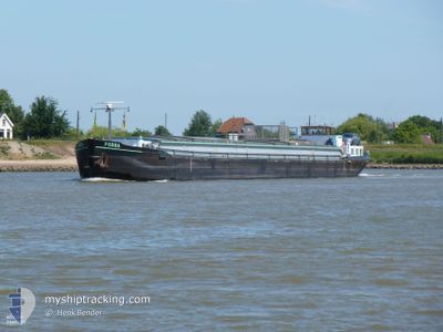
FOSSA
Cargo
Current Trip
| Trip Time | 9 days |
|---|---|
| Trip Distance | 394.58 nm |
| AVG Speed | 5.9 Noeuds |
| MAX Speed | 9.6 Noeuds |
| Tirant d eau | 2.7 m |
| AVG Wind | 8.3 knots |
| MAX Wind | 19.4 knots |
| MIN Temp | -0.2°C / 31.64°F |
| MAX Temp | 15.7°C / 60.26°F |
| Position reçue | 1 m depuis |
Current Position
| Longitude | 5.65161° |
|---|---|
| Latitude | 51.95806° |
| Etat | Under way using engine |
| Vitesse | |
| Parcours | --- |
| Zone | North Sea |
| Station | T-AIS |
| Position reçue | 1 m depuis |
Info
Information
The current position of FOSSA is in North Sea with coordinates 51.95806° / 5.65161° as reported on 2024-04-28 06:27 by AIS to our vessel tracker app. The vessel's current speed is 0 Noeuds and is currently inside the port of WAGENINGEN.
The vessel FOSSA (MMSI: 244660009) is a Cargo It's sailing under the flag of [NL] Netherlands.
In this page you can find informations about the vessels current position, last detected port calls, and current voyage information. If the vessels is not in coverage by AIS you will find the latest position.
The current position of FOSSA is detected by our AIS receivers and we are not responsible for the reliability of the data. The last position was recorded while the vessel was in Coverage by the Ais receivers of our vessel tracking app.
The current draught of FOSSA as reported by AIS is 2.7 meters
Weather
| Temperature | 13.4°C / 56.12°F |
|---|---|
| Wind Speed | 12 knots |
| Direction | 178° S |
| Pressure | 1004.7 hPa |
| Humidity | 71.6 % |
| Cloud Coverage | 100 % |
Featured Company
Last Port Calls
| Port | Arrival | Departure | Time In Port |
|---|---|---|---|
| 2024-04-27 16:48 | |||
| 2024-04-17 18:04 | 2024-04-17 18:27 | 23 m | |
| 2024-04-16 13:51 | 2024-04-17 15:16 | 1 d | |
| 2024-04-14 12:46 | 2024-04-14 15:09 | 2 h | |
| 2024-04-12 14:57 | 2024-04-13 11:53 | 20 h | |
| 2024-04-12 10:00 | 2024-04-12 11:22 | 1 h | |
| 2024-04-11 06:14 | 2024-04-11 07:37 | 1 h | |
| 2024-04-10 11:46 | 2024-04-11 03:50 | 16 h | |
| 2024-04-09 20:45 | 2024-04-10 04:07 | 7 h | |
| 2024-04-08 11:59 | 2024-04-09 09:54 | 21 h |
Last Trips
| Origin | Departure | Destination | Arrival | Distance | |
|---|---|---|---|---|---|
| 2024-04-17 20:27 | 2024-04-27 18:48 | 394.58 nm | |||
| 2024-04-17 17:16 | 2024-04-17 20:04 | 17.07 nm | |||
| 2024-04-14 17:09 | 2024-04-16 15:51 | 0.31 nm | |||
| 2024-04-13 13:53 | 2024-04-14 14:46 | 0.38 nm | |||
| 2024-04-12 13:22 | 2024-04-12 16:57 | 17.40 nm | |||
| 2024-04-11 09:37 | 2024-04-12 12:00 | 77.28 nm | |||
| 2024-04-11 05:50 | 2024-04-11 08:14 | 12.34 nm | |||
| 2024-04-10 06:07 | 2024-04-10 13:46 | 37.61 nm | |||
| 2024-04-09 11:54 | 2024-04-09 22:45 | 52.61 nm | |||
| 2024-04-05 18:07 | 2024-04-08 13:59 | 90.61 nm |
Events
| Heure | Evenement | Détails | Position/ Destination | Info |
|---|---|---|---|---|
| 2024-04-27 16:49 | Arret |
51.95801 / 5.65163
[NL] WAGENINGEN
|
Vitesse: 0.3 kn Parcours: 511° |
|
| 2024-04-27 16:48 | Port d'arrivée |
|
51.95800 / 5.65161
[NL] WAGENINGEN
|
Vitesse: 0.8 kn Parcours: 511° |
| 2024-04-27 15:47 | Démarrage | 0.58 nm, West of DRIEL |
51.96572 / 5.80175
SKYLGE
|
Vitesse: 3.9 kn Parcours: 241.7° |
| 2024-04-27 15:36 | Arret | 0.49 nm, West of DRIEL |
51.96683 / 5.80474
SKYLGE
|
Vitesse: 0.3 kn Parcours: 511° |
| 2024-04-27 12:56 | Etat Changé | Under way using engine Default |
51.82806 / 6.24390
SKYLGE
|
Vitesse: 9 kn Parcours: 312° |
| 2024-04-27 12:47 | Dans la zone couverte |
51.82806 / 6.24390
North Sea
|
Vitesse: 8.6 kn Parcours: 281.6° |
|
| 2024-04-26 19:32 | Arret | 5.66 nm, East of MARL |
51.71500 / 7.24667
SKYLGE
|
Vitesse: Parcours: -1° |
| 2024-04-26 17:53 | Arret | 3.08 nm, North West of WALTROP |
51.66667 / 7.35667
SKYLGE
|
Vitesse: Parcours: -1° |
| 2024-04-26 04:32 | Etat Changé | Default Under way using engine |
52.36500 / 7.84667
SKYLGE
|
Vitesse: 4.8 kn Parcours: 234.5° |
| 2024-04-26 04:20 | Hors de la zone couverte |
52.37522 / 7.86970
North Sea
|
Vitesse: 4.8 kn Parcours: 234.5° |