
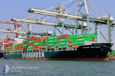
EVER OPTIMA
Cargo
Current Trip
| Time Travelled | 3 days |
|---|---|
| Remaining Time | 11 h, 53 mins |
| Distance Travelled | 1263.14 nm |
| Remaining Distance | 202.27 nm |
| AVG Speed | 16.5 Noeuds |
| MAX Speed | 18.6 Noeuds |
| AVG Wind | 6.8 knots |
| MAX Wind | 16 knots |
| MIN Temp | 21.7°C / 71.06°F |
| MAX Temp | 30.3°C / 86.54°F |
| Tirant d eau | 11.2 m |
| Position reçue | 3 d depuis |
Current Position
| Longitude | 114.46099° |
|---|---|
| Latitude | 22.15104° |
| Etat | Under way using engine |
| Vitesse | 16.6 Noeuds |
| Parcours | 176° |
| Zone | South China Sea |
| Station | T-AIS |
| Position reçue | 3 d depuis |
Info
Information
The current position of EVER OPTIMA is in South China Sea with coordinates 22.15104° / 114.46099° as reported on 2024-05-01 09:56 by AIS to our vessel tracker app. The vessel's current speed is 16.6 Noeuds and is heading at the port of PASIR GUDANG. The estimated time of arrival as calculated by MyShipTracking vessel tracking app is 2024-05-04 23:41 LT
The vessel EVER OPTIMA (IMO: 9919474, MMSI: 352001525) is a Cargo It's sailing under the flag of [PA] Panama.
In this page you can find informations about the vessels current position, last detected port calls, and current voyage information. If the vessels is not in coverage by AIS you will find the latest position.
The current position of EVER OPTIMA is detected by our AIS receivers and we are not responsible for the reliability of the data. The last position was recorded while the vessel was in Coverage by the Ais receivers of our vessel tracking app.
The current draught of EVER OPTIMA as reported by AIS is 11.2 meters
Weather
| Temperature | 29.3°C / 84.74°F |
|---|---|
| Wind Speed | 11 knots |
| Direction | 220° SW |
| Pressure | 1007.6 hPa |
| Humidity | 76.1 % |
| Cloud Coverage | 80 % |
Featured Company
Last Port Calls
| Port | Arrival | Departure | Time In Port |
|---|---|---|---|
| 2024-04-30 20:26 | 2024-05-01 07:48 | 11 h | |
| 2024-04-29 21:32 | 2024-04-30 15:38 | 18 h | |
| 2024-04-28 09:23 | 2024-04-28 17:44 | 8 h | |
| 2024-04-23 21:52 | 2024-04-24 10:20 | 12 h | |
| 2024-04-21 08:50 | 2024-04-22 01:36 | 16 h | |
| 2024-04-17 21:08 | 2024-04-18 18:46 | 21 h | |
| 2024-04-16 08:04 | 2024-04-16 20:40 | 12 h | |
| 2024-04-11 19:26 | 2024-04-12 23:58 | 1 d | |
| 2024-04-08 01:49 | 2024-04-10 03:49 | 2 d | |
| 2024-04-06 09:40 | 2024-04-07 06:17 | 20 h |
Last Trips
| Origin | Departure | Destination | Arrival | Distance | |
|---|---|---|---|---|---|
| 2024-04-30 23:38 | 2024-05-01 04:26 | 62.17 nm | |||
| 2024-04-29 01:44 | 2024-04-30 05:32 | 426.58 nm | |||
| 2024-04-24 18:20 | 2024-04-28 17:23 | 913.64 nm | |||
| 2024-04-22 10:36 | 2024-04-24 05:52 | 356.70 nm | |||
| 2024-04-19 02:46 | 2024-04-21 17:50 | 989.51 nm | |||
| 2024-04-17 04:40 | 2024-04-18 05:08 | 357.95 nm | |||
| 2024-04-13 07:58 | 2024-04-16 16:04 | 1349.50 nm | |||
| 2024-04-10 11:49 | 2024-04-12 03:26 | 640.48 nm | |||
| 2024-04-07 14:17 | 2024-04-08 09:49 | 224.28 nm | |||
| 2024-04-05 05:21 | 2024-04-06 17:40 | 16.16 nm |
Events
| Heure | Evenement | Détails | Position/ Destination | Info |
|---|---|---|---|---|
| 2024-05-01 10:04 | Etat Changé | Default Under way using engine |
22.11374 / 114.46847
MYJHR
|
Vitesse: 16.6 kn Parcours: 176° |
| 2024-05-01 09:56 | Hors de la zone couverte |
22.15104 / 114.46099
South China Sea
MYJHR
|
Vitesse: 16.6 kn Parcours: 176° |
|
| 2024-05-01 08:54 | Etat Changé | Under way using engine Default |
22.43332 / 114.46218
MYJHR
|
Vitesse: 15 kn Parcours: 158° |
| 2024-05-01 08:24 | Etat Changé | Default Under way using engine |
22.51147 / 114.41534
MYJHR
|
Vitesse: 11.9 kn Parcours: 135.2° |
| 2024-05-01 08:19 | Changement de destination | MYJHR CNYYT |
22.52212 / 114.40367
MYJHR
|
Vitesse: 11.9 kn Parcours: 135.2° |
| 2024-05-01 08:19 | Changement d'ETA | 2024/05/05 00:01 2024/04/30 19:00 |
22.52212 / 114.40367
MYJHR
|
Vitesse: 11.9 kn Parcours: 135.2° |
| 2024-05-01 08:19 | Etat Changé | Under way using engine Default |
22.52212 / 114.40367
CNYYT
|
Vitesse: 13.4 kn Parcours: 130° |
| 2024-05-01 08:12 | Dans la zone couverte |
22.52212 / 114.40367
South China Sea
MYJHR
|
Vitesse: 11.9 kn Parcours: 135.2° |
|
| 2024-05-01 07:48 | PORT DE DEPART |
|
22.56312 / 114.29675
CNYYT
|
Vitesse: 8.3 kn Parcours: 93° |
| 2024-05-01 07:35 | Démarrage |
22.56946 / 114.26614
[CN] YANTIAN
|
Vitesse: 4.7 kn Parcours: 131° |