
EUROPE
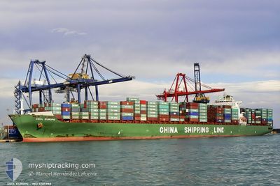
Container Ship
Current Trip
| Trip Time | 7 days |
|---|---|
| Trip Distance | 1632.37 nm |
| AVG Speed | 11.9 Noeuds |
| MAX Speed | 18.1 Noeuds |
| Tirant d eau | 12.8 m |
| AVG Wind | 9.4 knots |
| MAX Wind | 22 knots |
| MIN Temp | 19.6°C / 67.28°F |
| MAX Temp | 28.2°C / 82.76°F |
| Position reçue | 5 m depuis |
Current Position
| Longitude | -81.14048° |
|---|---|
| Latitude | 32.13082° |
| Etat | Moored |
| Vitesse | |
| Parcours | 319° |
| Zone | North Atlantic Ocean |
| Station | T-AIS |
| Position reçue | 5 m depuis |
Info
Information
The current position of EUROPE is in North Atlantic Ocean with coordinates 32.13082° / -81.14048° as reported on 2024-05-02 20:59 by AIS to our vessel tracker app. The vessel's current speed is 0 Noeuds and is currently inside the port of SAVANNAH.
The vessel EUROPE (IMO: 9285988, MMSI: 212175000) is a Container Ship that was built in 2004 ( 20 Age ). It's sailing under the flag of [CY] Cyprus.
In this page you can find informations about the vessels current position, last detected port calls, and current voyage information. If the vessels is not in coverage by AIS you will find the latest position.
The current position of EUROPE is detected by our AIS receivers and we are not responsible for the reliability of the data. The last position was recorded while the vessel was in Coverage by the Ais receivers of our vessel tracking app.
The current draught of EUROPE as reported by AIS is 12.8 meters
Weather
| Temperature | 28.3°C / 82.94°F |
|---|---|
| Wind Speed | 9 knots |
| Direction | 125° SE |
| Pressure | 1013.7 hPa |
| Humidity | 45.7 % |
| Cloud Coverage | 97 % |
Featured Company
Last Port Calls
| Port | Arrival | Departure | Time In Port |
|---|---|---|---|
| 2024-05-02 05:18 | |||
| 2024-04-24 08:26 | 2024-04-25 02:06 | 17 h | |
| 2024-03-30 00:48 | 2024-03-31 06:32 | 1 d | |
| 2024-03-27 01:07 | 2024-03-27 18:57 | 17 h | |
| 2024-03-23 01:47 | 2024-03-23 21:03 | 19 h | |
| 2024-03-15 21:42 | 2024-03-16 04:07 | 6 h | |
| 2024-03-04 01:07 |
Most Visited Ports (Last year)
| Port | Arrivals | |
|---|---|---|
| 12 | ||
| 10 | ||
| 8 | ||
| 7 | ||
| 6 | ||
| 6 |
Last Trips
| Origin | Departure | Destination | Arrival | Distance | |
|---|---|---|---|---|---|
| 2024-04-24 21:06 | 2024-05-02 01:18 | 1632.37 nm | |||
| 2024-03-31 15:32 | 2024-04-24 03:26 | 8697.85 nm | |||
| 2024-03-28 02:57 | 2024-03-30 09:48 | 518.49 nm | |||
| 2024-03-24 05:03 | 2024-03-27 09:07 | 817.03 nm | |||
| 2024-03-16 13:07 | 2024-03-23 09:47 | 1658.52 nm | |||
| 2024-03-03 17:07 | 2024-03-16 06:42 | 5203.59 nm |
Events
| Heure | Evenement | Détails | Position/ Destination | Info |
|---|---|---|---|---|
| 2024-05-02 08:47 | Etat Changé | Moored Default |
32.13068 / -81.14042
[US] SAVANNAH
|
Vitesse: Parcours: 320° |
| 2024-05-02 08:41 | Etat Changé | Default Moored |
32.13067 / -81.14038
[US] SAVANNAH
|
Vitesse: Parcours: 320° |
| 2024-05-02 06:41 | Etat Changé | Moored Under way using engine |
32.13062 / -81.14040
[US] SAVANNAH
|
Vitesse: 0.1 kn Parcours: 320° |
| 2024-05-02 06:16 | Arret |
32.13143 / -81.13923
[US] SAVANNAH
|
Vitesse: 0.3 kn Parcours: 331° |
|
| 2024-05-02 05:18 | Port d'arrivée |
|
32.08038 / -81.05377
[US] SAVANNAH
|
Vitesse: 7.4 kn Parcours: 275° |
| 2024-05-02 02:03 | Démarrage |
31.92840 / -80.44938
USSAV
|
Vitesse: 3.1 kn Parcours: 19° |
|
| 2024-05-02 01:45 | Etat Changé | Under way using engine At anchor |
31.92668 / -80.45607
USSAV
|
Vitesse: 0.3 kn Parcours: 137° |
| 2024-05-02 01:42 | Changement d'ETA | 2024/05/02 03:15 2024/05/02 03:45 |
31.92695 / -80.45605
USSAV
|
Vitesse: 0.3 kn Parcours: 137° |
| 2024-05-02 00:54 | Etat Changé | At anchor Default |
31.92817 / -80.45593
USSAV
|
Vitesse: Parcours: 164° |
| 2024-05-02 00:48 | Etat Changé | Default At anchor |
31.92835 / -80.45554
USSAV
|
Vitesse: 0.1 kn Parcours: 165° |