
ESL DANA
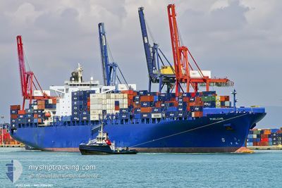
Container Ship
Current Trip
| Time Travelled | 4 days |
|---|---|
| Remaining Time | --- |
| Distance Travelled | 1124.98 nm |
| Remaining Distance | --- |
| AVG Speed | 11.4 Noeuds |
| MAX Speed | 16.3 Noeuds |
| AVG Wind | 9.6 knots |
| MAX Wind | 12 knots |
| MIN Temp | 6.7°C / 44.06°F |
| MAX Temp | 22.1°C / 71.78°F |
| Tirant d eau | 9.2 m |
| Position reçue | 17 h, 27 m depuis |
Current Position
| Longitude | --- |
|---|---|
| Latitude | --- |
| Etat | Under way using engine |
| Vitesse | 6 Noeuds |
| Parcours | 337.1° |
| Zone | Japan Sea |
| Station | T-AIS |
| Position reçue | 17 h, 27 m depuis |
Info
Information
The current position of ESL DANA is in Japan Sea with coordinates 34.96635° / 128.81927° as reported on 2025-03-06 08:29 by AIS to our vessel tracker app. The vessel's current speed is 6 Noeuds
The vessel ESL DANA (IMO: 9306287, MMSI: 255915678) is a Container Ship that was built in 2007 ( 18 Age ). It's sailing under the flag of [PT] Portugal.
In this page you can find informations about the vessels current position, last detected port calls, and current voyage information. If the vessels is not in coverage by AIS you will find the latest position.
The current position of ESL DANA is detected by our AIS receivers and we are not responsible for the reliability of the data. The last position was recorded while the vessel was in Coverage by the Ais receivers of our vessel tracking app.
The current draught of ESL DANA as reported by AIS is 9.2 meters
Weather
| Temperature | 7.4°C / 45.32°F |
|---|---|
| Wind Speed | 5 knots |
| Direction | 128° SE |
| Pressure | 1023.9 hPa |
| Humidity | 59 % |
| Cloud Coverage | 86 % |
Featured Company
Last Port Calls
| Port | Arrival | Departure | Time In Port |
|---|---|---|---|
| 2025-03-01 23:15 | 2025-03-02 10:31 | 11 h | |
| 2025-02-15 21:19 | 2025-02-16 10:20 | 13 h | |
| 2025-02-13 11:53 | 2025-02-15 10:46 | 1 d | |
| 2025-02-09 14:33 | 2025-02-12 07:42 | 2 d |
Most Visited Ports (Last year)
| Port | Arrivals | |
|---|---|---|
| 8 | ||
| 5 | ||
| 4 | ||
| 3 | ||
| 3 | ||
| 2 |
Last Trips
| Origin | Departure | Destination | Arrival | Distance | |
|---|---|---|---|---|---|
| 2025-02-16 13:20 | 2025-03-02 07:15 | 5109.21 nm | |||
| 2025-02-15 13:46 | 2025-02-16 00:19 | 99.09 nm | |||
| 2025-02-12 11:42 | 2025-02-13 14:53 | 328.87 nm | |||
| 2024-12-27 07:38 | 2025-02-09 18:33 | 8452.64 nm |
Events
| Heure | Evenement | Détails | Position/ Destination | Info |
|---|---|---|---|---|
| 2025-03-06 08:29 | Hors de la zone couverte |
34.96635 / 128.81927
Japan Sea
KRPUS
|
Vitesse: 6 kn Parcours: 337.1° |
|
| 2025-03-06 05:55 | Changement d'ETA | 2025/03/06 07:00 2025/03/05 23:59 |
34.80402 / 128.96176
KRPUS
|
Vitesse: 4.7 kn Parcours: 334° |
| 2025-03-06 05:25 | Detecté en mer | South Korean part of the Japan Sea |
34.75816 / 128.96791
Japan Sea
|
Vitesse: 5.4 kn Parcours: 7.5° |
| 2025-03-06 05:25 | Dans la zone couverte |
34.75816 / 128.96791
Japan Sea
|
Vitesse: 5.4 kn Parcours: 7.5° |
|
| 2025-03-02 12:53 | Hors de la zone couverte |
22.24847 / 114.11557
South China Sea
KRPUS
|
Vitesse: 10.8 kn Parcours: 147.9° |
|
| 2025-03-02 10:40 | Tirant d'eau modifié | 9.2 9.9 |
22.53058 / 113.85187
KRPUS
|
Vitesse: 4.6 kn Parcours: 169° |
| 2025-03-02 10:40 | Changement de destination | KRPUS CNDCB |
22.53058 / 113.85187
KRPUS
|
Vitesse: 4.6 kn Parcours: 169° |
| 2025-03-02 10:40 | Changement d'ETA | 2025/03/05 23:59 2025/03/01 20:00 |
22.53058 / 113.85187
KRPUS
|
Vitesse: 4.6 kn Parcours: 169° |
| 2025-03-02 10:39 | Démarrage | 0.17 nm, South of DA CHAN BAY |
22.53101 / 113.85178
CNDCB
|
Vitesse: 4.3 kn Parcours: 169° |
| 2025-03-02 10:31 | PORT DE DEPART |
|
22.53506 / 113.85148
CNDCB
|
Vitesse: 1 kn Parcours: 212° |