
ERVING
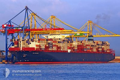
Container Ship
Current Trip
| Time Travelled | 15 h, 47 mins |
|---|---|
| Remaining Time | --- |
| Distance Travelled | 172.34 nm |
| Remaining Distance | --- |
| AVG Speed | 14.4 Noeuds |
| MAX Speed | 16 Noeuds |
| AVG Wind | 7.7 knots |
| MAX Wind | 14.3 knots |
| MIN Temp | 29.8°C / 85.64°F |
| MAX Temp | 30.9°C / 87.62°F |
| Tirant d eau | 12.4 m |
| Position reçue | 12 h, 37 m depuis |
Current Position
| Longitude | 100.80066° |
|---|---|
| Latitude | 12.37571° |
| Etat | Under way using engine |
| Vitesse | 15.6 Noeuds |
| Parcours | 151° |
| Zone | Gulf of Thailand |
| Station | T-AIS |
| Position reçue | 12 h, 37 m depuis |
Info
Information
The current position of ERVING is in Gulf of Thailand with coordinates 12.37571° / 100.80066° as reported on 2024-05-10 02:06 by AIS to our vessel tracker app. The vessel's current speed is 15.6 Noeuds and is heading at the port of VUNG TAU. The estimated time of arrival as calculated by MyShipTracking vessel tracking app is 2024-05-11 23:00 LT
The vessel ERVING (IMO: 9463023, MMSI: 235084298) is a Container Ship that was built in 2011 ( 13 Age ). It's sailing under the flag of [GB] United Kingdom.
In this page you can find informations about the vessels current position, last detected port calls, and current voyage information. If the vessels is not in coverage by AIS you will find the latest position.
The current position of ERVING is detected by our AIS receivers and we are not responsible for the reliability of the data. The last position was recorded while the vessel was in Coverage by the Ais receivers of our vessel tracking app.
The current draught of ERVING as reported by AIS is 12.4 meters
Weather
| Temperature | 30.8°C / 87.44°F |
|---|---|
| Wind Speed | 15 knots |
| Direction | 131° SE |
| Pressure | 1009.1 hPa |
| Humidity | 72.3 % |
| Cloud Coverage | 100 % |
Featured Company
Last Port Calls
| Port | Arrival | Departure | Time In Port |
|---|---|---|---|
| 2024-05-08 11:24 | 2024-05-09 22:56 | 1 d | |
| 2024-05-04 14:07 | 2024-05-05 14:25 | 1 d | |
| 2024-05-01 06:04 | 2024-05-02 21:36 | 1 d | |
| 2024-03-29 01:01 | 2024-03-30 06:52 | 1 d | |
| 2024-03-25 12:13 | 2024-03-27 05:56 | 1 d | |
| 2024-03-21 01:06 | 2024-03-22 17:52 | 1 d | |
| 2024-03-18 12:52 | 2024-03-18 20:30 | 7 h | |
| 2024-03-15 04:15 | 2024-03-17 09:08 | 2 d | |
| 2024-03-12 14:20 | 2024-03-13 08:04 | 17 h | |
| 2024-03-03 14:37 | 2024-03-04 11:34 | 20 h |
Most Visited Ports (Last year)
| Port | Arrivals | |
|---|---|---|
| 5 | ||
| 4 | ||
| 4 | ||
| 3 | ||
| 3 | ||
| 2 |
Last Trips
| Origin | Departure | Destination | Arrival | Distance | |
|---|---|---|---|---|---|
| 2024-05-05 22:25 | 2024-05-08 18:24 | 834.73 nm | |||
| 2024-05-03 05:36 | 2024-05-04 22:07 | 202.29 nm | |||
| 2024-03-30 02:52 | 2024-05-01 14:04 | 11578.17 nm | |||
| 2024-03-27 01:56 | 2024-03-28 21:01 | 121.66 nm | |||
| 2024-03-22 13:52 | 2024-03-25 08:13 | 520.37 nm | |||
| 2024-03-18 16:30 | 2024-03-20 21:06 | 293.48 nm | |||
| 2024-03-17 05:08 | 2024-03-18 08:52 | 248.70 nm | |||
| 2024-03-13 05:04 | 2024-03-15 00:15 | 609.66 nm | |||
| 2024-03-04 12:34 | 2024-03-12 11:20 | 2906.17 nm | |||
| 2024-02-09 19:00 | 2024-03-03 15:37 | 9416.74 nm |
Events
| Heure | Evenement | Détails | Position/ Destination | Info |
|---|---|---|---|---|
| 2024-05-10 02:12 | Etat Changé | Default Under way using engine |
12.34975 / 100.81549
VNVUT
|
Vitesse: 15.6 kn Parcours: 151° |
| 2024-05-10 02:06 | Hors de la zone couverte |
12.37571 / 100.80066
Gulf of Thailand
VNVUT
|
Vitesse: 15.6 kn Parcours: 151° |
|
| 2024-05-10 02:05 | Etat Changé | Under way using engine Default |
12.37918 / 100.79871
VNVUT
|
Vitesse: 15.5 kn Parcours: 151° |
| 2024-05-10 01:56 | Etat Changé | Default Under way using engine |
12.41015 / 100.78118
VNVUT
|
Vitesse: 15.3 kn Parcours: 151.4° |
| 2024-05-10 01:38 | Tirant d'eau modifié | 12.4 12.1 |
12.48259 / 100.75330
VNVUT
|
Vitesse: 15.4 kn Parcours: 183° |
| 2024-05-10 01:38 | Changement de destination | VNVUT THLCH |
12.48259 / 100.75330
VNVUT
|
Vitesse: 15.4 kn Parcours: 183° |
| 2024-05-10 01:38 | Changement d'ETA | 2024/05/11 23:00 2024/05/08 11:00 |
12.48259 / 100.75330
VNVUT
|
Vitesse: 15.4 kn Parcours: 183° |
| 2024-05-10 01:20 | Etat Changé | Under way using engine Default |
12.55756 / 100.74856
THLCH
|
Vitesse: 15.5 kn Parcours: 176° |
| 2024-05-10 01:17 | Dans la zone couverte |
12.54867 / 100.74918
Gulf of Thailand
|
Vitesse: 16 kn Parcours: 176.2° |
|
| 2024-05-10 00:04 | Hors de la zone couverte |
12.88550 / 100.72201
Gulf of Thailand
|
Vitesse: 15.1 kn Parcours: 180.7° |