
ERIN MANX
Cargo
Current Trip
| Time Travelled | 43 days |
|---|---|
| Remaining Time | --- |
| Distance Travelled | 9764.94 nm |
| Remaining Distance | --- |
| AVG Speed | 10.3 Noeuds |
| MAX Speed | 15.6 Noeuds |
| AVG Wind | 11.8 knots |
| MAX Wind | 36 knots |
| MIN Temp | -0.9°C / 30.38°F |
| MAX Temp | 30.7°C / 87.26°F |
| Tirant d eau | 12.3 m |
| Position reçue | 5 d depuis |
Current Position
| Longitude | 76.61560° |
|---|---|
| Latitude | 8.26028° |
| Etat | Under way using engine |
| Vitesse | 11 Noeuds |
| Parcours | 304.6° |
| Zone | Laccadive Sea |
| Station | T-AIS |
| Position reçue | 5 d depuis |
Info
Information
The current position of ERIN MANX is in Laccadive Sea with coordinates 8.26028° / 76.61560° as reported on 2024-04-20 20:39 by AIS to our vessel tracker app. The vessel's current speed is 11 Noeuds
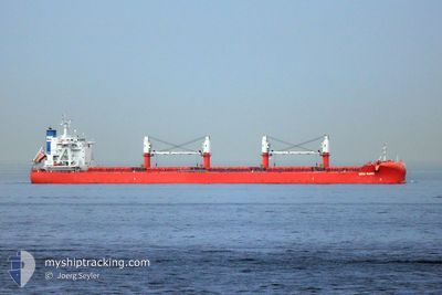
The vessel ERIN MANX (IMO: 9801744, MMSI: 232027170) is a Cargo It's sailing under the flag of [GB] United Kingdom.
In this page you can find informations about the vessels current position, last detected port calls, and current voyage information. If the vessels is not in coverage by AIS you will find the latest position.
The current position of ERIN MANX is detected by our AIS receivers and we are not responsible for the reliability of the data. The last position was recorded while the vessel was in Coverage by the Ais receivers of our vessel tracking app.
The current draught of ERIN MANX as reported by AIS is 12.3 meters
Weather
| Temperature | 29.4°C / 84.92°F |
|---|---|
| Wind Speed | 14 knots |
| Direction | 318° NW |
| Pressure | 1006.8 hPa |
| Humidity | 69.5 % |
| Cloud Coverage | --- |
Featured Company
Last Port Calls
| Port | Arrival | Departure | Time In Port |
|---|---|---|---|
| 2024-03-13 14:37 | 2024-03-13 15:45 | 1 h | |
| 2024-02-23 02:29 | 2024-03-01 00:38 | 6 d | |
| 2024-02-16 18:19 | 2024-02-17 07:41 | 13 h |
Most Visited Ports (Last year)
| Port | Arrivals | |
|---|---|---|
| 2 | ||
| 1 | ||
| 1 | ||
| 1 | ||
| 1 | ||
| 1 |
Last Trips
| Origin | Departure | Destination | Arrival | Distance | |
|---|---|---|---|---|---|
| 2024-02-29 18:38 | 2024-03-13 07:37 | 2769.76 nm | |||
| 2024-02-16 23:41 | 2024-02-22 20:29 | 1367.06 nm | |||
| 2023-12-15 22:36 | 2024-02-16 10:19 | 9793.38 nm |
Events
| Heure | Evenement | Détails | Position/ Destination | Info |
|---|---|---|---|---|
| 2024-04-23 18:36 | Arret | 4.42 nm, South of MUMBAI |
18.91095 / 72.87015
IN BOM
|
Vitesse: 0.3 kn Parcours: 90° |
| 2024-04-23 15:51 | Démarrage | 19.53 nm, South West of MUMBAI |
18.77167 / 72.61166
IN BOM
|
Vitesse: 4 kn Parcours: -1° |
| 2024-04-23 12:54 | Arret | 19.79 nm, South West of MUMBAI |
18.76500 / 72.61166
IN BOM
|
Vitesse: Parcours: -1° |
| 2024-04-20 20:48 | Etat Changé | Default Under way using engine |
8.27333 / 76.59333
IN BOM
|
Vitesse: 11 kn Parcours: 304.6° |
| 2024-04-20 20:39 | Etat Changé | Under way using engine Default |
8.26028 / 76.61560
IN BOM
|
Vitesse: 10 kn Parcours: 304° |
| 2024-04-20 20:39 | Hors de la zone couverte |
8.26028 / 76.61560
Laccadive Sea
IN BOM
|
Vitesse: 11 kn Parcours: 304.6° |
|
| 2024-04-20 20:35 | Etat Changé | Default Under way using engine |
8.25167 / 76.62500
IN BOM
|
Vitesse: 10.8 kn Parcours: 306.2° |
| 2024-04-20 15:03 | Changement d'ETA | 2024/04/23 11:00 2024/04/23 12:00 |
7.68975 / 77.41451
IN BOM
|
Vitesse: 10.8 kn Parcours: 294.2° |
| 2024-04-20 14:21 | Etat Changé | Under way using engine Default |
7.62991 / 77.52485
IN BOM
|
Vitesse: 11 kn Parcours: 308° |
| 2024-04-20 14:18 | Etat Changé | Default Under way using engine |
7.62167 / 77.53333
IN BOM
|
Vitesse: 10.9 kn Parcours: 305.4° |