
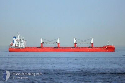
ERIN MANX
Cargo
Current Trip
| Time Travelled | 36 days |
|---|---|
| Remaining Time | --- |
| Distance Travelled | 8304.92 nm |
| Remaining Distance | --- |
| AVG Speed | 10.3 Knots |
| MAX Speed | 15.6 Knots |
| AVG Wind | 11.8 knots |
| MAX Wind | 36 knots |
| MIN Temp | -0.9°C / 30.38°F |
| MAX Temp | 30.7°C / 87.26°F |
| Draught | 12.3 m |
| Position Received | 4 d ago |
Current Position
| Longitude | 103.52341° |
|---|---|
| Latitude | 1.20439° |
| Status | Under way using engine |
| Speed | 13 Knots |
| Course | 282.8° |
| Area | Singapore Strait |
| Station | T-AIS |
| Position Received | 4 d ago |
Info
Information
The current position of ERIN MANX is in Singapore Strait with coordinates 1.20439° / 103.52341° as reported on 2024-04-14 15:02 by AIS to our vessel tracker app. The vessel's current speed is 13 Knots and is heading at the port of MUMBAI. The estimated time of arrival as calculated by MyShipTracking vessel tracking app is 2024-04-23 12:00 LT
The vessel ERIN MANX (IMO: 9801744, MMSI: 232027170) is a Cargo It's sailing under the flag of [GB] United Kingdom.
In this page you can find informations about the vessels current position, last detected port calls, and current voyage information. If the vessels is not in coverage by AIS you will find the latest position.
The current position of ERIN MANX is detected by our AIS receivers and we are not responsible for the reliability of the data. The last position was recorded while the vessel was in Coverage by the Ais receivers of our vessel tracking app.
The current draught of ERIN MANX as reported by AIS is 12.3 meters
Weather
| Temperature | 29°C / 84.2°F |
|---|---|
| Wind Speed | 6 knots |
| Direction | 19° NNE |
| Pressure | 1009.8 hPa |
| Humidity | 71.3 % |
| Cloud Coverage | 56 % |
Featured Company
Last Port Calls
| Port | Arrival | Departure | Time In Port |
|---|---|---|---|
| 2024-03-13 14:37 | 2024-03-13 15:45 | 1 h | |
| 2024-02-23 02:29 | 2024-03-01 00:38 | 6 d | |
| 2024-02-16 18:19 | 2024-02-17 07:41 | 13 h |
Most Visited Ports (Last year)
| Port | Arrivals | |
|---|---|---|
| 2 | ||
| 1 | ||
| 1 | ||
| 1 | ||
| 1 | ||
| 1 |
Last Trips
| Origin | Departure | Destination | Arrival | Distance | |
|---|---|---|---|---|---|
| 2024-02-29 18:38 | 2024-03-13 07:37 | 2769.76 nm | |||
| 2024-02-16 23:41 | 2024-02-22 20:29 | 1367.06 nm | |||
| 2023-12-15 22:36 | 2024-02-16 10:19 | 9793.38 nm |
Events
| Time | Event | Details | Position / Dest | Info |
|---|---|---|---|---|
| 2024-04-14 15:06 | Status Changed | Default Under way using engine |
1.20741 / 103.50987
IN BOM
|
Speed: 13 kn Course: 282.8° |
| 2024-04-14 15:02 | OUT of Coverage |
1.20439 / 103.52341
Singapore Strait
IN BOM
|
Speed: 13 kn Course: 282.8° |
|
| 2024-04-14 14:46 | Change Sea Area | Malaysian part of the Singapore Strait Indonesian part of the Singapore Strait |
1.19111 / 103.58082
Singapore Strait
IN BOM
|
Speed: 13.3 kn Course: 281.1° |
| 2024-04-14 14:01 | Change Sea Area | Indonesian part of the Singapore Strait Singaporean part of the Singapore Strait |
1.14005 / 103.72255
Singapore Strait
IN BOM
|
Speed: 9.5 kn Course: 284.2° |
| 2024-04-14 12:06 | ETA Changed | 2024/04/23 12:00 2024/04/23 17:00 |
1.27344 / 103.99482
IN BOM
|
Speed: 5.2 kn Course: 182.3° |
| 2024-04-14 11:53 | START Moving | 2.76 nm, South West of TANAH MERAH |
1.28158 / 103.98337
IN BOM
|
Speed: 3.1 kn Course: 118° |
| 2024-04-14 11:48 | Status Changed | Under way using engine Default |
1.28286 / 103.98249
IN BOM
|
Speed: Course: -1° |
| 2024-04-14 11:48 | Draught Changed | 12.3 12 |
1.28207 / 103.98147
IN BOM
|
Speed: 0.4 kn Course: 79° |
| 2024-04-14 11:48 | Destination Changed | IN BOM SG SIN |
1.28207 / 103.98147
IN BOM
|
Speed: 0.4 kn Course: 79° |
| 2024-04-14 11:48 | ETA Changed | 2024/04/23 17:00 2024/04/13 20:00 |
1.28207 / 103.98147
IN BOM
|
Speed: 0.4 kn Course: 79° |