
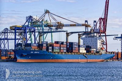
EM CORFU
Cargo
Current Trip
| Time Travelled | 16 days |
|---|---|
| Remaining Time | --- |
| Distance Travelled | 5559.20 nm |
| Remaining Distance | --- |
| AVG Speed | 15.9 Noeuds |
| MAX Speed | 21.1 Noeuds |
| AVG Wind | 12 knots |
| MAX Wind | 27.9 knots |
| MIN Temp | 5.7°C / 42.26°F |
| MAX Temp | 31.1°C / 87.98°F |
| Tirant d eau | 10.9 m |
| Position reçue | 7 h, 58 m depuis |
Current Position
| Longitude | -96.12987° |
|---|---|
| Latitude | 19.25092° |
| Etat | Under way using engine |
| Vitesse | 8.2 Noeuds |
| Parcours | 210.5° |
| Zone | Gulf of Mexico |
| Station | T-AIS |
| Position reçue | 7 h, 58 m depuis |
Info
Information
The current position of EM CORFU is in Gulf of Mexico with coordinates 19.25092° / -96.12987° as reported on 2024-04-27 21:39 by AIS to our vessel tracker app. The vessel's current speed is 8.2 Noeuds
The vessel EM CORFU (IMO: 923149400, MMSI: 538007209) is a Cargo It's sailing under the flag of [MH] Marshall Is.
In this page you can find informations about the vessels current position, last detected port calls, and current voyage information. If the vessels is not in coverage by AIS you will find the latest position.
The current position of EM CORFU is detected by our AIS receivers and we are not responsible for the reliability of the data. The last position was recorded while the vessel was in Coverage by the Ais receivers of our vessel tracking app.
The current draught of EM CORFU as reported by AIS is 10.9 meters
Weather
| Temperature | 27°C / 80.6°F |
|---|---|
| Wind Speed | --- |
| Direction | 41° NE |
| Pressure | 1007.9 hPa |
| Humidity | 79.6 % |
| Cloud Coverage | 85 % |
Featured Company
Last Port Calls
| Port | Arrival | Departure | Time In Port |
|---|---|---|---|
| 2024-04-10 22:34 | 2024-04-11 21:22 | 22 h | |
| 2024-04-09 04:49 | 2024-04-09 17:49 | 12 h | |
| 2024-04-06 23:20 | 2024-04-08 01:39 | 1 d | |
| 2024-04-04 21:36 | 2024-04-05 17:14 | 19 h | |
| 2024-03-24 03:11 | 2024-03-24 22:08 | 18 h | |
| 2024-03-19 12:29 | 2024-03-22 12:53 | 3 d | |
| 2024-03-11 19:42 | |||
| 2024-02-20 17:54 | 2024-02-21 20:26 | 1 d | |
| 2024-02-19 10:30 | 2024-02-20 07:01 | 20 h | |
| 2024-02-16 22:39 | 2024-02-17 22:52 | 1 d |
Most Visited Ports (Last year)
| Port | Arrivals | |
|---|---|---|
| 8 | ||
| 8 | ||
| 8 | ||
| 7 | ||
| 7 | ||
| 7 |
Last Trips
| Origin | Departure | Destination | Arrival | Distance | |
|---|---|---|---|---|---|
| 2024-04-09 19:49 | 2024-04-11 00:34 | 123.97 nm | |||
| 2024-04-08 03:39 | 2024-04-09 06:49 | 420.53 nm | |||
| 2024-04-05 18:14 | 2024-04-07 01:20 | 266.86 nm | |||
| 2024-03-24 17:08 | 2024-04-04 22:36 | 4312.54 nm | |||
| 2024-03-22 07:53 | 2024-03-23 22:11 | 285.81 nm | |||
| 2024-03-11 13:42 | 2024-03-19 07:29 | 1359.78 nm | |||
| 2024-02-20 08:01 | 2024-02-20 18:54 | 117.12 nm | |||
| 2024-02-17 23:52 | 2024-02-19 11:30 | 427.68 nm | |||
| 2024-02-15 20:26 | 2024-02-16 23:39 | 262.30 nm | |||
| 2024-02-04 14:15 | 2024-02-15 04:54 | 4425.97 nm |
Events
| Heure | Evenement | Détails | Position/ Destination | Info |
|---|---|---|---|---|
| 2024-04-27 22:14 | Arret | 3.22 nm, North West of VERACRUZ |
19.23713 / -96.16936
MXVER
|
Vitesse: 0.1 kn Parcours: 351° |
| 2024-04-27 21:44 | Etat Changé | Default Under way using engine |
19.24084 / -96.13715
MXVER
|
Vitesse: 8.2 kn Parcours: 210.5° |
| 2024-04-27 21:39 | Etat Changé | Under way using engine Default |
19.25092 / -96.12987
MXVER
|
Vitesse: 13.4 kn Parcours: 167° |
| 2024-04-27 21:39 | Dans la zone couverte |
19.25092 / -96.12987
Gulf of Mexico
|
Vitesse: 8.2 kn Parcours: 210.5° |
|
| 2024-04-27 21:39 | Hors de la zone couverte |
19.25092 / -96.12987
Gulf of Mexico
|
Vitesse: 8.2 kn Parcours: 210.5° |
|
| 2024-04-27 02:25 | Etat Changé | Default Under way using engine |
19.57874 / -95.97887
MXVER
|
Vitesse: 1.1 kn Parcours: 38° |
| 2024-04-27 02:18 | Etat Changé | Under way using engine Default |
19.57788 / -95.97672
MXVER
|
Vitesse: 1.1 kn Parcours: 43° |
| 2024-04-27 02:18 | Hors de la zone couverte |
19.57788 / -95.97672
Gulf of Mexico
|
Vitesse: 1.1 kn Parcours: 294.8° |
|
| 2024-04-27 01:26 | Etat Changé | Default Under way using engine |
19.55738 / -95.94704
MXVER
|
Vitesse: 5.9 kn Parcours: 252.5° |
| 2024-04-27 01:17 | Changement de zone | Mexican part of the Gulf of Mexico Bahamas part of the North Atlantic Ocean |
19.56610 / -95.93462
Gulf of Mexico
|
Vitesse: 5.9 kn Parcours: 209.3° |