
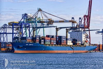
EM CORFU
Cargo
Current Trip
| Time Travelled | 2 days |
|---|---|
| Remaining Time | 7 days |
| Distance Travelled | 1126.17 nm |
| Remaining Distance | 3180.87 nm |
| AVG Speed | 17.2 Knots |
| MAX Speed | 19 Knots |
| AVG Wind | 14.4 knots |
| MAX Wind | 22 knots |
| MIN Temp | 22.8°C / 73.04°F |
| MAX Temp | 28.2°C / 82.76°F |
| Dybgang | 10.1 m |
| Position Modtaget | 8 h, 32 m siden |
Current Position
| Longitude | -63.20171° |
|---|---|
| Latitude | 23.51457° |
| Status | Under way using engine |
| Fart | 17.3 Knots |
| Kurs | 44.5° |
| Område | North Atlantic Ocean |
| Station | T-AIS |
| Position Modtaget | 8 h, 32 m siden |
Info
Information
The current position of EM CORFU is in North Atlantic Ocean with coordinates 23.51457° / -63.20171° as reported on 2024-05-15 09:49 by AIS to our vessel tracker app. The vessel's current speed is 17.3 Knots and is heading at the port of SOUTHAMPTON. The estimated time of arrival as calculated by MyShipTracking vessel tracking app is 2024-05-23 08:16 LT
The vessel EM CORFU (IMO: 923149400, MMSI: 538007209) is a Cargo It's sailing under the flag of [MH] Marshall Is.
In this page you can find informations about the vessels current position, last detected port calls, and current voyage information. If the vessels is not in coverage by AIS you will find the latest position.
The current position of EM CORFU is detected by our AIS receivers and we are not responsible for the reliability of the data. The last position was recorded while the vessel was in Coverage by the Ais receivers of our vessel tracking app.
The current draught of EM CORFU as reported by AIS is 10.1 meters
Weather
| Temperature | 23°C / 73.4°F |
|---|---|
| Wind Speed | 6 knots |
| Direction | 47° NE |
| Pressure | 1017.8 hPa |
| Humidity | 65.9 % |
| Cloud Coverage | 100 % |
Featured Company
Last Port Calls
| Port | Arrival | Departure | Time In Port |
|---|---|---|---|
| 2024-05-12 11:16 | 2024-05-13 00:57 | 13 h | |
| 2024-05-09 04:38 | 2024-05-11 08:26 | 2 d | |
| 2024-05-07 13:14 | 2024-05-08 15:06 | 1 d | |
| 2024-04-29 22:40 | 2024-04-30 21:52 | 23 h | |
| 2024-04-10 22:34 | 2024-04-11 21:22 | 22 h | |
| 2024-04-09 04:49 | 2024-04-09 17:49 | 12 h | |
| 2024-04-06 23:20 | 2024-04-08 01:39 | 1 d | |
| 2024-04-04 21:36 | 2024-04-05 17:14 | 19 h | |
| 2024-03-24 03:11 | 2024-03-24 22:08 | 18 h | |
| 2024-03-19 12:29 | 2024-03-22 12:53 | 3 d |
Most Visited Ports (Last year)
| Port | Arrivals | |
|---|---|---|
| 8 | ||
| 8 | ||
| 7 | ||
| 7 | ||
| 7 | ||
| 7 |
Last Trips
| Origin | Departure | Destination | Arrival | Distance | |
|---|---|---|---|---|---|
| 2024-05-11 03:26 | 2024-05-12 06:16 | 287.34 nm | |||
| 2024-05-08 10:06 | 2024-05-08 23:38 | 239.33 nm | |||
| 2024-04-30 16:52 | 2024-05-07 08:14 | 1109.18 nm | |||
| 2024-04-11 23:22 | 2024-04-29 17:40 | 5970.50 nm | |||
| 2024-04-09 19:49 | 2024-04-11 00:34 | 123.97 nm | |||
| 2024-04-08 03:39 | 2024-04-09 06:49 | 420.53 nm | |||
| 2024-04-05 18:14 | 2024-04-07 01:20 | 266.86 nm | |||
| 2024-03-24 17:08 | 2024-04-04 22:36 | 4312.54 nm | |||
| 2024-03-22 07:53 | 2024-03-23 22:11 | 285.81 nm | |||
| 2024-03-11 13:42 | 2024-03-19 07:29 | 1359.78 nm |
Events
| Tid | Hændelsen | Detaljer | Position / Dest | Info |
|---|---|---|---|---|
| 2024-05-15 10:00 | Status er ændret | Default Under way using engine |
23.55354 / -63.15975
GBSOU
|
Fart: 17.3 kn Kurs: 44.5° |
| 2024-05-15 09:49 | Udenfor Dækning |
23.51457 / -63.20171
North Atlantic Ocean
GBSOU
|
Fart: 17.3 kn Kurs: 44.5° |
|
| 2024-05-15 08:25 | Ændre havområde | High seas of the North Atlantic Ocean Puerto Rican part of the North Atlantic Ocean |
23.22829 / -63.51178
North Atlantic Ocean
GBSOU
|
Fart: 17.1 kn Kurs: 45.5° |
| 2024-05-15 08:25 | Status er ændret | Under way using engine Default |
23.22829 / -63.51178
GBSOU
|
Fart: 17.1 kn Kurs: 45° |
| 2024-05-15 08:25 | Indenfor Dækning |
23.22829 / -63.51178
North Atlantic Ocean
GBSOU
|
Fart: 17.1 kn Kurs: 45.5° |
|
| 2024-05-14 18:19 | Status er ændret | Default Under way using engine |
20.22868 / -66.58122
GBSOU
|
Fart: 17.6 kn Kurs: 43.7° |
| 2024-05-14 18:07 | Status er ændret | Under way using engine Default |
20.18590 / -66.62412
GBSOU
|
Fart: 17.5 kn Kurs: 43° |
| 2024-05-14 18:07 | Indenfor Dækning |
20.18590 / -66.62412
North Atlantic Ocean
GBSOU
|
Fart: 17.6 kn Kurs: 43.7° |
|
| 2024-05-14 18:07 | Udenfor Dækning |
20.18590 / -66.62412
North Atlantic Ocean
GBSOU
|
Fart: 17.6 kn Kurs: 43.7° |
|
| 2024-05-14 16:43 | Udenfor Dækning |
19.88596 / -66.91850
North Atlantic Ocean
GBSOU
|
Fart: 17.7 kn Kurs: 42.5° |