
DESERT RANGER
Cargo
Current Trip
| Time Travelled | 2 days |
|---|---|
| Remaining Time | 1 h, 40 mins |
| Distance Travelled | 328.61 nm |
| Remaining Distance | 90.94 nm |
| AVG Speed | 8.8 Noeuds |
| MAX Speed | 12.8 Noeuds |
| AVG Wind | 14.7 knots |
| MAX Wind | 22 knots |
| MIN Temp | -1.9°C / 28.58°F |
| MAX Temp | 0.6°C / 33.08°F |
| Tirant d eau | 7 m |
| Position reçue | 19 h, 55 m depuis |
Current Position
| Longitude | --- |
|---|---|
| Latitude | --- |
| Etat | Under way using engine |
| Vitesse | 5.1 Noeuds |
| Parcours | 66.1° |
| Zone | Baltic Sea |
| Station | T-AIS |
| Position reçue | 19 h, 55 m depuis |
Info
Information
The current position of DESERT RANGER is in Baltic Sea with coordinates 55.55128° / 16.69658° as reported on 2025-02-16 12:23 by AIS to our vessel tracker app. The vessel's current speed is 5.1 Noeuds and is heading at the port of KLAIPEDA. The estimated time of arrival as calculated by MyShipTracking vessel tracking app is 2025-02-17 09:58 LT
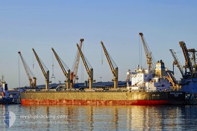
The vessel DESERT RANGER (IMO: 9699854, MMSI: 241489000) is a Cargo It's sailing under the flag of [GR] Greece.
In this page you can find informations about the vessels current position, last detected port calls, and current voyage information. If the vessels is not in coverage by AIS you will find the latest position.
The current position of DESERT RANGER is detected by our AIS receivers and we are not responsible for the reliability of the data. The last position was recorded while the vessel was in Coverage by the Ais receivers of our vessel tracking app.
The current draught of DESERT RANGER as reported by AIS is 7 meters
Weather
| Temperature | 0.2°C / 32.36°F |
|---|---|
| Wind Speed | 16 knots |
| Direction | 290° WNW |
| Pressure | 1020.5 hPa |
| Humidity | 67.5 % |
| Cloud Coverage | 100 % |
Featured Company
Last Port Calls
| Port | Arrival | Departure | Time In Port |
|---|---|---|---|
| 2025-02-06 01:33 | 2025-02-14 18:24 | 8 d | |
| 2025-01-07 10:13 | 2025-01-13 15:56 | 6 d | |
| 2024-12-15 08:41 | 2024-12-26 07:57 | 10 d |
Most Visited Ports (Last year)
| Port | Arrivals | |
|---|---|---|
| 2 | ||
| 2 | ||
| 2 | ||
| 2 | ||
| 1 | ||
| 1 |
Last Trips
| Origin | Departure | Destination | Arrival | Distance | |
|---|---|---|---|---|---|
| 2025-01-13 12:56 | 2025-02-06 02:33 | 5077.98 nm | |||
| 2024-12-26 08:57 | 2025-01-07 07:13 | 3490.44 nm | |||
| 2024-11-09 17:32 | 2024-12-15 09:41 | 6210.09 nm |
Events
| Heure | Evenement | Détails | Position/ Destination | Info |
|---|---|---|---|---|
| 2025-02-16 12:29 | Etat Changé | Default Under way using engine |
55.54814 / 16.71115
LTKLJ
|
Vitesse: 5.1 kn Parcours: 66.1° |
| 2025-02-16 12:23 | Hors de la zone couverte |
55.55128 / 16.69658
Baltic Sea
LTKLJ
|
Vitesse: 5.1 kn Parcours: 66.1° |
|
| 2025-02-16 12:18 | Etat Changé | Under way using engine Default |
55.54714 / 16.68663
LTKLJ
|
Vitesse: 6.8 kn Parcours: 51° |
| 2025-02-16 12:17 | Etat Changé | Default Under way using engine |
55.54577 / 16.68371
LTKLJ
|
Vitesse: 7.7 kn Parcours: 53° |
| 2025-02-16 11:42 | Etat Changé | Under way using engine Default |
55.49386 / 16.56241
LTKLJ
|
Vitesse: 9.1 kn Parcours: 53° |
| 2025-02-16 11:29 | Etat Changé | Default Under way using engine |
55.47531 / 16.51802
LTKLJ
|
Vitesse: 9.2 kn Parcours: 54° |
| 2025-02-16 11:29 | Etat Changé | Under way using engine Default |
55.47481 / 16.51681
LTKLJ
|
Vitesse: 9.2 kn Parcours: 54° |
| 2025-02-16 11:21 | Etat Changé | Default Under way using engine |
55.46348 / 16.48886
LTKLJ
|
Vitesse: 9.1 kn Parcours: 56.1° |
| 2025-02-16 11:16 | Etat Changé | Under way using engine Default |
55.45647 / 16.47052
LTKLJ
|
Vitesse: 9.1 kn Parcours: 56° |
| 2025-02-16 11:09 | Etat Changé | Default Under way using engine |
55.44665 / 16.44483
LTKLJ
|
Vitesse: 9 kn Parcours: 55.2° |