
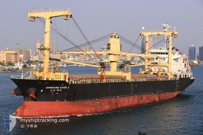
DDS MARINA
General Cargo
Current Trip
IN PRT
| Time Travelled | 11 h, 35 mins |
|---|---|
| Remaining Time | --- |
| Distance Travelled | 118.10 nm |
| Remaining Distance | --- |
| AVG Speed | 10.9 Noeuds |
| MAX Speed | 12.1 Noeuds |
| AVG Wind | 7.8 knots |
| MAX Wind | 10.7 knots |
| MIN Temp | 25°C / 77°F |
| MAX Temp | 26.8°C / 80.24°F |
| Tirant d eau | 9.2 m |
| Position reçue | 15 d depuis |
Current Position
| Longitude | --- |
|---|---|
| Latitude | --- |
| Etat | Under way using engine |
| Vitesse | 10 Noeuds |
| Parcours | 310° |
| Zone | Malacca Strait |
| Station | T-AIS |
| Position reçue | 15 d depuis |
Info
Information
The current position of DDS MARINA is in Malacca Strait with coordinates 1.25018° / 103.40072° as reported on 2025-02-14 04:14 by AIS to our vessel tracker app. The vessel's current speed is 10 Noeuds
The vessel DDS MARINA (IMO: 9513206, MMSI: 441783000) is a General Cargo that was built in 2011 ( 14 Age ). It's sailing under the flag of [KR] Korea.
In this page you can find informations about the vessels current position, last detected port calls, and current voyage information. If the vessels is not in coverage by AIS you will find the latest position.
The current position of DDS MARINA is detected by our AIS receivers and we are not responsible for the reliability of the data. The last position was recorded while the vessel was in Coverage by the Ais receivers of our vessel tracking app.
The current draught of DDS MARINA as reported by AIS is 9.2 meters
Weather
| Temperature | 26.7°C / 80.06°F |
|---|---|
| Wind Speed | 10 knots |
| Direction | 189° S |
| Pressure | 1010.4 hPa |
| Humidity | 65.2 % |
| Cloud Coverage | --- |
Featured Company
Events
| Heure | Evenement | Détails | Position/ Destination | Info |
|---|---|---|---|---|
| 2025-03-01 01:14 | PORT DE DEPART |
|
20.25993 / 86.68262
IN PRT
|
Vitesse: 7.1 kn Parcours: 127° |
| 2025-03-01 01:09 | Démarrage |
20.26700 / 86.67322
[IN] PARADIP
|
Vitesse: 7.5 kn Parcours: 137° |
|
| 2025-02-23 18:21 | Arret |
20.27663 / 86.67032
[IN] PARADIP
|
Vitesse: Parcours: 206° |
|
| 2025-02-23 17:58 | Port d'arrivée |
|
20.27663 / 86.67032
[IN] PARADIP
|
Vitesse: 8.4 kn Parcours: 330° |
| 2025-02-23 16:23 | Démarrage | 5.59 nm, South East of PARADIP |
20.22138 / 86.76037
IN PRT
|
Vitesse: 3.5 kn Parcours: 230° |