

DDS MARINA
General Cargo

Current Trip
| Time Travelled | --- |
|---|---|
| Remaining Time | 4 days |
| Distance Travelled | --- |
| Remaining Distance | 1100.36 nm |
| AVG Speed | --- |
| MAX Speed | --- |
| AVG Wind | --- |
| MAX Wind | --- |
| MIN Temp | --- |
| MAX Temp | --- |
| Dybgang | 9.2 m |
| Position Modtaget | 1 d siden |
Current Position
| Longitude | --- |
|---|---|
| Latitude | --- |
| Status | Under way using engine |
| Fart | 10 Knots |
| Kurs | 310° |
| Område | Malacca Strait |
| Station | T-AIS |
| Position Modtaget | 1 d siden |
Information
The current position of DDS MARINA is in Malacca Strait with coordinates 1.25018° / 103.40072° as reported on 2025-02-14 04:14 by AIS to our vessel tracker app. The vessel's current speed is 10 Knots and is heading at the port of PARADIP. The estimated time of arrival as calculated by MyShipTracking vessel tracking app is 2025-02-20 00:55 LT
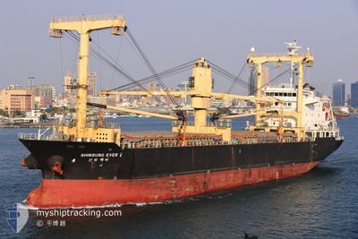
The vessel DDS MARINA (IMO: 9513206, MMSI: 441783000) is a General Cargo that was built in 2011 ( 14 år gamle ). It's sailing under the flag of [KR] Korea.
In this page you can find informations about the vessels current position, last detected port calls, and current voyage information. If the vessels is not in coverage by AIS you will find the latest position.
The current position of DDS MARINA is detected by our AIS receivers and we are not responsible for the reliability of the data. The last position was recorded while the vessel was in Coverage by the Ais receivers of our vessel tracking app.
The current draught of DDS MARINA as reported by AIS is 9.2 meters
Weather
| Temperature | 27.7°C / 81.86°F |
|---|---|
| Wind Speed | 10 knots |
| Direction | 335° NNW |
| Pressure | 1008.6 hPa |
| Humidity | 75.2 % |
| Cloud Coverage | 100 % |


Featured Company
Most Visited Ports (Last year)
| Port | Arrivals | |
|---|---|---|
| 2 | ||
| 2 | ||
| 1 | ||
| 1 | ||
| 1 | ||
| 1 |
Events
| Tid | Hændelsen | Detaljer | Position / Dest | Info |
|---|---|---|---|---|
| 2025-02-14 04:21 | Status er ændret | Default Under way using engine |
1.26182 / 103.38721
IN PRT
|
Fart: 10 kn Kurs: 310° |
| 2025-02-14 04:14 | Status er ændret | Under way using engine Default |
1.25018 / 103.40072
IN PRT
|
Fart: 9.9 kn Kurs: 310° |
| 2025-02-14 04:14 | Udenfor Dækning |
1.25018 / 103.40072
Malacca Strait
IN PRT
|
Fart: 10 kn Kurs: 310° |
|
| 2025-02-14 04:13 | Status er ændret | Default Under way using engine |
1.24858 / 103.40255
IN PRT
|
Fart: 9.9 kn Kurs: 310° |
| 2025-02-14 03:53 | Ændre havområde | Malaysian part of the Malacca Strait Malaysian part of the Singapore Strait |
1.22757 / 103.45520
Malacca Strait
IN PRT
|
Fart: 10 kn Kurs: 285° |
| 2025-02-14 03:08 | Ændre havområde | Malaysian part of the Singapore Strait Indonesian part of the Singapore Strait |
1.19465 / 103.58293
Singapore Strait
IN PRT
|
Fart: 11 kn Kurs: 283° |
| 2025-02-14 02:17 | Ændre havområde | Indonesian part of the Singapore Strait Singaporean part of the Singapore Strait |
1.13587 / 103.73222
Singapore Strait
IN PRT
|
Fart: 12 kn Kurs: 269° |
| 2025-02-14 02:06 | ETA er ændret | 2025/02/20 11:00 2025/02/19 18:00 |
1.15215 / 103.76565
IN PRT
|
Fart: 12.6 kn Kurs: 233° |
| 2025-02-14 00:55 | START Sejllads | 1.92 nm, East of SINGAPORE |
1.25558 / 103.88647
IN PRT
|
Fart: 3.1 kn Kurs: 125° |
| 2025-02-14 00:42 | Dybgangen er ændret | 9.2 8.5 |
1.25715 / 103.88628
IN PRT
|
Fart: 0.3 kn Kurs: 45° |