
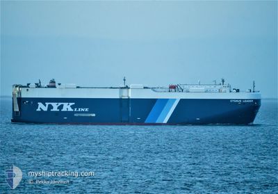
CYGNUS LEADER
Vehicles Carrier
Current Trip
| Time Travelled | 23 days |
|---|---|
| Remaining Time | 11 h, 37 mins |
| Distance Travelled | 7761.74 nm |
| Remaining Distance | 83.79 nm |
| AVG Speed | 14.1 Noeuds |
| MAX Speed | 18.5 Noeuds |
| AVG Wind | 11.5 knots |
| MAX Wind | 30 knots |
| MIN Temp | 7.1°C / 44.78°F |
| MAX Temp | 31.8°C / 89.24°F |
| Tirant d eau | 9.3 m |
| Position reçue | Maintenant |
Current Position
| Longitude | -118.05987° |
|---|---|
| Latitude | 33.35545° |
| Etat | Under way using engine |
| Vitesse | 8.8 Noeuds |
| Parcours | 341° |
| Zone | North Pacific Ocean |
| Station | T-AIS |
| Position reçue | Maintenant |
Info
Information
The current position of CYGNUS LEADER is in North Pacific Ocean with coordinates 33.35545° / -118.05987° as reported on 2024-05-03 01:49 by AIS to our vessel tracker app. The vessel's current speed is 8.8 Noeuds and is heading at the port of HUENEME. The estimated time of arrival as calculated by MyShipTracking vessel tracking app is 2024-05-03 13:26 LT
The vessel CYGNUS LEADER (IMO: 9381249, MMSI: 372747000) is a Vehicles Carrier that was built in 2007 ( 17 Age ). It's sailing under the flag of [PA] Panama.
In this page you can find informations about the vessels current position, last detected port calls, and current voyage information. If the vessels is not in coverage by AIS you will find the latest position.
The current position of CYGNUS LEADER is detected by our AIS receivers and we are not responsible for the reliability of the data. The last position was recorded while the vessel was in Coverage by the Ais receivers of our vessel tracking app.
The current draught of CYGNUS LEADER as reported by AIS is 9.3 meters
Weather
| Temperature | 16°C / 60.8°F |
|---|---|
| Wind Speed | 6 knots |
| Direction | 280° W |
| Pressure | 1011.1 hPa |
| Humidity | 81.4 % |
| Cloud Coverage | --- |
Featured Company
Last Port Calls
| Port | Arrival | Departure | Time In Port |
|---|---|---|---|
| 2024-04-09 13:49 | 2024-04-10 01:48 | 11 h | |
| 2024-04-06 21:09 | 2024-04-08 18:02 | 1 d | |
| 2024-04-03 16:07 | 2024-04-05 22:49 | 2 d | |
| 2024-04-01 22:54 | 2024-04-02 16:26 | 17 h | |
| 2024-03-30 09:27 | 2024-03-30 23:49 | 14 h | |
| 2024-03-25 23:41 | 2024-03-28 00:50 | 2 d | |
| 2024-03-19 16:19 | 2024-03-21 02:33 | 1 d |
Most Visited Ports (Last year)
| Port | Arrivals | |
|---|---|---|
| 6 | ||
| 5 | ||
| 3 | ||
| 3 | ||
| 2 | ||
| 2 |
Last Trips
| Origin | Departure | Destination | Arrival | Distance | |
|---|---|---|---|---|---|
| 2024-04-08 20:02 | 2024-04-09 14:49 | 205.16 nm | |||
| 2024-04-06 00:49 | 2024-04-06 23:09 | 330.97 nm | |||
| 2024-04-02 18:26 | 2024-04-03 18:07 | 316.76 nm | |||
| 2024-03-30 23:49 | 2024-04-02 00:54 | 605.18 nm | |||
| 2024-03-28 01:50 | 2024-03-30 09:27 | 556.04 nm | |||
| 2024-03-21 03:33 | 2024-03-26 00:41 | 1446.87 nm |
Events
| Heure | Evenement | Détails | Position/ Destination | Info |
|---|---|---|---|---|
| 2024-05-03 00:36 | Démarrage | 17.55 nm, South East of AVALON |
33.21435 / -118.01067
US NTD
|
Vitesse: 3.2 kn Parcours: 9° |
| 2024-05-03 00:29 | Arret | 17.61 nm, South East of AVALON |
33.21180 / -118.01097
US NTD
|
Vitesse: 0.3 kn Parcours: 306° |
| 2024-05-02 23:07 | Tirant d'eau modifié | 9.3 9.6 |
33.03258 / -117.94990
US NTD
|
Vitesse: 11.4 kn Parcours: 347° |
| 2024-05-02 23:07 | Changement d'ETA | 2024/05/03 11:45 2024/05/03 12:30 |
33.03258 / -117.94990
US NTD
|
Vitesse: 11.4 kn Parcours: 347° |
| 2024-05-02 20:55 | Changement de zone | United States part of the North Pacific Ocean Mexican part of the North Pacific Ocean |
32.63473 / -117.82453
North Pacific Ocean
US NTD
|
Vitesse: 11.3 kn Parcours: 346° |
| 2024-05-02 18:06 | Etat Changé | Under way using engine Default |
32.10617 / -117.74382
US NTD
|
Vitesse: 11.3 kn Parcours: 347° |
| 2024-05-02 17:58 | Etat Changé | Default Under way using engine |
32.08203 / -117.73762
US NTD
|
Vitesse: 11.6 kn Parcours: 348° |
| 2024-05-02 17:21 | Etat Changé | Under way using engine Default |
31.94387 / -117.70073
US NTD
|
Vitesse: 15.2 kn Parcours: 346° |
| 2024-05-02 17:18 | Etat Changé | Default Under way using engine |
31.92925 / -117.69680
US NTD
|
Vitesse: 15.1 kn Parcours: 347° |
| 2024-05-02 16:00 | Etat Changé | Under way using engine Default |
31.60047 / -117.68133
US NTD
|
Vitesse: 14 kn Parcours: 1° |