
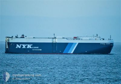
CYGNUS LEADER
Vehicles Carrier
Current Trip
| Time Travelled | 9 days |
|---|---|
| Remaining Time | --- |
| Distance Travelled | 3443.86 nm |
| Remaining Distance | --- |
| AVG Speed | 14.4 Knop |
| MAX Speed | 18.4 Knop |
| AVG Wind | 14.6 knots |
| MAX Wind | 30 knots |
| MIN Temp | 7.1°C / 44.78°F |
| MAX Temp | 24.2°C / 75.56°F |
| Djupgående | 9.6 m |
| Position mottagen | 5 d sen |
Current Position
| Longitud | -31.91070° |
|---|---|
| Latitude | 39.85497° |
| Status | Under way using engine |
| Fart | 16.4 Knop |
| Kurs | 258° |
| Område | North Atlantic Ocean |
| Station | T-AIS |
| Position mottagen | 5 d sen |
Info
Information
The current position of CYGNUS LEADER is in North Atlantic Ocean with coordinates 39.85497° / -31.91070° as reported on 2024-04-14 11:21 by AIS to our vessel tracker app. The vessel's current speed is 16.4 Knop and is heading at the port of CRISTOBAL. The estimated time of arrival as calculated by MyShipTracking vessel tracking app is 2024-04-23 03:00 LT
The vessel CYGNUS LEADER (IMO: 9381249, MMSI: 372747000) is a Vehicles Carrier that was built in 2007 ( 17 År gammal ). It's sailing under the flag of [PA] Panama.
In this page you can find informations about the vessels current position, last detected port calls, and current voyage information. If the vessels is not in coverage by AIS you will find the latest position.
The current position of CYGNUS LEADER is detected by our AIS receivers and we are not responsible for the reliability of the data. The last position was recorded while the vessel was in Coverage by the Ais receivers of our vessel tracking app.
The current draught of CYGNUS LEADER as reported by AIS is 9.6 meters
Weather
| Temperature | 24.2°C / 75.56°F |
|---|---|
| Wind Speed | 5 knots |
| Direction | 10° N |
| Pressure | 1014.1 hPa |
| Humidity | 75.2 % |
| Cloud Coverage | 4 % |
Featured Company
Last Port Calls
| Port | Arrival | Departure | Time In Port |
|---|---|---|---|
| 2024-04-09 13:49 | 2024-04-10 01:48 | 11 h | |
| 2024-04-06 21:09 | 2024-04-08 18:02 | 1 d | |
| 2024-04-03 16:07 | 2024-04-05 22:49 | 2 d | |
| 2024-04-01 22:54 | 2024-04-02 16:26 | 17 h | |
| 2024-03-30 09:27 | 2024-03-30 23:49 | 14 h | |
| 2024-03-25 23:41 | 2024-03-28 00:50 | 2 d | |
| 2024-03-19 16:19 | 2024-03-21 02:33 | 1 d | |
| 2024-02-06 01:46 | 2024-02-06 10:42 | 8 h | |
| 2024-02-02 11:58 | 2024-02-02 17:46 | 5 h |
Most Visited Ports (Last year)
| Port | Arrivals | |
|---|---|---|
| 6 | ||
| 5 | ||
| 3 | ||
| 3 | ||
| 2 | ||
| 2 |
Last Trips
| Origin | Departure | Destination | Arrival | Distance | |
|---|---|---|---|---|---|
| 2024-04-08 20:02 | 2024-04-09 14:49 | 205.16 nm | |||
| 2024-04-06 00:49 | 2024-04-06 23:09 | 330.97 nm | |||
| 2024-04-02 18:26 | 2024-04-03 18:07 | 316.76 nm | |||
| 2024-03-30 23:49 | 2024-04-02 00:54 | 605.18 nm | |||
| 2024-03-28 01:50 | 2024-03-30 09:27 | 556.04 nm | |||
| 2024-03-21 03:33 | 2024-03-26 00:41 | 1446.87 nm | |||
| 2024-02-03 01:46 | 2024-02-06 09:46 | 676.74 nm | |||
| 2024-01-27 20:15 | 2024-02-02 19:58 | 1722.62 nm |
Events
| Tid | Event | Detaljer | Position / Dest | Information |
|---|---|---|---|---|
| 2024-04-14 11:25 | Status ändrad | Default Under way using engine |
39.85160 / -31.93347
PA CTB
|
Fart: 16.4 kn Kurs: 258° |
| 2024-04-14 11:21 | UTANFÖR täckningsområde |
39.85497 / -31.91070
North Atlantic Ocean
PA CTB
|
Fart: 16.4 kn Kurs: 258° |
|
| 2024-04-14 10:59 | Status ändrad | Under way using engine Default |
39.87360 / -31.78347
PA CTB
|
Fart: 16.4 kn Kurs: 238° |
| 2024-04-14 10:47 | I täckningsområde |
39.87353 / -31.78405
North Atlantic Ocean
PA CTB
|
Fart: 16.2 kn Kurs: 256° |
|
| 2024-04-14 06:38 | Status ändrad | Default Under way using engine |
40.40215 / -30.34718
PA CTB
|
Fart: 17.5 kn Kurs: 243° |
| 2024-04-14 06:31 | Status ändrad | Under way using engine Default |
40.41567 / -30.31258
PA CTB
|
Fart: 17.6 kn Kurs: 242° |
| 2024-04-14 06:31 | UTANFÖR täckningsområde |
40.41567 / -30.31258
North Atlantic Ocean
PA CTB
|
Fart: 17.5 kn Kurs: 243° |
|
| 2024-04-14 06:00 | Status ändrad | Default Under way using engine |
40.48695 / -30.13382
PA CTB
|
Fart: 17.8 kn Kurs: 242° |
| 2024-04-14 05:50 | Byter havsområde | Portuguese (Azores) part of the North Atlantic Ocean High seas of the North Atlantic Ocean |
40.51022 / -30.07580
North Atlantic Ocean
PA CTB
|
Fart: 17.8 kn Kurs: 242° |
| 2024-04-14 05:50 | Status ändrad | Under way using engine Default |
40.51065 / -30.07475
PA CTB
|
Fart: 17.7 kn Kurs: 244° |