
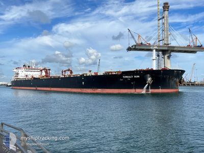
COBALT SUN
Tanker
Current Trip
| Trip Time | 17 days |
|---|---|
| Trip Distance | 491.19 nm |
| AVG Speed | 7.2 Noeuds |
| MAX Speed | 13.6 Noeuds |
| Tirant d eau | 9.2 m |
| AVG Wind | 13.7 knots |
| MAX Wind | 24 knots |
| MIN Temp | 18.5°C / 65.3°F |
| MAX Temp | 31.2°C / 88.16°F |
| Position reçue | 1 m depuis |
Current Position
| Longitude | -95.02071° |
|---|---|
| Latitude | 29.71312° |
| Etat | Under way using engine |
| Vitesse | 8.9 Noeuds |
| Parcours | --- |
| Zone | Gulf of Mexico |
| Station | T-AIS |
| Position reçue | 1 m depuis |
Info
Information
The current position of COBALT SUN is in Gulf of Mexico with coordinates 29.71312° / -95.02071° as reported on 2024-05-09 07:55 by AIS to our vessel tracker app. The vessel's current speed is 8.9 Noeuds and is currently inside the port of HOUSTON.
The vessel COBALT SUN (IMO: 9814428, MMSI: 636019387) is a Tanker It's sailing under the flag of [LR] Liberia.
In this page you can find informations about the vessels current position, last detected port calls, and current voyage information. If the vessels is not in coverage by AIS you will find the latest position.
The current position of COBALT SUN is detected by our AIS receivers and we are not responsible for the reliability of the data. The last position was recorded while the vessel was in Coverage by the Ais receivers of our vessel tracking app.
The current draught of COBALT SUN as reported by AIS is 9.2 meters
Weather
| Temperature | 25°C / 77°F |
|---|---|
| Wind Speed | 6 knots |
| Direction | 172° S |
| Pressure | 1004.8 hPa |
| Humidity | 97 % |
| Cloud Coverage | 67 % |
Featured Company
Most Visited Ports (Last year)
| Port | Arrivals | |
|---|---|---|
| 4 | ||
| 4 | ||
| 3 | ||
| 2 | ||
| 2 | ||
| 2 |
Events
| Heure | Evenement | Détails | Position/ Destination | Info |
|---|---|---|---|---|
| 2024-05-09 07:00 | Port d'arrivée |
|
29.59220 / -94.94109
[US] HOUSTON
|
Vitesse: 9.8 kn Parcours: 332° |
| 2024-05-09 04:49 | Etat Changé | Under way using engine Default |
29.34300 / -94.70100
USHOU
|
Vitesse: 8.1 kn Parcours: 280° |
| 2024-05-09 04:47 | Etat Changé | Default Under way using engine |
29.34180 / -94.69453
USHOU
|
Vitesse: 8.4 kn Parcours: 300.4° |
| 2024-05-09 04:38 | Etat Changé | Under way using engine Default |
29.33421 / -94.67528
USHOU
|
Vitesse: 8.9 kn Parcours: 300° |
| 2024-05-09 04:35 | Etat Changé | Default Under way using engine |
29.32941 / -94.66660
USHOU
|
Vitesse: 9.2 kn Parcours: 301° |
| 2024-05-09 04:12 | Etat Changé | Under way using engine Default |
29.30004 / -94.60989
USHOU
|
Vitesse: 8.8 kn Parcours: 290° |
| 2024-05-09 04:10 | Dans la zone couverte |
29.30246 / -94.61585
Gulf of Mexico
USHOU
|
Vitesse: 9 kn Parcours: 294.3° |
|
| 2024-05-09 01:54 | Etat Changé | Default Under way using engine |
29.24021 / -94.28869
USHOU
|
Vitesse: 10.3 kn Parcours: 214.8° |
| 2024-05-09 01:48 | Hors de la zone couverte |
29.25733 / -94.27945
Gulf of Mexico
USHOU
|
Vitesse: 10.3 kn Parcours: 214.8° |
|
| 2024-05-08 17:53 | Tirant d'eau modifié | 9.2 11.7 |
30.01333 / -93.96769
USHOU
|
Vitesse: 8.8 kn Parcours: 58° |