

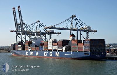
CMA CGM NIAGARA
Cargo
Current Trip
SAJED
| Time Travelled | 12 days |
|---|---|
| Remaining Time | --- |
| Distance Travelled | 3090.91 nm |
| Remaining Distance | --- |
| AVG Speed | 18 Noeuds |
| MAX Speed | 18.9 Noeuds |
| AVG Wind | 9.2 knots |
| MAX Wind | 16 knots |
| MIN Temp | 22.7°C / 72.86°F |
| MAX Temp | 28.6°C / 83.48°F |
| Tirant d eau | 13.5 m |
| Position reçue | 1 d depuis |
Current Position
| Longitude | --- |
|---|---|
| Latitude | --- |
| Etat | Under way using engine |
| Vitesse | 17.2 Noeuds |
| Parcours | 105.9° |
| Zone | Indian Ocean |
| Station | T-AIS |
| Position reçue | 1 d depuis |
Information
The current position of CMA CGM NIAGARA is in Indian Ocean with coordinates 5.57463° / 80.22730° as reported on 2025-03-05 09:39 by AIS to our vessel tracker app. The vessel's current speed is 17.2 Noeuds
The vessel CMA CGM NIAGARA (IMO: 9722675, MMSI: 249168000) is a Cargo It's sailing under the flag of [MT] Malta.
In this page you can find informations about the vessels current position, last detected port calls, and current voyage information. If the vessels is not in coverage by AIS you will find the latest position.
The current position of CMA CGM NIAGARA is detected by our AIS receivers and we are not responsible for the reliability of the data. The last position was recorded while the vessel was in Coverage by the Ais receivers of our vessel tracking app.
The current draught of CMA CGM NIAGARA as reported by AIS is 13.5 meters
Weather
| Temperature | 27.7°C / 81.86°F |
|---|---|
| Wind Speed | 12 knots |
| Direction | 4° N |
| Pressure | 1010 hPa |
| Humidity | 69.2 % |
| Cloud Coverage | 100 % |
Featured Company
Last Port Calls
| Port | Arrival | Departure | Time In Port |
|---|---|---|---|
| 2025-02-21 06:28 | 2025-02-22 09:56 | 1 d | |
| 2025-02-19 03:56 | 2025-02-19 12:57 | 9 h | |
| 2025-02-16 15:23 | 2025-02-17 17:59 | 1 d | |
| 2025-02-12 14:16 | 2025-02-13 21:13 | 1 d | |
| 2025-02-10 09:11 | 2025-02-12 00:07 | 1 d | |
| 2025-02-07 19:08 | 2025-02-10 06:42 | 2 d | |
| 2025-01-31 04:46 | 2025-01-31 22:47 | 18 h | |
| 2025-01-29 10:37 | 2025-01-30 07:39 | 21 h | |
| 2025-01-28 04:05 | 2025-01-28 13:25 | 9 h | |
| 2025-01-09 22:53 | 2025-01-11 14:07 | 1 d |
Most Visited Ports (Last year)
| Port | Arrivals | |
|---|---|---|
| 8 | ||
| 8 | ||
| 6 | ||
| 5 | ||
| 4 | ||
| 4 |
Last Trips
| Origin | Departure | Destination | Arrival | Distance | |
|---|---|---|---|---|---|
| 2025-02-17 19:59 | 2025-02-21 09:28 | 896.89 nm | |||
| 2025-02-17 19:59 | 2025-02-19 05:56 | 181.10 nm | |||
| 2025-02-13 22:13 | 2025-02-16 17:23 | 1211.03 nm | |||
| 2025-02-12 01:07 | 2025-02-12 15:16 | 160.23 nm | |||
| 2025-02-10 07:42 | 2025-02-10 10:11 | 11.55 nm | |||
| 2025-02-01 00:47 | 2025-02-07 20:08 | 1508.16 nm | |||
| 2025-01-30 09:39 | 2025-01-31 06:46 | 360.47 nm | |||
| 2025-01-11 22:07 | 2025-01-29 12:37 | 5317.11 nm | |||
| 2025-01-11 22:07 | 2025-01-28 06:05 | 5036.63 nm | |||
| 2025-01-06 18:17 | 2025-01-10 06:53 | 1469.12 nm |
Events
| Heure | Evenement | Détails | Position/ Destination | Info |
|---|---|---|---|---|
| 2025-03-05 09:58 | Etat Changé | Default Under way using engine |
5.54863 / 80.31756
SAJED
|
Vitesse: 17.2 kn Parcours: 105.9° |
| 2025-03-05 09:39 | Detecté en mer | Sri Lankan part of the Indian Ocean |
5.57463 / 80.22730
Indian Ocean
|
Vitesse: 17.2 kn Parcours: 105.9° |
| 2025-03-05 09:39 | Etat Changé | Under way using engine Default |
5.57463 / 80.22730
SAJED
|
Vitesse: 16.9 kn Parcours: 106° |
| 2025-03-05 09:39 | Dans la zone couverte |
5.57463 / 80.22730
Indian Ocean
|
Vitesse: 17.2 kn Parcours: 105.9° |
|
| 2025-03-05 09:39 | Hors de la zone couverte |
5.57463 / 80.22730
Indian Ocean
|
Vitesse: 17.2 kn Parcours: 105.9° |
|
| 2025-03-04 20:38 | Etat Changé | Default Under way using engine |
6.61370 / 76.65088
SAJED
|
Vitesse: 18.3 kn Parcours: 107.1° |
| 2025-03-04 20:28 | Etat Changé | Under way using engine Default |
6.62868 / 76.60156
SAJED
|
Vitesse: 18.4 kn Parcours: 107° |
| 2025-03-04 20:28 | Hors de la zone couverte |
6.62868 / 76.60156
Laccadive Sea
|
Vitesse: 18.3 kn Parcours: 107.1° |
|
| 2025-03-04 20:16 | Etat Changé | Default Under way using engine |
6.64642 / 76.54325
SAJED
|
Vitesse: 18.4 kn Parcours: 106.8° |
| 2025-03-04 19:59 | Etat Changé | Under way using engine Default |
6.67209 / 76.45933
SAJED
|
Vitesse: 18.4 kn Parcours: 107° |