
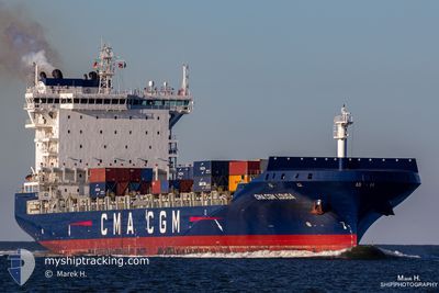
CMA CGM LOUGA
Cargo A
Current Trip
| Time Travelled | 1 day |
|---|---|
| Remaining Time | 9 h, 37 mins |
| Distance Travelled | 443.99 nm |
| Remaining Distance | 123.82 nm |
| AVG Speed | 11.2 Noeuds |
| MAX Speed | 16.5 Noeuds |
| AVG Wind | 7.8 knots |
| MAX Wind | 22.8 knots |
| MIN Temp | 16.8°C / 62.24°F |
| MAX Temp | 17.6°C / 63.68°F |
| Tirant d eau | 10.8 m |
| Position reçue | 4 h, 33 m depuis |
Current Position
| Longitude | 17.83569° |
|---|---|
| Latitude | 35.88310° |
| Etat | Under way using engine |
| Vitesse | 11.4 Noeuds |
| Parcours | 267.3° |
| Zone | Mediterranean Sea - Eastern Basin |
| Station | T-AIS |
| Position reçue | 4 h, 33 m depuis |
Info
Information
The current position of CMA CGM LOUGA is in Mediterranean Sea - Eastern Basin with coordinates 35.88310° / 17.83569° as reported on 2024-04-28 04:38 by AIS to our vessel tracker app. The vessel's current speed is 11.4 Noeuds and is heading at the port of MARSAXLOKK. The estimated time of arrival as calculated by MyShipTracking vessel tracking app is 2024-04-28 18:48 LT
The vessel CMA CGM LOUGA (IMO: 9745550, MMSI: 248655000) is a Cargo A It's sailing under the flag of [MT] Malta.
In this page you can find informations about the vessels current position, last detected port calls, and current voyage information. If the vessels is not in coverage by AIS you will find the latest position.
The current position of CMA CGM LOUGA is detected by our AIS receivers and we are not responsible for the reliability of the data. The last position was recorded while the vessel was in Coverage by the Ais receivers of our vessel tracking app.
The current draught of CMA CGM LOUGA as reported by AIS is 10.8 meters
Weather
| Temperature | 17.5°C / 63.5°F |
|---|---|
| Wind Speed | 22 knots |
| Direction | 89° E |
| Pressure | 1015.1 hPa |
| Humidity | 79.2 % |
| Cloud Coverage | 6 % |
Featured Company
Last Port Calls
| Port | Arrival | Departure | Time In Port |
|---|---|---|---|
| 2024-04-26 12:22 | 2024-04-26 17:36 | 5 h | |
| 2024-04-23 10:47 | 2024-04-24 04:33 | 17 h | |
| 2024-04-21 05:44 | 2024-04-22 05:52 | 1 d | |
| 2024-04-15 06:51 | 2024-04-17 07:06 | 2 d | |
| 2024-04-03 20:38 | 2024-04-04 22:38 | 1 d | |
| 2024-03-30 04:17 | 2024-04-02 17:20 | 3 d | |
| 2024-03-29 09:33 | 2024-03-29 19:22 | 9 h | |
| 2024-03-24 09:53 | 2024-03-24 18:21 | 8 h | |
| 2024-03-20 14:58 | 2024-03-21 23:32 | 1 d | |
| 2024-03-18 22:46 | 2024-03-19 19:36 | 20 h |
Most Visited Ports (Last year)
| Port | Arrivals | |
|---|---|---|
| 14 | ||
| 10 | ||
| 9 | ||
| 8 | ||
| 8 | ||
| 8 |
Last Trips
| Origin | Departure | Destination | Arrival | Distance | |
|---|---|---|---|---|---|
| 2024-04-24 06:33 | 2024-04-26 15:22 | 625.37 nm | |||
| 2024-04-22 07:52 | 2024-04-23 12:47 | 170.04 nm | |||
| 2024-04-17 09:06 | 2024-04-21 07:44 | 821.09 nm | |||
| 2024-04-05 00:38 | 2024-04-15 08:51 | 2510.19 nm | |||
| 2024-04-02 19:20 | 2024-04-03 22:38 | 315.40 nm | |||
| 2024-03-29 20:22 | 2024-03-30 05:17 | 116.33 nm | |||
| 2024-03-24 20:21 | 2024-03-29 10:33 | 1121.37 nm | |||
| 2024-03-22 00:32 | 2024-03-24 11:53 | 287.95 nm | |||
| 2024-03-19 21:36 | 2024-03-20 15:58 | 281.84 nm | |||
| 2024-03-18 15:57 | 2024-03-19 00:46 | 118.87 nm |
Events
| Heure | Evenement | Détails | Position/ Destination | Info |
|---|---|---|---|---|
| 2024-04-28 04:48 | Etat Changé | Default Under way using engine |
35.88167 / 17.79500
MTMAR
|
Vitesse: 11.4 kn Parcours: 267.3° |
| 2024-04-28 04:38 | Etat Changé | Under way using engine Default |
35.88310 / 17.83569
MTMAR
|
Vitesse: 11 kn Parcours: 268° |
| 2024-04-28 04:38 | Hors de la zone couverte |
35.88310 / 17.83569
Mediterranean Sea - Eastern Basin
MTMAR
|
Vitesse: 11.4 kn Parcours: 267.3° |
|
| 2024-04-28 04:00 | Etat Changé | Default Under way using engine |
35.88693 / 17.98160
MTMAR
|
Vitesse: 11.5 kn Parcours: 269.1° |
| 2024-04-28 03:53 | Changement d'ETA | 2024/04/28 19:00 2024/04/28 06:00 |
35.88779 / 18.02021
MTMAR
|
Vitesse: 11.5 kn Parcours: 267.9° |
| 2024-04-28 03:44 | Etat Changé | Under way using engine Default |
35.88853 / 18.04512
MTMAR
|
Vitesse: 11.3 kn Parcours: 268° |
| 2024-04-28 03:18 | Etat Changé | Default Under way using engine |
35.89167 / 18.14833
MTMAR
|
Vitesse: 11.4 kn Parcours: 267.8° |
| 2024-04-28 03:12 | Etat Changé | Under way using engine Default |
35.89173 / 18.16991
MTMAR
|
Vitesse: 11.4 kn Parcours: 268° |
| 2024-04-28 03:04 | Etat Changé | Default Under way using engine |
35.89249 / 18.20059
MTMAR
|
Vitesse: 11.5 kn Parcours: 268.2° |
| 2024-04-28 02:40 | Detecté en mer | Italian part of the Mediterranean Sea - Eastern Basin |
35.89506 / 18.29449
Mediterranean Sea - Eastern Basin
MTMAR
|
Vitesse: 11.6 kn Parcours: 268.1° |