
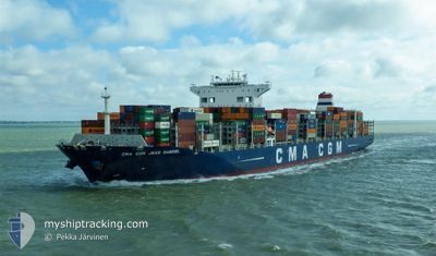
CMA CGM JEAN GABRIEL
Cargo A
Current Trip
| Time Travelled | 3 days |
|---|---|
| Remaining Time | 2 h, 35 mins |
| Distance Travelled | 1419.97 nm |
| Remaining Distance | 31.38 nm |
| AVG Speed | 14.4 Noeuds |
| MAX Speed | 18.7 Noeuds |
| AVG Wind | 8 knots |
| MAX Wind | 19.3 knots |
| MIN Temp | 8.9°C / 48.02°F |
| MAX Temp | 17.3°C / 63.14°F |
| Tirant d eau | 13 m |
| Position reçue | Maintenant |
Current Position
| Longitude | --- |
|---|---|
| Latitude | --- |
| Etat | Under way using engine |
| Vitesse | 11 Noeuds |
| Parcours | 324° |
| Zone | Adriatic Sea |
| Station | T-AIS |
| Position reçue | Maintenant |
Info
Information
The current position of CMA CGM JEAN GABRIEL is in Adriatic Sea with coordinates 45.36211° / 13.12799° as reported on 2025-01-06 13:16 by AIS to our vessel tracker app. The vessel's current speed is 11 Noeuds and is heading at the port of KOPER. The estimated time of arrival as calculated by MyShipTracking vessel tracking app is 2025-01-06 15:52 LT
The vessel CMA CGM JEAN GABRIEL (IMO: 9729128, MMSI: 248703000) is a Cargo A It's sailing under the flag of [MT] Malta.
In this page you can find informations about the vessels current position, last detected port calls, and current voyage information. If the vessels is not in coverage by AIS you will find the latest position.
The current position of CMA CGM JEAN GABRIEL is detected by our AIS receivers and we are not responsible for the reliability of the data. The last position was recorded while the vessel was in Coverage by the Ais receivers of our vessel tracking app.
The current draught of CMA CGM JEAN GABRIEL as reported by AIS is 13 meters
Weather
| Temperature | 9.2°C / 48.56°F |
|---|---|
| Wind Speed | 5 knots |
| Direction | 7° N |
| Pressure | 1011.4 hPa |
| Humidity | 86.6 % |
| Cloud Coverage | 100 % |
Featured Company
Last Port Calls
| Port | Arrival | Departure | Time In Port |
|---|---|---|---|
| 2025-01-02 14:14 | |||
| 2024-12-30 10:41 | 2024-12-31 19:48 | 1 d | |
| 2024-12-28 11:07 | 2024-12-29 06:54 | 19 h | |
| 2024-12-27 07:06 | 2024-12-27 17:53 | 10 h | |
| 2024-12-06 22:50 | 2024-12-07 19:19 | 20 h | |
| 2024-12-01 17:48 | 2024-12-03 01:24 | 1 d | |
| 2024-11-25 19:00 | 2024-11-27 15:07 | 1 d | |
| 2024-11-15 13:51 | 2024-11-17 08:48 | 1 d | |
| 2024-11-01 07:58 |
Most Visited Ports (Last year)
| Port | Arrivals | |
|---|---|---|
| 6 | ||
| 5 | ||
| 5 | ||
| 4 | ||
| 4 | ||
| 3 |
Last Trips
| Origin | Departure | Destination | Arrival | Distance | |
|---|---|---|---|---|---|
| 2024-12-29 08:54 | 2024-12-30 12:41 | 400.63 nm | |||
| 2024-12-08 03:19 | 2024-12-28 13:07 | 5413.76 nm | |||
| 2024-12-08 03:19 | 2024-12-27 09:06 | 5049.91 nm | |||
| 2024-12-03 09:24 | 2024-12-07 06:50 | 1473.54 nm | |||
| 2024-11-28 00:07 | 2024-12-02 01:48 | 1230.23 nm | |||
| 2024-11-17 16:48 | 2024-11-26 04:00 | 2819.73 nm | |||
| 2024-11-01 10:58 | 2024-11-15 21:51 | 4115.47 nm |
Events
| Heure | Evenement | Détails | Position/ Destination | Info |
|---|---|---|---|---|
| 2025-01-06 12:33 | Changement d'ETA | 2025/01/06 18:00 2025/01/06 19:00 |
45.24189 / 13.21321
SIKOP
|
Vitesse: 11.2 kn Parcours: 335.2° |
| 2025-01-06 08:15 | Changement d'ETA | 2025/01/06 19:00 2025/01/06 15:00 |
44.53668 / 13.76188
SIKOP
|
Vitesse: 12.1 kn Parcours: 326.2° |
| 2025-01-06 04:10 | Etat Changé | Under way using engine Default |
43.81342 / 14.48951
SIKOP
|
Vitesse: 13.1 kn Parcours: 321° |
| 2025-01-06 03:52 | Dans la zone couverte |
43.81342 / 14.48951
Adriatic Sea
SIKOP
|
Vitesse: 13.2 kn Parcours: 320.9° |
|
| 2025-01-06 00:34 | Etat Changé | Default Under way using engine |
43.19406 / 15.17480
SIKOP
|
Vitesse: 13.4 kn Parcours: 320.6° |
| 2025-01-06 00:31 | Hors de la zone couverte |
43.18448 / 15.18544
Adriatic Sea
SIKOP
|
Vitesse: 13.4 kn Parcours: 320.6° |
|
| 2025-01-05 18:34 | Changement de zone | Croatian part of the Adriatic Sea Italian part of the Adriatic Sea |
42.17656 / 16.39364
Adriatic Sea
SIKOP
|
Vitesse: 13.8 kn Parcours: 314.7° |
| 2025-01-05 15:43 | Dans la zone couverte |
41.70760 / 16.99849
Adriatic Sea
SIKOP
|
Vitesse: 13.4 kn Parcours: 316° |
|
| 2025-01-05 15:42 | Etat Changé | Under way using engine Default |
41.70404 / 17.00312
SIKOP
|
Vitesse: 13.2 kn Parcours: 317° |
| 2025-01-05 13:44 | Hors de la zone couverte |
41.36850 / 17.45980
Adriatic Sea
SIKOP
|
Vitesse: 13.3 kn Parcours: 299.8° |