

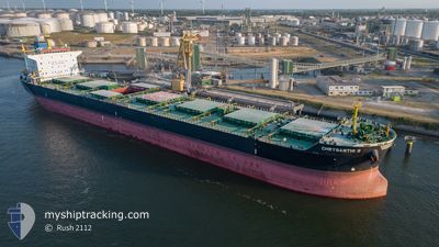
CHRYSANTHI S
Bulk Carrier

Current Trip
| Time Travelled | 2 days |
|---|---|
| Remaining Time | --- |
| Distance Travelled | 522.28 nm |
| Remaining Distance | --- |
| AVG Speed | 10.4 Noeuds |
| MAX Speed | 10.4 Noeuds |
| AVG Wind | 18.2 knots |
| MAX Wind | 39.3 knots |
| MIN Temp | -5.1°C / 22.82°F |
| MAX Temp | 7°C / 44.6°F |
| Tirant d eau | 14.2 m |
| Position reçue | 2 m depuis |
Current Position
| Longitude | --- |
|---|---|
| Latitude | --- |
| Etat | Under way using engine |
| Vitesse | 7.7 Noeuds |
| Parcours | 224.9° |
| Zone | Norwegian Sea |
| Station | T-AIS |
| Position reçue | 2 m depuis |
Information
The current position of CHRYSANTHI S is in Norwegian Sea with coordinates 70.12595° / 15.83175° as reported on 2025-02-22 19:29 by AIS to our vessel tracker app. The vessel's current speed is 7.7 Noeuds and is heading at the port of ISKENDERUN. The estimated time of arrival as calculated by MyShipTracking vessel tracking app is 2025-03-10 12:00 LT
The vessel CHRYSANTHI S (IMO: 9527441, MMSI: 636015701) is a Bulk Carrier that was built in 2012 ( 13 Age ). It's sailing under the flag of [LR] Liberia.
In this page you can find informations about the vessels current position, last detected port calls, and current voyage information. If the vessels is not in coverage by AIS you will find the latest position.
The current position of CHRYSANTHI S is detected by our AIS receivers and we are not responsible for the reliability of the data. The last position was recorded while the vessel was in Coverage by the Ais receivers of our vessel tracking app.
The current draught of CHRYSANTHI S as reported by AIS is 14.2 meters
Weather
| Temperature | 6.9°C / 44.42°F |
|---|---|
| Wind Speed | 30 knots |
| Direction | 212° SSW |
| Pressure | 997.4 hPa |
| Humidity | 86 % |
| Cloud Coverage | 100 % |


Featured Company
Last Port Calls
| Port | Arrival | Departure | Time In Port |
|---|---|---|---|
| 2025-02-11 04:29 | 2025-02-20 16:35 | 9 d | |
| 2025-01-17 07:23 | 2025-01-22 16:29 | 5 d | |
| 2024-12-24 21:22 | 2024-12-28 20:58 | 3 d | |
| 2024-12-02 04:39 | 2024-12-02 14:16 | 9 h |
Most Visited Ports (Last year)
| Port | Arrivals | |
|---|---|---|
| 3 | ||
| 3 | ||
| 2 | ||
| 2 | ||
| 2 | ||
| 1 |
Events
| Heure | Evenement | Détails | Position/ Destination | Info |
|---|---|---|---|---|
| 2025-02-21 20:34 | Detecté en mer | Norwegian part of the Norwegian Sea |
71.68567 / 24.64518
Norwegian Sea
TR ISK
|
Vitesse: 9.9 kn Parcours: 259.7° |
| 2025-02-21 04:14 | Detecté en mer | Norwegian part of the Barentsz Sea |
70.52707 / 32.40426
Barentsz Sea
TR ISK
|
Vitesse: 11.1 kn Parcours: 328.8° |
| 2025-02-20 23:59 | Dans la zone couverte |
69.88064 / 33.56322
Barentsz Sea
TR ISK
|
Vitesse: 9.7 kn Parcours: 324.9° |
|
| 2025-02-20 22:44 | Hors de la zone couverte |
69.11223 / 33.50070
Barentsz Sea
TR ISK
|
Vitesse: 8 kn Parcours: 359.5° |
|
| 2025-02-20 22:22 | Tirant d'eau modifié | 14.2 9 |
68.83831 / 33.48550
TR ISK
|
Vitesse: 7.8 kn Parcours: 270.2° |
| 2025-02-20 22:22 | Changement de destination | TR ISK RUMMK |
68.83831 / 33.48550
TR ISK
|
Vitesse: 7.8 kn Parcours: 270.2° |
| 2025-02-20 22:22 | Changement d'ETA | 2025/03/10 12:00 2025/02/11 02:00 |
68.83831 / 33.48550
TR ISK
|
Vitesse: 7.8 kn Parcours: 270.2° |
| 2025-02-20 21:22 | Etat Changé | Under way using engine Default |
68.83771 / 33.48649
RUMMK
|
Vitesse: 25.7 kn Parcours: 317° |
| 2025-02-20 21:22 | Dans la zone couverte |
68.83771 / 33.48649
Barentsz Sea
|
Vitesse: 8.4 kn Parcours: 235.6° |
|
| 2025-02-20 18:19 | Démarrage |
69.01465 / 33.04408
[RU] MURMANSK
|
Vitesse: 4.9 kn Parcours: 16° |