
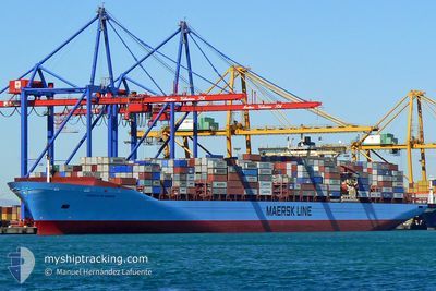
CHARLOTTE MAERSK
Container Ship
Current Trip
| Time Travelled | 1 day |
|---|---|
| Remaining Time | 1 day |
| Distance Travelled | 423.31 nm |
| Remaining Distance | 552.02 nm |
| AVG Speed | 16.6 Noeuds |
| MAX Speed | 19 Noeuds |
| AVG Wind | 18 knots |
| MAX Wind | 27 knots |
| MIN Temp | 4°C / 39.2°F |
| MAX Temp | 13.5°C / 56.3°F |
| Tirant d eau | 12.1 m |
| Position reçue | 12 d depuis |
Current Position
| Longitude | --- |
|---|---|
| Latitude | --- |
| Etat | Under way using engine |
| Vitesse | 15.2 Noeuds |
| Parcours | 160.9° |
| Zone | South China Sea |
| Station | T-AIS |
| Position reçue | 12 d depuis |
Info
Information
The current position of CHARLOTTE MAERSK is in South China Sea with coordinates 22.21584° / 113.81219° as reported on 2025-12-24 09:14 by AIS to our vessel tracker app. The vessel's current speed is 15.2 Noeuds and is heading at the port of SHANGHAI. The estimated time of arrival as calculated by MyShipTracking vessel tracking app is 2026-01-07 16:50 LT
The vessel CHARLOTTE MAERSK (IMO: 9245744, MMSI: 220059000) is a Container Ship that was built in 2002 ( 24 Age ). It's sailing under the flag of [DK] Denmark.
In this page you can find informations about the vessels current position, last detected port calls, and current voyage information. If the vessels is not in coverage by AIS you will find the latest position.
The current position of CHARLOTTE MAERSK is detected by our AIS receivers and we are not responsible for the reliability of the data. The last position was recorded while the vessel was in Coverage by the Ais receivers of our vessel tracking app.
The current draught of CHARLOTTE MAERSK as reported by AIS is 12.1 meters
Weather
| Temperature | 13.2°C / 55.76°F |
|---|---|
| Wind Speed | 18 knots |
| Direction | 360° N |
| Pressure | 1020.3 hPa |
| Humidity | 59.4 % |
| Cloud Coverage | 8 % |
Featured Company
Last Port Calls
| Port | Arrival | Departure | Time In Port |
|---|---|---|---|
| 2026-01-03 23:01 | 2026-01-05 09:40 | 1 d | |
| 2025-12-30 23:32 | 2025-12-31 22:52 | 23 h | |
| 2025-12-26 23:52 | 2025-12-28 00:32 | 1 d | |
| 2025-12-23 10:40 | 2025-12-24 15:00 | 1 d | |
| 2025-11-24 06:44 | 2025-11-27 14:10 | 3 d | |
| 2025-11-20 13:25 | 2025-11-22 05:45 | 1 d | |
| 2025-11-17 00:49 | 2025-11-18 05:38 | 1 d | |
| 2025-11-12 22:11 | 2025-11-14 12:42 | 1 d | |
| 2025-11-07 13:54 | 2025-11-09 09:10 | 1 d |
Most Visited Ports (Last year)
| Port | Arrivals | |
|---|---|---|
| 4 | ||
| 4 | ||
| 4 | ||
| 4 | ||
| 4 | ||
| 4 |
Last Trips
| Origin | Departure | Destination | Arrival | Distance | |
|---|---|---|---|---|---|
| 2025-12-31 22:52 | 2026-01-03 23:01 | 535.40 nm | |||
| 2025-12-28 00:32 | 2025-12-30 23:32 | 157.62 nm | |||
| 2025-12-24 15:00 | 2025-12-26 23:52 | 896.29 nm | |||
| 2025-11-27 14:10 | 2025-12-23 10:40 | 11620.79 nm | |||
| 2025-11-22 05:45 | 2025-11-24 06:44 | 662.78 nm | |||
| 2025-11-18 05:38 | 2025-11-20 13:25 | 783.85 nm | |||
| 2025-11-14 12:42 | 2025-11-17 00:49 | 1141.64 nm | |||
| 2025-11-09 09:10 | 2025-11-12 22:11 | 510.04 nm | |||
| 2025-10-20 01:44 | 2025-11-07 13:54 | 8267.55 nm |
Events
| Heure | Evenement | Détails | Position/ Destination | Info |
|---|---|---|---|---|
| 2026-01-05 00:40 | PORT DE DEPART |
|
35.04605 / 128.77843
CNSGH
|
Vitesse: 10.3 kn Parcours: 203° |
| 2026-01-05 00:25 | Démarrage |
35.07202 / 128.80154
[KR] BUSAN NEW PORT
|
Vitesse: 4.4 kn Parcours: 274° |
|
| 2026-01-03 14:12 | Arret |
35.07684 / 128.80794
[KR] BUSAN NEW PORT
|
Vitesse: 0.3 kn Parcours: 91° |
|
| 2026-01-03 14:01 | Port d'arrivée |
|
35.07549 / 128.80766
[KR] BUSAN NEW PORT
|
Vitesse: 1.1 kn Parcours: 91° |
| 2025-12-31 14:52 | Démarrage | 0.8 nm, North West of NINGBO |
29.95435 / 121.83663
CNSGH
|
Vitesse: 6.6 kn Parcours: 53° |
| 2025-12-31 14:52 | PORT DE DEPART |
|
29.95435 / 121.83663
CNSGH
|
Vitesse: 0.9 kn Parcours: 323° |
| 2025-12-30 15:32 | Arret |
29.94689 / 121.83369
[CN] NINGBO
|
Vitesse: 0.2 kn Parcours: 293° |
|
| 2025-12-30 15:32 | Port d'arrivée |
|
29.94689 / 121.83369
[CN] NINGBO
|
Vitesse: 1.3 kn Parcours: 290° |
| 2025-12-30 08:13 | Démarrage |
29.78191 / 122.93793
CNSGH
|
Vitesse: 4.1 kn Parcours: 259° |
|
| 2025-12-28 04:43 | Arret |
29.79966 / 122.95641
CNSGH
|
Vitesse: 0.2 kn Parcours: 82° |