
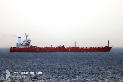
BINTA SALEH
Oil Products Tanker
Current Trip
FOR ORDERS
| Time Travelled | --- |
|---|---|
| Remaining Time | --- |
| Distance Travelled | 904.02 nm |
| Remaining Distance | --- |
| AVG Speed | 8.9 Noeuds |
| MAX Speed | 13.4 Noeuds |
| AVG Wind | 10.2 knots |
| MAX Wind | 20 knots |
| MIN Temp | 26.3°C / 79.34°F |
| MAX Temp | 37.5°C / 99.5°F |
| Tirant d eau | 11.5 m |
| Position reçue | 2024-02-28 11:07 |
Current Position
| Longitude | 3.40184° |
|---|---|
| Latitude | 6.39327° |
| Etat | Under way using engine |
| Vitesse | 9.7 Noeuds |
| Parcours | 155.4° |
| Zone | Gulf of Guinea |
| Station | T-AIS |
| Position reçue | 2024-02-28 11:07 |
Info
Information
The current position of BINTA SALEH is in Gulf of Guinea with coordinates 6.39327° / 3.40184° as reported on 2024-02-28 11:07 by AIS to our vessel tracker app. The vessel's current speed is 9.7 Noeuds
The vessel BINTA SALEH (IMO: 9402809, MMSI: 538008289) is a Oil Products Tanker that was built in 2010 ( 14 Age ). It's sailing under the flag of [MH] Marshall Is.
In this page you can find informations about the vessels current position, last detected port calls, and current voyage information. If the vessels is not in coverage by AIS you will find the latest position.
The current position of BINTA SALEH is detected by our AIS receivers and we are not responsible for the reliability of the data. The last position was recorded while the vessel was in Coverage by the Ais receivers of our vessel tracking app.
The current draught of BINTA SALEH as reported by AIS is 11.5 meters
Weather
| Temperature | 29.3°C / 84.74°F |
|---|---|
| Wind Speed | 7 knots |
| Direction | 224° SW |
| Pressure | 1007.2 hPa |
| Humidity | 77.6 % |
| Cloud Coverage | 100 % |
Featured Company
Last Port Calls
Last Trips
| Origin | Departure | Destination | Arrival | Distance |
|---|
Events
| Heure | Evenement | Détails | Position/ Destination | Info |
|---|---|---|---|---|
| 2024-04-25 17:12 | Arret | 5.7 nm, West of LAGOS |
6.42925 / 3.26938
FOR ORDERS
|
Vitesse: Parcours: 266° |
| 2024-04-25 13:24 | Démarrage | 4.07 nm, South of LAGOS |
6.36576 / 3.34921
FOR ORDERS
|
Vitesse: 4.3 kn Parcours: 172° |
| 2024-04-24 18:01 | Arret | 3.65 nm, South of LAGOS |
6.37263 / 3.35046
FOR ORDERS
|
Vitesse: 0.2 kn Parcours: 175° |
| 2024-04-24 11:48 | Démarrage |
6.36382 / 3.94769
FOR ORDERS
|
Vitesse: 3.7 kn Parcours: 255° |
|
| 2024-04-23 22:57 | Arret |
6.35940 / 3.95468
FOR ORDERS
|
Vitesse: 0.3 kn Parcours: 166° |
|
| 2024-04-23 21:20 | Démarrage |
6.37730 / 3.87975
FOR ORDERS
|
Vitesse: 3.1 kn Parcours: 267° |
|
| 2024-04-22 16:08 | Arret |
6.37112 / 3.88841
FOR ORDERS
|
Vitesse: 0.3 kn Parcours: 181° |
|
| 2024-04-22 14:00 | Démarrage |
6.32787 / 3.88294
FOR ORDERS
|
Vitesse: 4.1 kn Parcours: 31° |
|
| 2024-04-22 12:24 | Arret |
6.33122 / 3.86887
FOR ORDERS
|
Vitesse: 0.3 kn Parcours: 149° |
|
| 2024-04-22 09:28 | Démarrage | 6.03 nm, South East of LAGOS |
6.35372 / 3.42853
FOR ORDERS
|
Vitesse: 3.7 kn Parcours: 97° |