
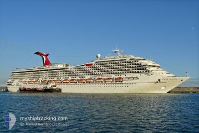
CARNIVAL FREEDOM
Passengers Ship
Current Trip
| Trip Time | 1 day |
|---|---|
| Trip Distance | 404.31 nm |
| AVG Speed | 10.8 Noeuds |
| MAX Speed | 12.6 Noeuds |
| Tirant d eau | 8.4 m |
| AVG Wind | 10.6 knots |
| MAX Wind | 15 knots |
| MIN Temp | 26.6°C / 79.88°F |
| MAX Temp | 28°C / 82.4°F |
| Position reçue | 20 h, 59 m depuis |
Current Position
| Longitude | -77.02433° |
|---|---|
| Latitude | 26.96367° |
| Etat | Under way using engine |
| Vitesse | 12 Noeuds |
| Parcours | 127.8° |
| Zone | North Atlantic Ocean |
| Station | T-AIS |
| Position reçue | 20 h, 59 m depuis |
Info
Information
The current position of CARNIVAL FREEDOM is in North Atlantic Ocean with coordinates 26.96367° / -77.02433° as reported on 2024-05-31 17:00 by AIS to our vessel tracker app. The vessel's current speed is 12 Noeuds and is currently inside the port of NASSAU.
The vessel CARNIVAL FREEDOM (IMO: 9333149, MMSI: 371154000) is a Passengers Ship that was built in 2007 ( 17 Age ). It's sailing under the flag of [PA] Panama.
In this page you can find informations about the vessels current position, last detected port calls, and current voyage information. If the vessels is not in coverage by AIS you will find the latest position.
The current position of CARNIVAL FREEDOM is detected by our AIS receivers and we are not responsible for the reliability of the data. The last position was recorded while the vessel was in Coverage by the Ais receivers of our vessel tracking app.
The current draught of CARNIVAL FREEDOM as reported by AIS is 8.4 meters
Weather
| Temperature | 27.4°C / 81.32°F |
|---|---|
| Wind Speed | 15 knots |
| Direction | 68° ENE |
| Pressure | 1017.6 hPa |
| Humidity | 65.3 % |
| Cloud Coverage | 97 % |
Featured Company
Last Port Calls
| Port | Arrival | Departure | Time In Port |
|---|---|---|---|
| 2024-06-01 07:12 | |||
| 2024-05-30 03:25 | 2024-05-30 17:46 | 14 h | |
| 2024-05-28 10:51 | 2024-05-28 18:06 | 7 h | |
| 2024-05-27 07:07 | 2024-05-27 15:47 | 8 h | |
| 2024-05-26 09:15 | 2024-05-26 19:03 | 9 h | |
| 2024-05-25 04:39 | 2024-05-25 15:56 | 11 h | |
| 2024-05-23 07:18 | 2024-05-23 16:21 | 9 h | |
| 2024-05-22 10:13 | 2024-05-22 18:29 | 8 h | |
| 2024-05-20 04:37 | 2024-05-20 16:22 | 11 h | |
| 2024-05-18 08:25 | 2024-05-18 16:57 | 8 h |
Most Visited Ports (Last year)
| Port | Arrivals | |
|---|---|---|
| 70 | ||
| 41 | ||
| 32 | ||
| 24 | ||
| 24 | ||
| 5 |
Last Trips
| Origin | Departure | Destination | Arrival | Distance | |
|---|---|---|---|---|---|
| 2024-05-30 17:46 | 2024-06-01 07:12 | 404.31 nm | |||
| 2024-05-28 18:06 | 2024-05-30 03:25 | 673.64 nm | |||
| 2024-05-27 15:47 | 2024-05-28 10:51 | 352.58 nm | |||
| 2024-05-26 19:03 | 2024-05-27 07:07 | 167.97 nm | |||
| 2024-05-25 15:56 | 2024-05-26 09:15 | 278.39 nm | |||
| 2024-05-23 16:21 | 2024-05-25 04:39 | 675.37 nm | |||
| 2024-05-22 18:29 | 2024-05-23 07:18 | 113.16 nm | |||
| 2024-05-20 16:22 | 2024-05-22 10:13 | 763.68 nm | |||
| 2024-05-18 16:57 | 2024-05-20 04:37 | 381.69 nm | |||
| 2024-05-17 18:15 | 2024-05-18 08:25 | 170.28 nm |
Events
| Heure | Evenement | Détails | Position/ Destination | Info |
|---|---|---|---|---|
| 2024-06-01 11:24 | Arret |
25.08349 / -77.34786
[BS] NASSAU
|
Vitesse: 0.2 kn Parcours: 300° |
|
| 2024-06-01 11:12 | Port d'arrivée |
|
25.08440 / -77.35120
[BS] NASSAU
|
Vitesse: 7.7 kn Parcours: 153° |
| 2024-05-31 17:10 | Etat Changé | Default Under way using engine |
26.94333 / -76.99667
USPCV>BSNAS
|
Vitesse: 12 kn Parcours: 127.8° |
| 2024-05-31 17:00 | Hors de la zone couverte |
26.96367 / -77.02433
North Atlantic Ocean
USPCV>BSNAS
|
Vitesse: 12 kn Parcours: 127.8° |
|
| 2024-05-31 16:41 | Etat Changé | Under way using engine Default |
27.00168 / -77.08100
USPCV>BSNAS
|
Vitesse: 12 kn Parcours: 126° |
| 2024-05-31 16:27 | Dans la zone couverte |
27.00168 / -77.08100
North Atlantic Ocean
USPCV>BSNAS
|
Vitesse: 12.3 kn Parcours: 126.2° |
|
| 2024-05-31 12:21 | Etat Changé | Default Under way using engine |
27.41167 / -77.93833
USPCV>BSNAS
|
Vitesse: 12.3 kn Parcours: 113.9° |
| 2024-05-31 12:14 | Hors de la zone couverte |
27.42170 / -77.96318
North Atlantic Ocean
USPCV>BSNAS
|
Vitesse: 12.3 kn Parcours: 113.9° |
|
| 2024-05-31 12:12 | Etat Changé | Under way using engine Default |
27.42452 / -77.97017
USPCV>BSNAS
|
Vitesse: 12.4 kn Parcours: 114° |
| 2024-05-31 11:47 | Etat Changé | Default Under way using engine |
27.46083 / -78.06016
USPCV>BSNAS
|
Vitesse: 12.3 kn Parcours: 114.3° |