
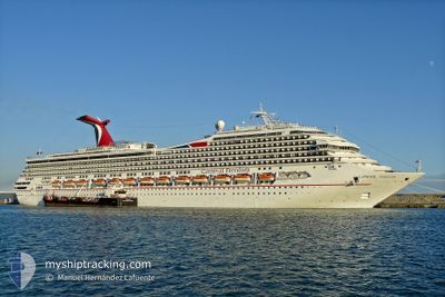
CARNIVAL FREEDOM
Passengers Ship
Current Trip
| Trip Time | 1 day |
|---|---|
| Trip Distance | 381.69 nm |
| AVG Speed | 10.6 Knots |
| MAX Speed | 13 Knots |
| Dybgang | 8.4 m |
| AVG Wind | 9.4 knots |
| MAX Wind | 24.9 knots |
| MIN Temp | 23.9°C / 75.02°F |
| MAX Temp | 27.8°C / 82.04°F |
| Position Modtaget | Nu |
Current Position
| Longitude | -80.60844° |
|---|---|
| Latitude | 28.41000° |
| Status | Under way using engine |
| Fart | 5.8 Knots |
| Kurs | 271° |
| Område | North Atlantic Ocean |
| Station | T-AIS |
| Position Modtaget | Nu |
Info
Information
The current position of CARNIVAL FREEDOM is in North Atlantic Ocean with coordinates 28.41000° / -80.60844° as reported on 2024-05-20 08:46 by AIS to our vessel tracker app. The vessel's current speed is 5.8 Knots and is currently inside the port of CAPE CANAVERAL.
The vessel CARNIVAL FREEDOM (IMO: 9333149, MMSI: 371154000) is a Passengers Ship that was built in 2007 ( 17 år gamle ). It's sailing under the flag of [PA] Panama.
In this page you can find informations about the vessels current position, last detected port calls, and current voyage information. If the vessels is not in coverage by AIS you will find the latest position.
The current position of CARNIVAL FREEDOM is detected by our AIS receivers and we are not responsible for the reliability of the data. The last position was recorded while the vessel was in Coverage by the Ais receivers of our vessel tracking app.
The current draught of CARNIVAL FREEDOM as reported by AIS is 8.4 meters
Weather
| Temperature | 24.7°C / 76.46°F |
|---|---|
| Wind Speed | 11 knots |
| Direction | 268° W |
| Pressure | 1010.5 hPa |
| Humidity | 76.9 % |
| Cloud Coverage | --- |
Featured Company
Last Port Calls
| Port | Arrival | Departure | Time In Port |
|---|---|---|---|
| 2024-05-20 04:37 | |||
| 2024-05-18 08:25 | 2024-05-18 16:57 | 8 h | |
| 2024-05-17 09:09 | 2024-05-17 18:15 | 9 h | |
| 2024-05-16 05:47 | 2024-05-16 16:07 | 10 h | |
| 2024-05-14 10:56 | 2024-05-14 18:05 | 7 h | |
| 2024-05-13 07:14 | 2024-05-13 15:44 | 8 h | |
| 2024-05-12 09:19 | 2024-05-12 18:57 | 9 h | |
| 2024-05-11 04:43 | 2024-05-11 16:23 | 11 h | |
| 2024-05-08 08:17 | 2024-05-08 18:27 | 10 h | |
| 2024-05-06 04:42 | 2024-05-06 15:54 | 11 h |
Most Visited Ports (Last year)
| Port | Arrivals | |
|---|---|---|
| 70 | ||
| 41 | ||
| 31 | ||
| 25 | ||
| 24 | ||
| 5 |
Last Trips
| Origin | Departure | Destination | Arrival | Distance | |
|---|---|---|---|---|---|
| 2024-05-18 16:57 | 2024-05-20 04:37 | 381.69 nm | |||
| 2024-05-17 18:15 | 2024-05-18 08:25 | 170.28 nm | |||
| 2024-05-16 16:07 | 2024-05-17 09:09 | 277.94 nm | |||
| 2024-05-14 18:05 | 2024-05-16 05:47 | 673.61 nm | |||
| 2024-05-13 15:44 | 2024-05-14 10:56 | 351.99 nm | |||
| 2024-05-12 18:57 | 2024-05-13 07:14 | 179.08 nm | |||
| 2024-05-11 16:23 | 2024-05-12 09:19 | 278.54 nm | |||
| 2024-05-08 18:27 | 2024-05-11 04:43 | 777.34 nm | |||
| 2024-05-06 15:54 | 2024-05-08 08:17 | 673.63 nm | |||
| 2024-05-04 17:02 | 2024-05-06 04:42 | 382.88 nm |
Events
| Tid | Hændelsen | Detaljer | Position / Dest | Info |
|---|---|---|---|---|
| 2024-05-20 08:37 | Skibe i havn |
|
28.40974 / -80.58943
[US] CAPE CANAVERAL
|
Fart: 9.2 kn Kurs: 270.8° |
| 2024-05-20 08:27 | Status er ændret | Under way using engine Default |
28.39885 / -80.56023
BSELE>USPCV
|
Fart: 13 kn Kurs: 310° |
| 2024-05-20 08:26 | Status er ændret | Default Under way using engine |
28.39667 / -80.55666
BSELE>USPCV
|
Fart: 12.2 kn Kurs: 310.3° |
| 2024-05-20 05:37 | Destination er ændret | BSELE>USPCV USPCV>BSNAS |
28.22725 / -80.12184
BSELE>USPCV
|
Fart: 10.8 kn Kurs: 287.8° |
| 2024-05-20 05:37 | ETA er ændret | 2024/05/20 08:12 2024/05/17 13:00 |
28.22725 / -80.12184
BSELE>USPCV
|
Fart: 10.8 kn Kurs: 287.8° |
| 2024-05-20 05:29 | Ændre havområde | United States part of the North Atlantic Ocean Bahamas part of the North Atlantic Ocean |
28.22098 / -80.09651
North Atlantic Ocean
|
Fart: 11 kn Kurs: 285.8° |
| 2024-05-20 05:28 | Indenfor Dækning |
28.22098 / -80.09651
North Atlantic Ocean
|
Fart: 11 kn Kurs: 285.8° |
|
| 2024-05-20 05:27 | Status er ændret | Under way using engine Default |
28.21895 / -80.08867
USPCV>BSNAS
|
Fart: 11.4 kn Kurs: 288° |
| 2024-05-19 14:11 | Status er ændret | Default Under way using engine |
27.17167 / -77.29833
USPCV>BSNAS
|
Fart: 10.3 kn Kurs: 304.9° |
| 2024-05-19 14:09 | Udenfor Dækning |
27.16684 / -77.29100
North Atlantic Ocean
|
Fart: 10.3 kn Kurs: 304.9° |