

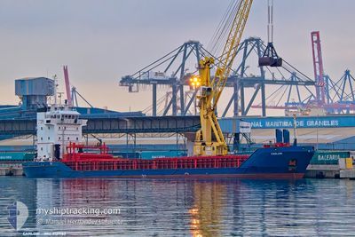
CARLOW
General Cargo

Current Trip
| Time Travelled | 3 days |
|---|---|
| Remaining Time | 7 days |
| Distance Travelled | 586.65 nm |
| Remaining Distance | 1796.17 nm |
| AVG Speed | 7.2 Noeuds |
| MAX Speed | 11 Noeuds |
| AVG Wind | 28.2 knots |
| MAX Wind | 46.5 knots |
| MIN Temp | 9.1°C / 48.38°F |
| MAX Temp | 17.5°C / 63.5°F |
| Tirant d eau | 6.1 m |
| Position reçue | 2 d depuis |
Current Position
| Longitude | --- |
|---|---|
| Latitude | --- |
| Etat | Under way using engine |
| Vitesse | 5.5 Noeuds |
| Parcours | 217.9° |
| Zone | North Atlantic Ocean |
| Station | T-AIS |
| Position reçue | 2 d depuis |
Information
The current position of CARLOW is in North Atlantic Ocean with coordinates 40.03629° / -9.24783° as reported on 2025-03-19 23:02 by AIS to our vessel tracker app. The vessel's current speed is 5.5 Noeuds and is heading at the port of IZMIR. The estimated time of arrival as calculated by MyShipTracking vessel tracking app is 2025-03-29 09:55 LT
The vessel CARLOW (IMO: 9127162, MMSI: 371949000) is a General Cargo that was built in 1995 ( 30 Age ). It's sailing under the flag of [PA] Panama.
In this page you can find informations about the vessels current position, last detected port calls, and current voyage information. If the vessels is not in coverage by AIS you will find the latest position.
The current position of CARLOW is detected by our AIS receivers and we are not responsible for the reliability of the data. The last position was recorded while the vessel was in Coverage by the Ais receivers of our vessel tracking app.
The current draught of CARLOW as reported by AIS is 6.1 meters
Weather
| Temperature | 14.9°C / 58.82°F |
|---|---|
| Wind Speed | 27 knots |
| Direction | 295° WNW |
| Pressure | 1016.6 hPa |
| Humidity | 64 % |
| Cloud Coverage | 100 % |


Featured Company
Last Port Calls
| Port | Arrival | Departure | Time In Port |
|---|---|---|---|
| 2025-03-18 03:55 | 2025-03-18 22:19 | 18 h | |
| 2025-03-02 14:57 | 2025-03-11 07:22 | 8 d | |
| 2025-02-22 07:39 | 2025-02-24 12:58 | 2 d | |
| 2025-02-14 02:24 | 2025-02-15 23:55 | 1 d | |
| 2025-02-11 14:41 | 2025-02-12 04:58 | 14 h | |
| 2025-01-24 23:32 | 2025-01-25 10:08 | 10 h | |
| 2025-01-17 00:06 | 2025-01-17 07:50 | 7 h | |
| 2025-01-08 02:43 | 2025-01-08 20:03 | 17 h | |
| 2025-01-02 19:11 |
Most Visited Ports (Last year)
| Port | Arrivals | |
|---|---|---|
| 3 | ||
| 2 | ||
| 2 | ||
| 2 | ||
| 2 | ||
| 2 |
Last Trips
| Origin | Departure | Destination | Arrival | Distance | |
|---|---|---|---|---|---|
| 2025-03-11 07:22 | 2025-03-18 03:55 | 1225.31 nm | |||
| 2025-02-24 12:58 | 2025-03-02 14:57 | 1107.61 nm | |||
| 2025-02-15 23:55 | 2025-02-22 07:39 | 1213.44 nm | |||
| 2025-02-12 04:58 | 2025-02-14 02:24 | 229.22 nm | |||
| 2025-01-25 10:08 | 2025-02-11 14:41 | 3478.20 nm | |||
| 2025-01-17 07:50 | 2025-01-24 23:32 | 816.85 nm | |||
| 2025-01-08 20:03 | 2025-01-17 00:06 | 18.18 nm | |||
| 2025-01-02 19:11 | 2025-01-08 02:43 | 847.83 nm |
Events
| Heure | Evenement | Détails | Position/ Destination | Info |
|---|---|---|---|---|
| 2025-03-19 23:08 | Etat Changé | Default Under way using engine |
40.02981 / -9.25470
TR IZM
|
Vitesse: 5.5 kn Parcours: 217.9° |
| 2025-03-19 23:02 | Etat Changé | Under way using engine Default |
40.03629 / -9.24783
TR IZM
|
Vitesse: 5.2 kn Parcours: 225° |
| 2025-03-19 23:02 | Hors de la zone couverte |
40.03629 / -9.24783
North Atlantic Ocean
TR IZM
|
Vitesse: 5.5 kn Parcours: 217.9° |
|
| 2025-03-19 22:48 | Dans la zone couverte |
40.03629 / -9.24783
North Atlantic Ocean
TR IZM
|
Vitesse: 5.5 kn Parcours: 217.9° |
|
| 2025-03-19 21:16 | Etat Changé | Default Under way using engine |
40.18892 / -9.13355
TR IZM
|
Vitesse: 6.8 kn Parcours: 205.4° |
| 2025-03-19 21:07 | Hors de la zone couverte |
40.20400 / -9.12431
North Atlantic Ocean
TR IZM
|
Vitesse: 6.8 kn Parcours: 205.4° |
|
| 2025-03-19 21:03 | Etat Changé | Under way using engine Default |
40.21187 / -9.11960
TR IZM
|
Vitesse: 6.7 kn Parcours: 204° |
| 2025-03-19 20:56 | Etat Changé | Default Under way using engine |
40.22507 / -9.11197
TR IZM
|
Vitesse: 7.5 kn Parcours: 203° |
| 2025-03-19 20:12 | Etat Changé | Under way using engine Default |
40.30531 / -9.06750
TR IZM
|
Vitesse: 7.1 kn Parcours: 196° |
| 2025-03-19 19:57 | Etat Changé | Default Under way using engine |
40.33310 / -9.05307
TR IZM
|
Vitesse: 7.3 kn Parcours: 203.4° |