

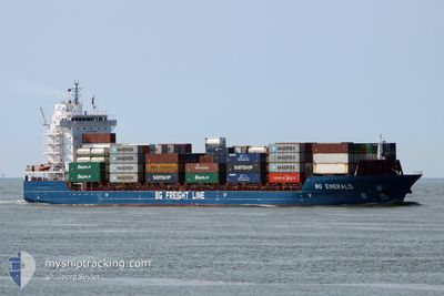
BG EMERALD
Cargo

Current Trip
| Time Travelled | 8 h, 56 mins |
|---|---|
| Remaining Time | 8 h, 45 mins |
| Distance Travelled | 123.14 nm |
| Remaining Distance | 136.10 nm |
| AVG Speed | 14.3 Noeuds |
| MAX Speed | 16.1 Noeuds |
| AVG Wind | 22.6 knots |
| MAX Wind | 33 knots |
| MIN Temp | 8.1°C / 46.58°F |
| MAX Temp | 9.6°C / 49.28°F |
| Tirant d eau | 7.8 m |
| Position reçue | 1 m depuis |
Current Position
| Longitude | --- |
|---|---|
| Latitude | --- |
| Etat | Under way using engine |
| Vitesse | 14.9 Noeuds |
| Parcours | 328.4° |
| Zone | North Sea |
| Station | T-AIS |
| Position reçue | 1 m depuis |
Information
The current position of BG EMERALD is in North Sea with coordinates 53.11689° / 1.37015° as reported on 2025-02-23 22:45 by AIS to our vessel tracker app. The vessel's current speed is 14.9 Noeuds and is heading at the port of TEES. The estimated time of arrival as calculated by MyShipTracking vessel tracking app is 2025-02-24 07:32 LT
The vessel BG EMERALD (IMO: 9803704, MMSI: 209248000) is a Cargo It's sailing under the flag of [CY] Cyprus.
In this page you can find informations about the vessels current position, last detected port calls, and current voyage information. If the vessels is not in coverage by AIS you will find the latest position.
The current position of BG EMERALD is detected by our AIS receivers and we are not responsible for the reliability of the data. The last position was recorded while the vessel was in Coverage by the Ais receivers of our vessel tracking app.
The current draught of BG EMERALD as reported by AIS is 7.8 meters
Weather
| Temperature | 9.5°C / 49.1°F |
|---|---|
| Wind Speed | 27 knots |
| Direction | 198° SSW |
| Pressure | 1012.4 hPa |
| Humidity | 85.6 % |
| Cloud Coverage | 100 % |


Featured Company
Last Port Calls
| Port | Arrival | Departure | Time In Port |
|---|---|---|---|
| 2025-02-23 14:51 | |||
| 2025-02-22 20:32 | 2025-02-23 02:38 | 6 h | |
| 2025-02-22 01:55 | 2025-02-22 18:40 | 16 h | |
| 2025-02-20 14:52 | 2025-02-22 01:52 | 1 d | |
| 2025-02-17 08:16 | 2025-02-18 23:30 | 1 d | |
| 2025-02-15 20:26 | 2025-02-16 08:09 | 11 h | |
| 2025-02-14 07:34 | 2025-02-15 04:20 | 20 h | |
| 2025-02-12 07:49 | 2025-02-14 07:30 | 1 d | |
| 2025-02-11 07:19 | 2025-02-12 06:18 | 22 h | |
| 2025-02-06 19:45 | 2025-02-08 21:10 | 2 d |
Most Visited Ports (Last year)
| Port | Arrivals | |
|---|---|---|
| 67 | ||
| 38 | ||
| 16 | ||
| 15 | ||
| 9 | ||
| 8 |
Last Trips
| Origin | Departure | Destination | Arrival | Distance | |
|---|---|---|---|---|---|
| 2025-02-22 18:40 | 2025-02-22 20:32 | 16.23 nm | |||
| 2025-02-22 01:52 | 2025-02-22 01:55 | 1.21 nm | |||
| 2025-02-18 23:30 | 2025-02-20 14:52 | 577.99 nm | |||
| 2025-02-16 08:09 | 2025-02-17 08:16 | 367.86 nm | |||
| 2025-02-15 04:20 | 2025-02-15 20:26 | 255.85 nm | |||
| 2025-02-14 07:30 | 2025-02-14 07:34 | 0.65 nm | |||
| 2025-02-12 06:18 | 2025-02-12 07:49 | 16.22 nm | |||
| 2025-02-08 21:10 | 2025-02-11 07:19 | 764.70 nm | |||
| 2025-02-04 18:36 | 2025-02-06 19:45 | 738.81 nm | |||
| 2025-02-03 22:39 | 2025-02-04 00:46 | 16.30 nm |
Events
| Heure | Evenement | Détails | Position/ Destination | Info |
|---|---|---|---|---|
| 2025-02-23 20:36 | Etat Changé | Under way using engine Default |
52.75654 / 2.01265
TEESPORT
|
Vitesse: 13.8 kn Parcours: 305° |
| 2025-02-23 20:26 | Etat Changé | Default Under way using engine |
52.73380 / 2.06578
TEESPORT
|
Vitesse: 13.8 kn Parcours: 307.2° |
| 2025-02-23 20:18 | Etat Changé | Under way using engine Default |
52.71683 / 2.10468
TEESPORT
|
Vitesse: 13.7 kn Parcours: 308° |
| 2025-02-23 20:14 | Etat Changé | Default Under way using engine |
52.70655 / 2.12732
TEESPORT
|
Vitesse: 13.7 kn Parcours: 308.2° |
| 2025-02-23 20:07 | Etat Changé | Under way using engine Default |
52.68987 / 2.16180
TEESPORT
|
Vitesse: 13.6 kn Parcours: 308° |
| 2025-02-23 19:13 | Etat Changé | Default Under way using engine |
52.57249 / 2.41582
TEESPORT
|
Vitesse: 12.7 kn Parcours: 301.7° |
| 2025-02-23 18:42 | Etat Changé | Under way using engine Default |
52.51635 / 2.57032
TEESPORT
|
Vitesse: 12.6 kn Parcours: 298° |
| 2025-02-23 18:41 | Etat Changé | Default Under way using engine |
52.51524 / 2.57378
TEESPORT
|
Vitesse: 12.6 kn Parcours: 295.9° |
| 2025-02-23 18:18 | Changement d'ETA | 2025/02/24 08:30 2025/02/24 07:30 |
52.47963 / 2.70840
TEESPORT
|
Vitesse: 12.9 kn Parcours: 290.9° |
| 2025-02-23 17:59 | Changement de zone | United Kingdom part of the North Sea Dutch part of the North Sea |
52.45733 / 2.80212
North Sea
TEESPORT
|
Vitesse: 12.9 kn Parcours: 295.9° |