
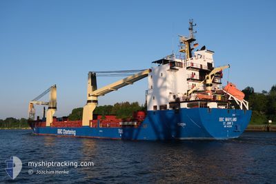
BBC MARYLAND
General Cargo
Current Trip
| Time Travelled | 2 days |
|---|---|
| Remaining Time | --- |
| Distance Travelled | 89.41 nm |
| Remaining Distance | --- |
| AVG Speed | 8.8 Noeuds |
| MAX Speed | 13.1 Noeuds |
| AVG Wind | 23.6 knots |
| MAX Wind | 37 knots |
| MIN Temp | 9°C / 48.2°F |
| MAX Temp | 12.8°C / 55.04°F |
| Tirant d eau | 5.9 m |
| Position reçue | 2 d depuis |
Current Position
| Longitude | --- |
|---|---|
| Latitude | --- |
| Etat | Under way using engine |
| Vitesse | 7.1 Noeuds |
| Parcours | 184.4° |
| Zone | Mediterranean Sea - Western Basin |
| Station | T-AIS |
| Position reçue | 2 d depuis |
Info
Information
The current position of BBC MARYLAND is in Mediterranean Sea - Western Basin with coordinates 43.01150° / 4.98048° as reported on 2025-02-14 18:19 by AIS to our vessel tracker app. The vessel's current speed is 7.1 Noeuds and is heading at the port of CIVITAVECCHIA. The estimated time of arrival as calculated by MyShipTracking vessel tracking app is 2025-02-15 16:00 LT
The vessel BBC MARYLAND (IMO: 9433298, MMSI: 305459000) is a General Cargo that was built in 2010 ( 15 Age ). It's sailing under the flag of [AG] Antigua Barbuda.
In this page you can find informations about the vessels current position, last detected port calls, and current voyage information. If the vessels is not in coverage by AIS you will find the latest position.
The current position of BBC MARYLAND is detected by our AIS receivers and we are not responsible for the reliability of the data. The last position was recorded while the vessel was in Coverage by the Ais receivers of our vessel tracking app.
The current draught of BBC MARYLAND as reported by AIS is 5.9 meters
Weather
| Temperature | 12.3°C / 54.14°F |
|---|---|
| Wind Speed | 10 knots |
| Direction | 307° NW |
| Pressure | 1013.7 hPa |
| Humidity | 77.1 % |
| Cloud Coverage | 8 % |
Featured Company
Last Port Calls
| Port | Arrival | Departure | Time In Port |
|---|---|---|---|
| 2025-02-12 12:56 | 2025-02-14 15:38 | 2 d | |
| 2025-02-04 06:21 | 2025-02-04 15:45 | 9 h | |
| 2025-01-22 18:15 | 2025-02-01 20:31 | 10 d | |
| 2025-01-19 03:27 | 2025-01-19 21:56 | 18 h | |
| 2025-01-14 05:10 | 2025-01-14 09:34 | 4 h | |
| 2024-12-23 01:09 | 2024-12-23 04:08 | 2 h | |
| 2024-12-12 19:08 | 2024-12-18 04:15 | 5 d | |
| 2024-12-10 16:09 | 2024-12-12 03:20 | 1 d | |
| 2024-12-03 17:42 | 2024-12-09 07:02 | 5 d |
Most Visited Ports (Last year)
| Port | Arrivals | |
|---|---|---|
| 4 | ||
| 2 | ||
| 2 | ||
| 2 | ||
| 1 | ||
| 1 |
Last Trips
| Origin | Departure | Destination | Arrival | Distance | |
|---|---|---|---|---|---|
| 2025-02-01 23:31 | 2025-02-12 13:56 | 2440.94 nm | |||
| 2025-02-01 23:31 | 2025-02-04 08:21 | 631.72 nm | |||
| 2025-01-14 12:34 | 2025-01-22 21:15 | 1772.51 nm | |||
| 2025-01-14 12:34 | 2025-01-19 05:27 | 1026.23 nm | |||
| 2024-12-22 23:08 | 2025-01-14 08:10 | 6252.25 nm | |||
| 2024-12-17 22:15 | 2024-12-22 20:09 | 1553.27 nm | |||
| 2024-12-11 21:20 | 2024-12-12 13:08 | 99.48 nm | |||
| 2024-12-09 01:02 | 2024-12-10 10:09 | 357.44 nm | |||
| 2024-11-29 13:30 | 2024-12-03 11:42 | 1223.87 nm |
Events
| Heure | Evenement | Détails | Position/ Destination | Info |
|---|---|---|---|---|
| 2025-02-14 18:24 | Etat Changé | Default Under way using engine |
43.00182 / 4.98064
CIVITAVECCHIA
|
Vitesse: 7.1 kn Parcours: 184.4° |
| 2025-02-14 18:19 | Etat Changé | Under way using engine Default |
43.01150 / 4.98048
CIVITAVECCHIA
|
Vitesse: 8.1 kn Parcours: 180° |
| 2025-02-14 18:19 | Hors de la zone couverte |
43.01150 / 4.98048
Mediterranean Sea - Western Basin
CIVITAVECCHIA
|
Vitesse: 7.1 kn Parcours: 184.4° |
|
| 2025-02-14 18:12 | Etat Changé | Default Under way using engine |
43.02881 / 4.98136
CIVITAVECCHIA
|
Vitesse: 7.6 kn Parcours: 182.6° |
| 2025-02-14 17:12 | Etat Changé | Under way using engine Default |
43.14160 / 4.97977
CIVITAVECCHIA
|
Vitesse: 6.4 kn Parcours: 179° |
| 2025-02-14 16:53 | Etat Changé | Default Under way using engine |
43.17992 / 4.97804
CIVITAVECCHIA
|
Vitesse: 7.8 kn Parcours: 178° |
| 2025-02-14 16:48 | Etat Changé | Under way using engine Default |
43.19144 / 4.97714
CIVITAVECCHIA
|
Vitesse: 7.7 kn Parcours: 176° |
| 2025-02-14 16:33 | Etat Changé | Default Under way using engine |
43.22316 / 4.97520
CIVITAVECCHIA
|
Vitesse: 12.6 kn Parcours: 178.8° |
| 2025-02-14 15:38 | PORT DE DEPART |
|
43.39213 / 4.92518
CIVITAVECCHIA
|
Vitesse: 12.2 kn Parcours: 119° |
| 2025-02-14 15:20 | Démarrage |
43.40489 / 4.85983
[FR] FOS
|
Vitesse: 7.1 kn Parcours: 113° |