
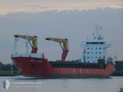
BBC JADE
Cargo
Current Trip
| Time Travelled | 19 days |
|---|---|
| Remaining Time | --- |
| Distance Travelled | 5875.30 nm |
| Remaining Distance | --- |
| AVG Speed | 12.7 Noeuds |
| MAX Speed | 15.3 Noeuds |
| AVG Wind | 11.7 knots |
| MAX Wind | 30.9 knots |
| MIN Temp | 9.5°C / 49.1°F |
| MAX Temp | 29.7°C / 85.46°F |
| Tirant d eau | 6.9 m |
| Position reçue | 3 d depuis |
Current Position
| Longitude | 9.09342° |
|---|---|
| Latitude | -17.31285° |
| Etat | Under way using engine |
| Vitesse | 12.2 Noeuds |
| Parcours | 138° |
| Zone | South Atlantic Ocean |
| Station | T-AIS |
| Position reçue | 3 d depuis |
Info
Information
The current position of BBC JADE is in South Atlantic Ocean with coordinates -17.31285° / 9.09342° as reported on 2024-05-17 11:12 by AIS to our vessel tracker app. The vessel's current speed is 12.2 Noeuds and is heading at the port of BUSAN. The estimated time of arrival as calculated by MyShipTracking vessel tracking app is 2024-06-17 17:00 LT
The vessel BBC JADE (IMO: 942111600, MMSI: 305097000) is a Cargo It's sailing under the flag of [AG] Antigua Barbuda.
In this page you can find informations about the vessels current position, last detected port calls, and current voyage information. If the vessels is not in coverage by AIS you will find the latest position.
The current position of BBC JADE is detected by our AIS receivers and we are not responsible for the reliability of the data. The last position was recorded while the vessel was in Coverage by the Ais receivers of our vessel tracking app.
The current draught of BBC JADE as reported by AIS is 6.9 meters
Weather
| Temperature | 17.3°C / 63.14°F |
|---|---|
| Wind Speed | 9 knots |
| Direction | 188° S |
| Pressure | 1015.6 hPa |
| Humidity | 78.9 % |
| Cloud Coverage | 6 % |
Featured Company
Last Port Calls
| Port | Arrival | Departure | Time In Port |
|---|---|---|---|
| 2024-04-27 22:51 | 2024-04-30 16:26 | 2 d | |
| 2024-04-26 11:18 | 2024-04-27 06:17 | 18 h | |
| 2024-04-19 05:50 | 2024-04-25 16:59 | 6 d | |
| 2024-04-15 10:51 | 2024-04-18 17:02 | 3 d | |
| 2024-03-12 10:22 |
Last Trips
| Origin | Departure | Destination | Arrival | Distance | |
|---|---|---|---|---|---|
| 2024-04-27 06:17 | 2024-04-27 22:51 | 212.12 nm | |||
| 2024-04-25 16:59 | 2024-04-26 11:18 | 235.51 nm | |||
| 2024-04-18 17:02 | 2024-04-19 05:50 | 132.25 nm | |||
| 2024-03-12 10:22 | 2024-04-15 10:51 | 10783.17 nm |
Events
| Heure | Evenement | Détails | Position/ Destination | Info |
|---|---|---|---|---|
| 2024-05-19 13:48 | Démarrage | 4.46 nm, North of WALVIS BAY |
-22.86955 / 14.47285
KR PUS
|
Vitesse: 4.2 kn Parcours: 308° |
| 2024-05-18 23:48 | Arret | 4.56 nm, North of WALVIS BAY |
-22.86697 / 14.47553
KR PUS
|
Vitesse: 0.1 kn Parcours: 229° |
| 2024-05-18 10:03 | Démarrage |
-20.80557 / 12.49330
KR PUS
|
Vitesse: 12.7 kn Parcours: 137° |
|
| 2024-05-18 09:51 | Arret |
-20.77502 / 12.46400
KR PUS
|
Vitesse: Parcours: 137° |
|
| 2024-05-17 11:18 | Etat Changé | Default Under way using engine |
-17.32978 / 9.10875
KR PUS
|
Vitesse: 12.2 kn Parcours: 138° |
| 2024-05-17 11:12 | Hors de la zone couverte |
-17.31285 / 9.09342
South Atlantic Ocean
|
Vitesse: 12.2 kn Parcours: 138° |
|
| 2024-05-17 11:11 | Changement de zone | Namibian part of the South Atlantic Ocean High seas of the South Atlantic Ocean |
-17.31024 / 9.09105
South Atlantic Ocean
|
Vitesse: 12.1 kn Parcours: 139° |
| 2024-05-17 11:11 | Etat Changé | Under way using engine Default |
-17.31024 / 9.09105
KR PUS
|
Vitesse: 12.2 kn Parcours: 137° |
| 2024-05-17 10:59 | Dans la zone couverte |
-17.31024 / 9.09105
South Atlantic Ocean
|
Vitesse: 12.1 kn Parcours: 139° |
|
| 2024-05-16 20:26 | Hors de la zone couverte |
-15.09779 / 6.97462
South Atlantic Ocean
|
Vitesse: 12.5 kn Parcours: 139° |