
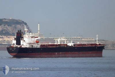
BANI YAS
Crude Oil Tanker
Current Trip
| Time Travelled | 4 days |
|---|---|
| Remaining Time | --- |
| Distance Travelled | 179.69 nm |
| Remaining Distance | --- |
| AVG Speed | 10.6 Noeuds |
| MAX Speed | 13.5 Noeuds |
| AVG Wind | 9.5 knots |
| MAX Wind | 17.9 knots |
| MIN Temp | 24.9°C / 76.82°F |
| MAX Temp | 27.4°C / 81.32°F |
| Tirant d eau | 12.5 m |
| Position reçue | 9 d depuis |
Current Position
| Longitude | --- |
|---|---|
| Latitude | --- |
| Etat | Under way using engine |
| Vitesse | 12.8 Noeuds |
| Parcours | 145.6° |
| Zone | Red Sea |
| Station | T-AIS |
| Position reçue | 9 d depuis |
Info
Information
The current position of BANI YAS is in Red Sea with coordinates 27.13457° / 34.34493° as reported on 2024-11-17 06:12 by AIS to our vessel tracker app. The vessel's current speed is 12.8 Noeuds
The vessel BANI YAS (IMO: 9487249, MMSI: 636014942) is a Crude Oil Tanker that was built in 2010 ( 14 Age ). It's sailing under the flag of [LR] Liberia.
In this page you can find informations about the vessels current position, last detected port calls, and current voyage information. If the vessels is not in coverage by AIS you will find the latest position.
The current position of BANI YAS is detected by our AIS receivers and we are not responsible for the reliability of the data. The last position was recorded while the vessel was in Coverage by the Ais receivers of our vessel tracking app.
The current draught of BANI YAS as reported by AIS is 12.5 meters
Weather
| Temperature | 24.9°C / 76.82°F |
|---|---|
| Wind Speed | 18 knots |
| Direction | 342° NNW |
| Pressure | 1013.7 hPa |
| Humidity | 73.3 % |
| Cloud Coverage | 100 % |
Featured Company
Last Port Calls
| Port | Arrival | Departure | Time In Port |
|---|---|---|---|
| 2024-11-18 08:20 | 2024-11-22 15:15 | 4 d | |
| 2024-11-16 04:59 | 2024-11-16 14:17 | 9 h | |
| 2024-10-27 18:40 | 2024-11-04 05:56 | 7 d | |
| 2024-10-24 19:06 | 2024-10-27 05:04 | 2 d | |
| 2024-10-24 17:32 | 2024-10-24 18:10 | 38 m | |
| 2024-09-10 11:41 | 2024-09-12 09:04 | 1 d |
Last Trips
| Origin | Departure | Destination | Arrival | Distance | |
|---|---|---|---|---|---|
| 2024-11-04 06:56 | 2024-11-18 11:20 | 4011.77 nm | |||
| 2024-11-04 06:56 | 2024-11-16 06:59 | 3414.67 nm | |||
| 2024-10-27 06:04 | 2024-10-27 19:40 | 41.84 nm | |||
| 2024-10-24 20:10 | 2024-10-24 21:06 | 5.50 nm | |||
| 2024-09-12 14:34 | 2024-10-24 19:32 | 11056.14 nm | |||
| 2024-08-13 16:55 | 2024-09-10 17:11 | 5827.38 nm |
Events
| Heure | Evenement | Détails | Position/ Destination | Info |
|---|---|---|---|---|
| 2024-11-24 19:08 | Arret |
22.32150 / 38.17791
JEDDAH/KSA
|
Vitesse: 0.2 kn Parcours: 264° |
|
| 2024-11-22 15:15 | PORT DE DEPART |
|
23.93540 / 38.21782
JEDDAH/KSA
|
Vitesse: 4.5 kn Parcours: 165° |
| 2024-11-22 15:09 | Démarrage |
23.94522 / 38.21498
[SA] YANBU
|
Vitesse: 4.5 kn Parcours: 165° |
|
| 2024-11-18 08:20 | Arret |
23.95185 / 38.21764
[SA] YANBU
|
Vitesse: Parcours: 299° |
|
| 2024-11-18 08:20 | Port d'arrivée |
|
23.95185 / 38.21764
[SA] YANBU
|
Vitesse: 0.6 kn Parcours: 329° |
| 2024-11-17 06:12 | Etat Changé | Default Under way using engine |
27.13254 / 34.34646
JEDDAH/KSA
|
Vitesse: 12.8 kn Parcours: 145.6° |
| 2024-11-17 06:12 | Hors de la zone couverte |
27.13457 / 34.34493
Red Sea
JEDDAH/KSA
|
Vitesse: 12.8 kn Parcours: 145.6° |
|
| 2024-11-17 04:31 | Changement d'ETA | 2024/11/18 20:00 2024/11/19 12:00 |
27.43384 / 34.11924
JEDDAH/KSA
|
Vitesse: 13 kn Parcours: 144.1° |
| 2024-11-17 04:17 | Changement de zone | Egyptian part of the Red Sea Egyptian part of the Gulf of Suez |
27.47563 / 34.08559
Red Sea
JEDDAH/KSA
|
Vitesse: 13 kn Parcours: 143.6° |
| 2024-11-17 04:10 | Etat Changé | Under way using engine Default |
27.49570 / 34.06871
JEDDAH/KSA
|
Vitesse: 12.6 kn Parcours: 138° |