

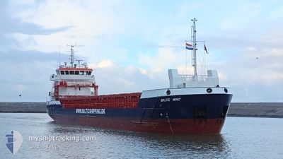
BALTIC WIND
Cargo

Current Trip
| Time Travelled | 1 day |
|---|---|
| Remaining Time | --- |
| Distance Travelled | 143.03 nm |
| Remaining Distance | --- |
| AVG Speed | 7.3 Noeuds |
| MAX Speed | 10 Noeuds |
| AVG Wind | 21 knots |
| MAX Wind | 31 knots |
| MIN Temp | -4.2°C / 24.44°F |
| MAX Temp | 2.6°C / 36.68°F |
| Tirant d eau | 5.7 m |
| Position reçue | 16 h, 49 m depuis |
Current Position
| Longitude | --- |
|---|---|
| Latitude | --- |
| Etat | Under way using engine |
| Vitesse | 7.1 Noeuds |
| Parcours | 243.4° |
| Zone | Baltic Sea |
| Station | T-AIS |
| Position reçue | 16 h, 49 m depuis |
Information
The current position of BALTIC WIND is in Baltic Sea with coordinates 59.13659° / 22.39811° as reported on 2025-02-21 04:21 by AIS to our vessel tracker app. The vessel's current speed is 7.1 Noeuds and is heading at the port of KOLDING. The estimated time of arrival as calculated by MyShipTracking vessel tracking app is 2025-02-23 21:00 LT
The vessel BALTIC WIND (IMO: 9953999, MMSI: 255915582) is a Cargo It's sailing under the flag of [PT] Portugal.
In this page you can find informations about the vessels current position, last detected port calls, and current voyage information. If the vessels is not in coverage by AIS you will find the latest position.
The current position of BALTIC WIND is detected by our AIS receivers and we are not responsible for the reliability of the data. The last position was recorded while the vessel was in Coverage by the Ais receivers of our vessel tracking app.
The current draught of BALTIC WIND as reported by AIS is 5.7 meters
Weather
| Temperature | 2.6°C / 36.68°F |
|---|---|
| Wind Speed | 24 knots |
| Direction | 210° SSW |
| Pressure | 1025 hPa |
| Humidity | 89.8 % |
| Cloud Coverage | 100 % |


Featured Company
Last Port Calls
| Port | Arrival | Departure | Time In Port |
|---|---|---|---|
| 2025-02-19 12:41 | 2025-02-20 20:05 | 1 d | |
| 2025-02-13 01:48 | 2025-02-13 14:52 | 13 h | |
| 2025-02-12 04:11 | 2025-02-12 19:11 | 14 h | |
| 2025-02-09 12:00 | 2025-02-11 11:54 | 1 d | |
| 2025-02-05 21:07 | 2025-02-08 20:55 | 2 d | |
| 2025-02-03 06:08 | 2025-02-04 16:21 | 1 d | |
| 2025-01-29 22:38 | 2025-01-30 14:16 | 15 h | |
| 2025-01-25 23:27 | 2025-01-28 18:27 | 2 d | |
| 2025-01-25 04:46 | 2025-01-25 22:11 | 17 h | |
| 2025-01-04 11:06 | 2025-01-23 21:20 | 19 d |
Most Visited Ports (Last year)
| Port | Arrivals | |
|---|---|---|
| 4 | ||
| 4 | ||
| 3 | ||
| 3 | ||
| 2 | ||
| 2 |
Last Trips
| Origin | Departure | Destination | Arrival | Distance | |
|---|---|---|---|---|---|
| 2025-02-13 14:52 | 2025-02-19 12:41 | 641.14 nm | |||
| 2025-02-12 19:11 | 2025-02-13 01:48 | 66.43 nm | |||
| 2025-02-11 11:54 | 2025-02-12 04:11 | 148.91 nm | |||
| 2025-02-08 20:55 | 2025-02-09 12:00 | 137.00 nm | |||
| 2025-02-04 16:21 | 2025-02-05 21:07 | 278.08 nm | |||
| 2025-01-30 14:16 | 2025-02-03 06:08 | 391.62 nm | |||
| 2025-01-28 18:27 | 2025-01-29 22:38 | 233.41 nm | |||
| 2025-01-25 22:11 | 2025-01-25 23:27 | 12.96 nm | |||
| 2025-01-23 21:20 | 2025-01-25 04:46 | 211.65 nm | |||
| 2025-01-03 18:17 | 2025-01-04 11:06 | 151.75 nm |
Events
| Heure | Evenement | Détails | Position/ Destination | Info |
|---|---|---|---|---|
| 2025-02-21 04:33 | Etat Changé | Default Under way using engine |
59.12529 / 22.35314
DKKOL
|
Vitesse: 7.1 kn Parcours: 243.4° |
| 2025-02-21 04:21 | Hors de la zone couverte |
59.13659 / 22.39811
Baltic Sea
DKKOL
|
Vitesse: 7.1 kn Parcours: 243.4° |
|
| 2025-02-21 04:18 | Etat Changé | Under way using engine Default |
59.13902 / 22.40773
DKKOL
|
Vitesse: 6.8 kn Parcours: 243° |
| 2025-02-21 04:03 | Dans la zone couverte |
59.13902 / 22.40773
Baltic Sea
DKKOL
|
Vitesse: 7.6 kn Parcours: 243.8° |
|
| 2025-02-21 00:58 | Etat Changé | Default Under way using engine |
59.33203 / 23.20061
DKKOL
|
Vitesse: 8.6 kn Parcours: 244.1° |
| 2025-02-21 00:45 | Hors de la zone couverte |
59.34626 / 23.25990
Baltic Sea
DKKOL
|
Vitesse: 8.6 kn Parcours: 244.1° |
|
| 2025-02-21 00:32 | Detecté en mer | Estonian part of the Baltic Sea |
59.36038 / 23.31505
Baltic Sea
DKKOL
|
Vitesse: 8.7 kn Parcours: 242.8° |
| 2025-02-20 18:05 | PORT DE DEPART |
|
59.50521 / 24.95846
DKKOL
|
Vitesse: 7.7 kn Parcours: 18° |
| 2025-02-20 18:01 | Démarrage |
59.49831 / 24.95067
[EE] MUUGA
|
Vitesse: 4.7 kn Parcours: 56° |
|
| 2025-02-20 17:58 | Etat Changé | Under way using engine Moored |
59.49670 / 24.94780
[EE] MUUGA
|
Vitesse: Parcours: 42° |