

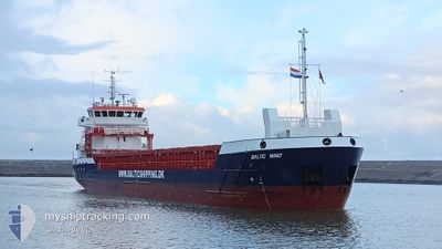
BALTIC WIND
Cargo

Current Trip
| Time Travelled | 3 days |
|---|---|
| Remaining Time | --- |
| Distance Travelled | 389.69 nm |
| Remaining Distance | --- |
| AVG Speed | 8.7 Knots |
| MAX Speed | 10.6 Knots |
| AVG Wind | 13.6 knots |
| MAX Wind | 21 knots |
| MIN Temp | 1.6°C / 34.88°F |
| MAX Temp | 5.9°C / 42.62°F |
| Dybgang | 3.5 m |
| Position Modtaget | 3 m siden |
Current Position
| Longitude | --- |
|---|---|
| Latitude | --- |
| Status | At anchor |
| Fart | |
| Kurs | 309° |
| Område | Baltic Sea |
| Station | T-AIS |
| Position Modtaget | 3 m siden |
Information
The current position of BALTIC WIND is in Baltic Sea with coordinates 54.43821° / 18.64625° as reported on 2025-02-02 14:50 by AIS to our vessel tracker app. The vessel's current speed is 0 Knots
The vessel BALTIC WIND (IMO: 9953999, MMSI: 255915582) is a Cargo It's sailing under the flag of [PT] Portugal.
In this page you can find informations about the vessels current position, last detected port calls, and current voyage information. If the vessels is not in coverage by AIS you will find the latest position.
The current position of BALTIC WIND is detected by our AIS receivers and we are not responsible for the reliability of the data. The last position was recorded while the vessel was in Coverage by the Ais receivers of our vessel tracking app.
The current draught of BALTIC WIND as reported by AIS is 3.5 meters
Weather
| Temperature | 2.3°C / 36.14°F |
|---|---|
| Wind Speed | 12 knots |
| Direction | 320° NW |
| Pressure | 1024.1 hPa |
| Humidity | 63.8 % |
| Cloud Coverage | 100 % |


Featured Company
Last Port Calls
| Port | Arrival | Departure | Time In Port |
|---|---|---|---|
| 2025-01-29 22:38 | 2025-01-30 14:16 | 15 h | |
| 2025-01-25 23:27 | 2025-01-28 18:27 | 2 d | |
| 2025-01-25 04:46 | 2025-01-25 22:11 | 17 h | |
| 2025-01-04 11:06 | 2025-01-23 21:20 | 19 d | |
| 2025-01-01 21:14 | 2025-01-03 18:17 | 1 d | |
| 2024-12-25 09:39 | 2024-12-27 20:35 | 2 d | |
| 2024-12-25 09:18 | 2024-12-25 09:31 | 13 m | |
| 2024-12-23 05:56 | 2024-12-23 21:34 | 15 h | |
| 2024-12-14 11:03 | 2024-12-14 14:14 | 3 h | |
| 2024-12-12 02:18 | 2024-12-12 03:01 | 43 m |
Most Visited Ports (Last year)
| Port | Arrivals | |
|---|---|---|
| 4 | ||
| 3 | ||
| 3 | ||
| 3 | ||
| 2 | ||
| 2 |
Last Trips
| Origin | Departure | Destination | Arrival | Distance | |
|---|---|---|---|---|---|
| 2025-01-28 18:27 | 2025-01-29 22:38 | 233.41 nm | |||
| 2025-01-25 22:11 | 2025-01-25 23:27 | 12.96 nm | |||
| 2025-01-23 21:20 | 2025-01-25 04:46 | 211.65 nm | |||
| 2025-01-03 18:17 | 2025-01-04 11:06 | 151.75 nm | |||
| 2024-12-27 20:35 | 2025-01-01 21:14 | 1150.97 nm | |||
| 2024-12-25 09:31 | 2024-12-25 09:39 | 0.66 nm | |||
| 2024-12-23 21:34 | 2024-12-25 09:18 | 342.38 nm | |||
| 2024-12-14 14:14 | 2024-12-23 05:56 | 1673.17 nm | |||
| 2024-12-12 03:01 | 2024-12-14 11:03 | 507.77 nm | |||
| 2024-12-11 18:33 | 2024-12-12 02:18 | 65.91 nm |
Events
| Tid | Hændelsen | Detaljer | Position / Dest | Info |
|---|---|---|---|---|
| 2025-02-01 07:02 | Status er ændret | At anchor Under way using engine |
54.43794 / 18.64588
PLGDN
|
Fart: 0.1 kn Kurs: 325° |
| 2025-02-01 06:56 | STOP Sejllads | 3.45 nm, North of GDANSK |
54.43810 / 18.64532
PLGDN
|
Fart: 0.3 kn Kurs: 331° |
| 2025-02-01 03:44 | ETA er ændret | 2025/02/01 08:00 2025/02/01 11:00 |
54.74387 / 19.01290
PLGDN
|
Fart: 7.5 kn Kurs: 202.8° |
| 2025-01-31 23:32 | Status er ændret | Under way using engine Default |
54.91114 / 18.11102
PLGDN
|
Fart: 8.6 kn Kurs: 81° |
| 2025-01-31 23:19 | Indenfor Dækning |
54.91191 / 18.12060
Baltic Sea
PLGDN
|
Fart: 8.7 kn Kurs: 81.4° |
|
| 2025-01-31 16:43 | Udenfor Dækning |
54.79154 / 16.34071
Baltic Sea
PLGDN
|
Fart: 9.4 kn Kurs: 96° |
|
| 2025-01-31 13:04 | Ændre havområde | Polish part of the Baltic Sea Danish part of the Kattegat |
54.84179 / 15.33512
Baltic Sea
PLGDN
|
Fart: 9.7 kn Kurs: 97.6° |
| 2025-01-31 08:25 | Ændre havområde | Danish part of the Kattegat German part of the Baltic Sea |
54.94290 / 14.01704
Kattegat
PLGDN
|
Fart: 9.8 kn Kurs: 97° |
| 2025-01-31 07:08 | Ændre havområde | German part of the Baltic Sea Swedish part of the Baltic Sea |
55.01714 / 13.73125
Baltic Sea
PLGDN
|
Fart: 9.8 kn Kurs: 115° |
| 2025-01-31 02:56 | Ændre havområde | Swedish part of the Baltic Sea Danish part of the Baltic Sea |
55.29605 / 12.64699
Baltic Sea
PLGDN
|
Fart: 9.5 kn Kurs: 110.5° |