

ATRIA
Tanker

Current Trip
| Time Travelled | 5 days |
|---|---|
| Remaining Time | --- |
| Distance Travelled | 843.13 nm |
| Remaining Distance | --- |
| AVG Speed | 8.9 Noeuds |
| MAX Speed | 11.9 Noeuds |
| AVG Wind | 10.3 knots |
| MAX Wind | 18.2 knots |
| MIN Temp | 2.3°C / 36.14°F |
| MAX Temp | 16.5°C / 61.7°F |
| Tirant d eau | 4.3 m |
| Position reçue | 1 d depuis |
Current Position
| Longitude | --- |
|---|---|
| Latitude | --- |
| Etat | Under way using engine |
| Vitesse | 0.1 Noeuds |
| Parcours | 222° |
| Zone | Mediterranean Sea - Eastern Basin |
| Station | T-AIS |
| Position reçue | 1 d depuis |
Information
The current position of ATRIA is in Mediterranean Sea - Eastern Basin with coordinates 36.77746° / 34.69028° as reported on 2025-03-24 15:31 by AIS to our vessel tracker app. The vessel's current speed is 0.1 Noeuds and is heading at the port of MERSIN. The estimated time of arrival as calculated by MyShipTracking vessel tracking app is 2025-03-24 15:00 LT
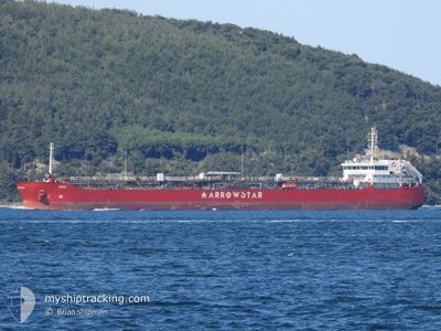
The vessel ATRIA (IMO: 9492842, MMSI: 636023432) is a Tanker It's sailing under the flag of [LR] Liberia.
In this page you can find informations about the vessels current position, last detected port calls, and current voyage information. If the vessels is not in coverage by AIS you will find the latest position.
The current position of ATRIA is detected by our AIS receivers and we are not responsible for the reliability of the data. The last position was recorded while the vessel was in Coverage by the Ais receivers of our vessel tracking app.
The current draught of ATRIA as reported by AIS is 4.3 meters
Weather
| Temperature | 14.1°C / 57.38°F |
|---|---|
| Wind Speed | 4 knots |
| Direction | 45° NE |
| Pressure | 1018.9 hPa |
| Humidity | 82 % |
| Cloud Coverage | 100 % |


Featured Company
Most Visited Ports (Last year)
| Port | Arrivals | |
|---|---|---|
| 12 | ||
| 3 | ||
| 2 | ||
| 2 | ||
| 1 | ||
| 1 |
Events
| Heure | Evenement | Détails | Position/ Destination | Info |
|---|---|---|---|---|
| 2025-03-24 15:36 | Etat Changé | Default Under way using engine |
36.77745 / 34.69026
TRMER
|
Vitesse: 0.1 kn Parcours: 222° |
| 2025-03-24 15:31 | Hors de la zone couverte |
36.77746 / 34.69028
Mediterranean Sea - Eastern Basin
TRMER
|
Vitesse: 0.1 kn Parcours: 192.7° |
|
| 2025-03-24 15:27 | Etat Changé | Under way using engine Default |
36.77740 / 34.69026
TRMER
|
Vitesse: 0.2 kn Parcours: 222° |
| 2025-03-24 15:21 | Etat Changé | Default Under way using engine |
36.77731 / 34.69024
TRMER
|
Vitesse: Parcours: 230° |
| 2025-03-24 15:08 | Etat Changé | Under way using engine Default |
36.77716 / 34.69016
TRMER
|
Vitesse: Parcours: 220° |
| 2025-03-24 15:06 | Etat Changé | Default Under way using engine |
36.77718 / 34.69012
TRMER
|
Vitesse: 0.5 kn Parcours: 213° |
| 2025-03-24 14:58 | Arret | 2.42 nm, South East of MERSIN |
36.77742 / 34.69012
TRMER
|
Vitesse: 0.2 kn Parcours: 206° |
| 2025-03-24 14:06 | Changement d'ETA | 2025/03/24 15:00 2025/03/24 22:00 |
36.67260 / 34.68236
TRMER
|
Vitesse: 9.4 kn Parcours: 3.5° |
| 2025-03-24 12:35 | Etat Changé | Under way using engine Default |
36.48977 / 34.49485
TRMER
|
Vitesse: 9.4 kn Parcours: 45° |
| 2025-03-24 12:17 | Etat Changé | Default Under way using engine |
36.45610 / 34.45594
TRMER
|
Vitesse: 9.3 kn Parcours: 44.2° |