
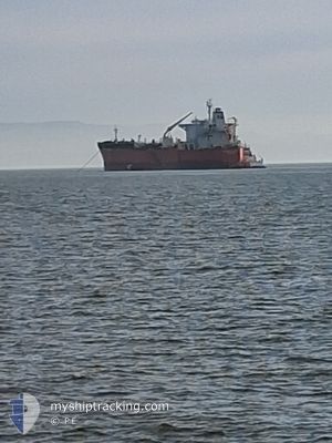
ATLANTIC EAGLE
Oil/Chemical Tanker
Current Trip
| Time Travelled | 9 days |
|---|---|
| Remaining Time | --- |
| Distance Travelled | 2049.77 nm |
| Remaining Distance | --- |
| AVG Speed | 9.8 Noeuds |
| MAX Speed | 14.5 Noeuds |
| AVG Wind | 18.9 knots |
| MAX Wind | 32 knots |
| MIN Temp | 15.2°C / 59.36°F |
| MAX Temp | 28°C / 82.4°F |
| Tirant d eau | 7.4 m |
| Position reçue | 8 d depuis |
Current Position
| Longitude | --- |
|---|---|
| Latitude | --- |
| Etat | Under way using engine |
| Vitesse | 11.7 Noeuds |
| Parcours | 88.7° |
| Zone | Singapore Strait |
| Station | T-AIS |
| Position reçue | 8 d depuis |
Info
Information
The current position of ATLANTIC EAGLE is in Singapore Strait with coordinates 1.24883° / 104.09749° as reported on 2026-01-01 19:32 by AIS to our vessel tracker app. The vessel's current speed is 11.7 Noeuds and is heading at the port of YEOSU. The estimated time of arrival as calculated by MyShipTracking vessel tracking app is 2026-01-10 11:00 LT
The vessel ATLANTIC EAGLE (IMO: 9332183, MMSI: 477969400) is a Oil/Chemical Tanker that was built in 2007 ( 19 Age ). It's sailing under the flag of [HK] Hong Kong.
In this page you can find informations about the vessels current position, last detected port calls, and current voyage information. If the vessels is not in coverage by AIS you will find the latest position.
The current position of ATLANTIC EAGLE is detected by our AIS receivers and we are not responsible for the reliability of the data. The last position was recorded while the vessel was in Coverage by the Ais receivers of our vessel tracking app.
The current draught of ATLANTIC EAGLE as reported by AIS is 7.4 meters
Weather
| Temperature | 11.3°C / 52.34°F |
|---|---|
| Wind Speed | 24 knots |
| Direction | 328° NNW |
| Pressure | 1026.3 hPa |
| Humidity | 53.5 % |
| Cloud Coverage | 33 % |
Featured Company
Last Port Calls
| Port | Arrival | Departure | Time In Port |
|---|---|---|---|
| 2025-12-31 09:21 | 2026-01-01 11:57 | 1 d | |
| 2025-12-28 04:35 | 2025-12-29 07:59 | 1 d | |
| 2025-12-15 06:23 | 2025-12-17 11:29 | 2 d | |
| 2025-12-01 06:58 | 2025-12-03 08:42 | 2 d | |
| 2025-11-16 01:26 | 2025-11-17 12:20 | 1 d |
Most Visited Ports (Last year)
| Port | Arrivals | |
|---|---|---|
| 2 | ||
| 2 | ||
| 2 | ||
| 1 | ||
| 1 | ||
| 1 |
Last Trips
| Origin | Departure | Destination | Arrival | Distance | |
|---|---|---|---|---|---|
| 2025-12-29 07:59 | 2025-12-31 09:21 | 156.90 nm | |||
| 2025-12-17 11:29 | 2025-12-28 04:35 | 1175.28 nm | |||
| 2025-12-03 08:42 | 2025-12-15 06:23 | 3682.57 nm | |||
| 2025-11-17 12:20 | 2025-12-01 06:58 | 3766.23 nm | |||
| 2025-10-18 01:59 | 2025-11-16 01:26 | 6238.06 nm |
Events
| Heure | Evenement | Détails | Position/ Destination | Info |
|---|---|---|---|---|
| 2026-01-01 19:33 | Etat Changé | Default Under way using engine |
1.24892 / 104.10076
MYSUP >> KRYOS
|
Vitesse: 11.7 kn Parcours: 88.7° |
| 2026-01-01 19:32 | Hors de la zone couverte |
1.24883 / 104.09749
Singapore Strait
MYSUP >> KRYOS
|
Vitesse: 11.7 kn Parcours: 88.7° |
|
| 2026-01-01 16:10 | Etat Changé | Under way using engine Default |
1.08920 / 103.57091
MYSUP >> KRYOS
|
Vitesse: 11.7 kn Parcours: 122° |
| 2026-01-01 15:37 | Etat Changé | Default Under way using engine |
1.14465 / 103.47885
MYSUP >> KRYOS
|
Vitesse: 11.5 kn Parcours: 114.6° |
| 2026-01-01 15:30 | Etat Changé | Under way using engine Default |
1.15425 / 103.45877
MYSUP >> KRYOS
|
Vitesse: 11.5 kn Parcours: 114° |
| 2026-01-01 15:29 | Etat Changé | Default Under way using engine |
1.15584 / 103.45531
MYSUP >> KRYOS
|
Vitesse: 11.5 kn Parcours: 114.3° |
| 2026-01-01 15:28 | Changement de zone | Indonesian part of the Singapore Strait Malaysian part of the Malacca Strait |
1.15606 / 103.45483
Singapore Strait
MYSUP >> KRYOS
|
Vitesse: 11.5 kn Parcours: 114.3° |
| 2026-01-01 15:28 | Etat Changé | Under way using engine Default |
1.15719 / 103.45241
MYSUP >> KRYOS
|
Vitesse: 11.5 kn Parcours: 116° |
| 2026-01-01 15:13 | Dans la zone couverte |
1.15606 / 103.45483
Singapore Strait
MYSUP >> KRYOS
|
Vitesse: 11.5 kn Parcours: 114.3° |
|
| 2026-01-01 09:19 | Hors de la zone couverte |
1.88800 / 102.27804
Malacca Strait
MYSUP >> KRYOS
|
Vitesse: 13.8 kn Parcours: 115° |