
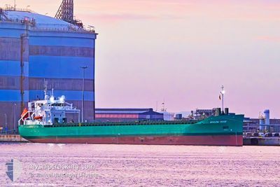
ARKLOW ROSE
Cargo
Current Trip
| Time Travelled | 15 h, 5 mins |
|---|---|
| Remaining Time | 3 days |
| Distance Travelled | 134.21 nm |
| Remaining Distance | 802.32 nm |
| AVG Speed | 11.3 Noeuds |
| MAX Speed | 14.2 Noeuds |
| AVG Wind | 12 knots |
| MAX Wind | 22.7 knots |
| MIN Temp | 8.2°C / 46.76°F |
| MAX Temp | 10.8°C / 51.44°F |
| Tirant d eau | 6.1 m |
| Position reçue | 3 h, 28 m depuis |
Current Position
| Longitude | --- |
|---|---|
| Latitude | --- |
| Etat | Under way using engine |
| Vitesse | 10.1 Noeuds |
| Parcours | 237.8° |
| Zone | Celtic Sea |
| Station | T-AIS |
| Position reçue | 3 h, 28 m depuis |
Information
The current position of ARKLOW ROSE is in Celtic Sea with coordinates 50.41863° / -5.85386° as reported on 2025-03-08 12:02 by AIS to our vessel tracker app. The vessel's current speed is 10.1 Noeuds and is heading at the port of SETUBAL. The estimated time of arrival as calculated by MyShipTracking vessel tracking app is 2025-03-11 16:33 LT
The vessel ARKLOW ROSE (IMO: 9923267, MMSI: 250014193) is a Cargo It's sailing under the flag of [IE] Ireland.
In this page you can find informations about the vessels current position, last detected port calls, and current voyage information. If the vessels is not in coverage by AIS you will find the latest position.
The current position of ARKLOW ROSE is detected by our AIS receivers and we are not responsible for the reliability of the data. The last position was recorded while the vessel was in Coverage by the Ais receivers of our vessel tracking app.
The current draught of ARKLOW ROSE as reported by AIS is 6.1 meters
Weather
| Temperature | 10.9°C / 51.62°F |
|---|---|
| Wind Speed | 19 knots |
| Direction | 120° ESE |
| Pressure | 1001 hPa |
| Humidity | 88.6 % |
| Cloud Coverage | 100 % |
Featured Company
Last Port Calls
| Port | Arrival | Departure | Time In Port |
|---|---|---|---|
| 2025-03-05 22:20 | 2025-03-08 00:25 | 2 d | |
| 2025-03-01 06:33 | 2025-03-02 11:13 | 1 d | |
| 2025-02-24 20:19 | 2025-02-27 19:56 | 2 d | |
| 2025-02-19 16:54 | 2025-02-20 22:16 | 1 d | |
| 2025-02-17 13:04 | 2025-02-19 16:11 | 2 d | |
| 2025-02-10 05:24 | 2025-02-10 11:00 | 5 h | |
| 2025-02-07 15:29 | |||
| 2025-02-03 11:31 | 2025-02-05 20:03 | 2 d | |
| 2025-01-25 10:08 | 2025-01-28 17:21 | 3 d | |
| 2025-01-17 06:14 | 2025-01-18 20:36 | 1 d |
Last Trips
| Origin | Departure | Destination | Arrival | Distance | |
|---|---|---|---|---|---|
| 2025-03-02 11:13 | 2025-03-05 22:20 | 63.97 nm | |||
| 2025-02-27 19:56 | 2025-03-01 06:33 | 323.46 nm | |||
| 2025-02-20 23:16 | 2025-02-24 20:19 | 800.39 nm | |||
| 2025-02-19 17:11 | 2025-02-19 17:54 | 6.35 nm | |||
| 2025-02-10 12:00 | 2025-02-17 14:04 | 1828.88 nm | |||
| 2025-02-05 20:03 | 2025-02-07 16:29 | 548.18 nm | |||
| 2025-01-28 18:21 | 2025-02-03 11:31 | 1393.54 nm | |||
| 2025-01-18 20:36 | 2025-01-25 11:08 | 506.92 nm | |||
| 2025-01-03 14:49 | 2025-01-17 06:14 | 1889.38 nm |
Events
| Heure | Evenement | Détails | Position/ Destination | Info |
|---|---|---|---|---|
| 2025-03-08 12:02 | Hors de la zone couverte |
50.41863 / -5.85386
Celtic Sea
PTSET
|
Vitesse: 10.1 kn Parcours: 237.8° |
|
| 2025-03-08 06:10 | Changement de zone | United Kingdom part of the Celtic Sea United Kingdom part of the Bristol Channel |
51.08995 / -4.58531
Celtic Sea
PTSET
|
Vitesse: 11.3 kn Parcours: 231.9° |
| 2025-03-08 00:25 | PORT DE DEPART |
|
51.54788 / -2.98627
PTSET
|
Vitesse: 4.2 kn Parcours: 166° |
| 2025-03-08 00:23 | Démarrage |
51.55139 / -2.98746
[GB] NEWPORT
|
Vitesse: 3.2 kn Parcours: 166° |
|
| 2025-03-08 00:07 | Etat Changé | Under way using engine Moored |
51.55279 / -2.98790
[GB] NEWPORT
|
Vitesse: Parcours: 167° |
| 2025-03-07 23:01 | Tirant d'eau modifié | 6.1 4 |
51.55413 / -2.98709
[GB] NEWPORT
|
Vitesse: Parcours: 54° |
| 2025-03-07 23:01 | Changement de destination | PTSET GBNPT |
51.55413 / -2.98709
[GB] NEWPORT
|
Vitesse: Parcours: 54° |
| 2025-03-07 23:01 | Changement d'ETA | 2025/03/11 20:00 2025/03/05 20:00 |
51.55413 / -2.98709
[GB] NEWPORT
|
Vitesse: Parcours: 54° |
| 2025-03-07 04:56 | Dans la zone couverte |
51.55413 / -2.98704
Bristol Channel
[GB] NEWPORT
|
Vitesse: Parcours: 121.3° |
|
| 2025-03-07 03:16 | Hors de la zone couverte |
51.55413 / -2.98709
Bristol Channel
[GB] NEWPORT
|
Vitesse: Parcours: 340.6° |