
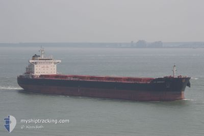
AP ARGOSY
Bulk Carrier
Current Trip
ID BUT
| Time Travelled | --- |
|---|---|
| Remaining Time | --- |
| Distance Travelled | 4694.03 nm |
| Remaining Distance | --- |
| AVG Speed | 10.2 Noeuds |
| MAX Speed | 14.8 Noeuds |
| AVG Wind | 12.7 knots |
| MAX Wind | 30 knots |
| MIN Temp | 22.9°C / 73.22°F |
| MAX Temp | 29.4°C / 84.92°F |
| Tirant d eau | 8 m |
| Position reçue | 4 d depuis |
Current Position
| Longitude | --- |
|---|---|
| Latitude | --- |
| Etat | Under way using engine |
| Vitesse | 11.6 Noeuds |
| Parcours | 158.4° |
| Zone | Java Sea |
| Station | T-AIS |
| Position reçue | 4 d depuis |
Info
Information
The current position of AP ARGOSY is in Java Sea with coordinates -4.34708° / 115.93822° as reported on 2025-02-12 10:55 by AIS to our vessel tracker app. The vessel's current speed is 11.6 Noeuds
The vessel AP ARGOSY (IMO: 9511258, MMSI: 215944000) is a Bulk Carrier that was built in 2012 ( 13 Age ). It's sailing under the flag of [MT] Malta.
In this page you can find informations about the vessels current position, last detected port calls, and current voyage information. If the vessels is not in coverage by AIS you will find the latest position.
The current position of AP ARGOSY is detected by our AIS receivers and we are not responsible for the reliability of the data. The last position was recorded while the vessel was in Coverage by the Ais receivers of our vessel tracking app.
The current draught of AP ARGOSY as reported by AIS is 8 meters
Weather
| Temperature | 27.6°C / 81.68°F |
|---|---|
| Wind Speed | 3 knots |
| Direction | 47° NE |
| Pressure | 1011.2 hPa |
| Humidity | 73.5 % |
| Cloud Coverage | 3 % |
Featured Company
Last Port Calls
Most Visited Ports (Last year)
| Port | Arrivals | |
|---|---|---|
| 4 | ||
| 1 | ||
| 1 | ||
| 1 | ||
| 1 | ||
| 1 |
Last Trips
| Origin | Departure | Destination | Arrival | Distance |
|---|
Events
| Heure | Evenement | Détails | Position/ Destination | Info |
|---|---|---|---|---|
| 2025-02-12 11:00 | Etat Changé | Default Under way using engine |
-4.36398 / 115.94317
ID BUT
|
Vitesse: 11.6 kn Parcours: 158.4° |
| 2025-02-12 10:55 | Etat Changé | Under way using engine Default |
-4.34708 / 115.93822
ID BUT
|
Vitesse: 11.6 kn Parcours: 158° |
| 2025-02-12 10:55 | Hors de la zone couverte |
-4.34708 / 115.93822
Java Sea
|
Vitesse: 11.6 kn Parcours: 158.4° |
|
| 2025-02-12 10:52 | Dans la zone couverte |
-4.34708 / 115.93822
Java Sea
|
Vitesse: 11.6 kn Parcours: 158.4° |
|
| 2025-02-12 09:04 | Etat Changé | Default Under way using engine |
-4.04207 / 115.76806
ID BUT
|
Vitesse: 10.6 kn Parcours: 154.1° |
| 2025-02-12 09:01 | Hors de la zone couverte |
-4.03180 / 115.76283
Java Sea
|
Vitesse: 10.6 kn Parcours: 154.1° |
|
| 2025-02-12 08:47 | Etat Changé | Under way using engine Default |
-3.99675 / 115.74850
ID BUT
|
Vitesse: 9 kn Parcours: 160° |
| 2025-02-12 08:40 | Etat Changé | Default Under way using engine |
-3.98002 / 115.74256
ID BUT
|
Vitesse: 6.2 kn Parcours: 199.2° |
| 2025-02-12 08:30 | Etat Changé | Under way using engine Default |
-3.96284 / 115.74394
ID BUT
|
Vitesse: 4.4 kn Parcours: 221° |
| 2025-02-12 08:24 | Etat Changé | Default Under way using engine |
-3.95897 / 115.74897
ID BUT
|
Vitesse: 0.7 kn Parcours: 262° |